Showing posts with label Moab. Show all posts

Tuesday, May 8, 2012

Fisher Towers Hike

Ancient Art and Stolen Chimney - Look closely for the climbers!
Before the heat of summer renders it too miserable, I want to try to hike as many of the nearby desert trails as possible. Scout and I were thwarted in our attempt to hike the Negro Bill Canyon trail near Moab back in March and ended up hiking the Poison Spider trail instead. So when I emailed my friend John Sasso to see if he would be interested in taking a hike this past Saturday, I was thinking Negro Bill. But John emailed me back to say there was too much poison ivy along the trail and that he knew about it from painful personal experience. I checked DiscoverMoab.com and came up with two alternatives, Fisher Towers or Corona Arch. Of course, John had already hiked both, and in the case of Fisher Towers, he had actually climbed the Titan tower. I have driven Highway 128, which is the scenic way to Moab from I-70, and passed Fisher Towers many times but never stopped to get a closer look. This would be a good opportunity.

The Cobra, with Ancient Art and Stolen Chimney in the background
Scout and I picked John up at the crack of 9:45 and headed west out of Grand Junction. John had suggested that we get some lunch at the Hogi Yogi in Moab, and I misunderstood him to mean that we would do this after the hike, not before. When I said so, he said that I should stop at one of the truck stops so he could pick up a sandwich, but the closest one was at the Highway 191 exit, which is the non-scenic way to Moab. I had eaten a big breakfast before picking him up, so a nasty truck-stop sandwich was the last thing I wanted. We reached a compromise and drove all the way in to Moab, only to find that the Hogi Yogi, which has been in operation at least since Nan and I started going to Moab in 1992, is now the Cabo Grill. In disappointment, John and I continued south and turned in at a... truck stop. But it turned out to be a truck stop that offered huge custom-made sandwiches, at great prices, while you waited. Who knew?

The Titan - John Sasso bivouacked at the base of the gendarme 'thumb' when he climbed it
We reversed course and took the turn onto Highway 128 at the north edge of town. We passed Negro Bill Canyon, and I was happy we weren't hiking it that day because the parking lot at the trailhead was full and people were parking along the highway. Pedestrians were taking their chances crossing the highway, and I could just imagine what a nightmare the trail would be. We continued until we reached a turn-off for Fisher Valley and Onion Creek, which we quickly discovered was wrong when we reached a stream crossing. I hadn't printed out the directions to the trailhead because I figured John knew where we were going, but he was a little fuzzy on exactly how to get there. Back on the highway, we reached another turn-off just a few hundred yards farther up, and John announced that we were on the right track. We parked in a spot right at the trailhead, and John ate his sandwich in the shade of a juniper tree while Scout and I got organized for the hike.

Scout's ears flying in the wind - Note his summer puppy cut and the Titan sign
It was hang-on-to-your-hat windy, which helped to keep it somewhat cool considering our nearly 1:00 starting time. I heard voices on the wind and looked around to see where they were coming from. I craned my neck and looked straight up to see climbers on a familiar-looking rock formation. I asked John if it was the one from the Citi TV commercial, featuring climbers Katie Brown and Alex Honnold, and he said that of course it was; he had already told me all about it on the drive. That's news to me, I thought, but what a sight! The trail angled around the formation, called Ancient Art, giving us a better perspective of the climbers and the Stolen Chimney route they had climbed to reach the final pitch featured in the TV commercial.

Along the climber's trail below Ancient Art, there were a few dramatic-looking hoodoos. According to John, the one with the thinnest neck is called The Cobra and it has been climbed successfully. To look at it, you would think anyone putting their weight on it would snap the top of it right off.

'Now what?!' - Scout at the top of the Fisher Towers ladder
The trail rounded a windy corner with excellent views of the Titan tower and proceeded onto a narrow ledge below sheer walls of converging sandstone. The trail abruptly ended at a metal ladder leading down several rungs to where the trail began again. There was no way Scout was going to climb down a ladder. John went down to look for an alternative route farther up into the notch formed by the converging walls. A minute later, he popped out on the sandstone above us and said he thought Scout could make it down the way he had come up. Scout and I followed him back to where a five-foot drop led through a narrow slot to the bottom of the ladder. John went down first and I followed, but when I whistled Scout to come, he realized that I intended to hoist him down and he backed out of reach. The more I coaxed him, the farther he backed away. I could have had John climb up and get behind Scout to herd him to me, but we decided against it and turned around instead. Maybe next time.

Trail looping around canyon notch, with Castle Rock and The Rectory in the distance
As we passed Ancient Art again on our return, we heard whooping from other hikers on the trail. One of the climbers had just stood up on the tiny summit, like Katie Brown in the dizzying final moments of the TV commercial. We just missed seeing it, but I felt I already had an idea of what it would be like.

Thursday, March 22, 2012

Poison Spider Hike

Scout above the Poison Spider slickrock ledges, with Moab Rim and the La Sal Mountains
Nan, Scout and I were in Moab again over the weekend. Nan was running in the annual Canyonlands five-mile race on Saturday morning, so Scout and I went along to do a hike. The hotels in Moab time their high-season rates to begin the weekend of the big race, which means the normally reasonable La Quinta zooms up to almost $200 a night. We spent the night at home instead and left in the dark at 5:30 to arrive by 7:30. After dropping Nan off with the hundreds of other runners, Scout and I headed north out of town. We had planned to hike Negro Bill Canyon for the first time, but the access to it off Highway 128 was closed due to the race. So we proceeded a little farther north, turned left onto Highway 279 and drove the couple of miles down to the Poison Spider Trail's trailhead.

I rode the Poison Spider Trail on my dirt bike years ago, and Charlie and I hiked it once--probably while Nan was running a race--but he and I had not gone far enough to see what I was hoping to see with Scout, the section of slickrock ledges that I remember being really difficult to get up and over on my dirt bike. We started out at 8:15, hiking up a series of rocky switchbacks in a blustery wind. The trail eventually leveled out heading west and then curved around to the north into a familiar-looking sand wash canyon with steep sandstone cliffs on either side. Where the deep sand ended, the steep slickrock ledges began. Scout leaped nimbly up them while I stood below trying to calculate the smoothest line to take if I was on my dirt bike. I remember needing to get off my dirt bike and do the same thing years ago, and even then, it took a couple of tries to get up some of the trickier sections.

Petroglyphs along Highway 279 near the Poison Spider Trail
The trail leveled out again above the slickrock ledges and provided the view you see in the photo above of the Moab Rim across the Colorado River and the snow-dusted La Sal Mountains beyond. Please click the photo for a full-size view. The lenticular clouds and Scout's blowing fur give a good idea of how windy it was. We needed to meet Nan at the finish area before noon, so this was our turnaround point at 10:30.

On the way back toward Moab on Highway 279, there were many groups of rock climbers scaling the sandstone faces that drop vertically to the shoulder of the narrow two-lane highway as it runs along the river. This must have been a popular area as well with the Native Americans who left their petroglyphs on the faces several feet above the ground. In the past, the lighter areas of stone below the rock art must have been covered by deep sand bars from the river that have since eroded away. The unintended effect is that the petroglyphs have been preserved out of reach of vandals and graffiti artists. Again, please click the photo for a full-size view.

Tuesday, December 6, 2011

Hidden Valley to Moab Rim Trail

Scout and me hiking the Hidden Valley Trail in Moab
A few weeks ago, Nan and I were in Moab for a race she wanted to run. It was a cold, wet and miserable Saturday morning, but she seemed upbeat and excited when Scout and I dropped her off in the muddy campground parking lot off Kane Creek Road. I told her we would pick her up in a couple of hours and then backtracked up the road to the parking lot at the trailhead of the Moab Rim Trail. It's the trail that connects with the Hidden Valley Trail, which I have hiked several times as an "out and back," first with Charlie and then with Scout. There is a chapter in my book, Raising Charlie, that details Charlie's and my last hike together on the Hidden Valley Trail, just weeks before he died.

Hidden Valley petroglyphs - note the human figure in the lower right
As Scout and I hiked through the drizzle up the steeply sloping slickrock, I thought about what it would take to hike the entire distance of Hidden Valley and Moab Rim. It would be six to seven miles one way, so having a car or an arranged ride at each end would be necessary. When Scout and I reached the top of the Rim, where the trail overlooks the city of Moab, I tried to gauge the distance and direction to the Hidden Valley trailhead, far out of sight around the Rim to the south, off Highway 191. Looking out ahead to where the trail would lead us if we had more time, I saw that it disappeared quickly among a series of loaf-shaped sandstone bluffs. Someday, I thought.

Well, someday came quickly. Last Saturday, Scout and I, along with my friend John Sasso, did the entire Hidden Valley to Moab Rim hike. Nan and John's wife D were running the annual Moab Winter Sun 10K, and we drove down separately, so we had the two cars we needed. I had asked John earlier in the week if he would be interested, knowing that he's always up for a hike, and then it was just a matter of working out the logistics.

Scout and me in front of the 'map' petroglyph
We dropped the wives off at the race and left John and D's car at the finish area, then drove down Highway 191 to the Hidden Valley trailhead, off Angel Rock Road. It felt good to be hiking the trail again. It had been since the same weekend last year while Nan was running the same race that Scout and I had hiked it. There had been snow that day, but only wind and cold on this day. It had been months since John and I had talked, so we used our hiking time together to catch up. Before I knew it, we were at the top of the initial steep, rocky section of the trail and standing in front of the juniper tree where Charlie and I had stopped for a drink on our last hike. It made me feel melancholy to picture him again sitting under the tree and smiling at me. I gave Scout a drink from my CamelBak and we continued up the trail and into the first of two giant sagebrush meadows.

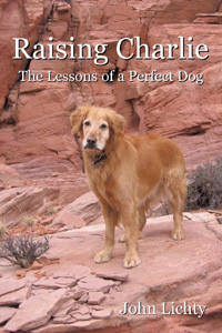
Before long, we reached the side trail to the wall of petroglyphs, where I took the cover photo for Raising Charlie. John was impressed by the figure of a single man etched into the rock and asked me how old I thought it was. I guessed, at least a thousand years, knowing that the Anasazi who lived in this area had moved on more than eight hundred years ago when the climate became too arid. I asked John to take a photo of Scout and me in front of the "map" petroglyph, which I believe is a representation of the access trail and two meadows that lead up to the wall from the valley floor below. Then I took one of John, with the valley and the La Sal Mountains in the background. I stopped and turned around as we were leaving the wall, again picturing Charlie as he had been that day. I will always associate him with this special place.

John Sasso at the Hidden Valley petroglyphs
We backtracked to the main trail and then, instead of heading back down the way we had come, as I had done so many times before, we continued up and over a low pass to the Moab Rim Trail for the very first time. At this point, I was no longer on familiar terrain and needed to pay close attention to the trail, even though it quickly turned into a double-track, because it wound crazily over and around extensive slickrock sections. Off in the distance, we saw three jeeps negotiating difficult spur trails, but they were the only other human activity we had seen to that point. We had been hiking for more than two hours when the trail seemed to loop back upon itself and head in an uphill direction, contrary to what I was expecting. But then we came around a curve and I spotted the trail sign that Scout and I had marked as our turnaround point on the Moab Rim hike a few weeks before.

The three of us paused to admire the view of Moab from the overlook and then headed down the steep slickrock toward the trailhead. I was looking ahead to see if Nan and D might be waiting for us down there, but I didn't see them. John had only one bar on his Verizon cell phone when we reached the parking lot, but he was able to call Nan and D and ask them to pick us up. John, Scout and I walked up Kane Creek Road a ways to meet them, piled into John and D's car, drove around to pick up our car at the Hidden Valley trailhead, and then drove back to the Moab Brewery for a well-deserved lunch before heading back home.

Sunday, December 5, 2010

Return to Hidden Valley

Scout posing in front of the petroglyph wall in Hidden Valley, Moab, UtahOn Friday afternoon, Nan, our dog Scout and I drove down to Moab for an overnight trip. Nan was signed up to run in the Winter Sun 10K race on Saturday morning, so Scout and I went for a hike.

In thinking about where Scout and I should take our hike in the days leading up to the trip, it occurred to me that I have not hiked the Hidden Valley trail in almost three years, not since our dog Charlie and I hiked it together a few weeks before he died of cancer. The cover of Raising Charlie, the book I wrote about him, shows a photo of Charlie standing in front of the trail's petroglyphs wall, which was our usual turn-around point. I knew it would make me sad to return to that spot, but I wanted to share it with our new dog, Scout.

The Hidden Valley trailhead is a few miles south of downtown Moab, just off of Highway 191. It is reached by turning right on to Angel Rock Road and then following the trail signs. The weather was cold and cloudy when Scout and I started hiking at 9:30, but we warmed up quickly while climbing the steep switchbacks leading up to the hidden valley that gives the trail its name.

When Charlie and I had hiked the trail together in March 2008, spring had already arrived in the high desert and it had been a warm day. We had stopped to rest and drink some water in the shade of a large juniper tree located where the trail starts to flatten out. The details of that hike are included in Raising Charlie, in a chapter titled "The Last Good Days." Scout and I stopped at that same tree, and I stood there for several moments, remembering Charlie sitting under it and smiling at me the way he did that day. Scout broke the spell by moaning as he rolled in a patch of snow that the tree was shading.

Scout on the Hidden Valley trail, with the petroglyph wall in the distanceWe set off again and soon emerged into the first of the sagebrush fields. Surprisingly, the trail through it was snow covered but the field itself was not. A few hundred yards further on, we crossed over a rocky section and entered the second sagebrush field. In the distance, I could see the petroglyph wall. In the photo to the right, if you click on it to see the full-size version and then draw a line from Scout's nose through the center of the dark bush behind him and extend it to the rock face in the distance, it will pass through the petroglyph wall right below the skyline.

The wall is a little ways off the right side of the trail, and there is not an established path to it, so Scout and I bushwhacked over to it through the rocks and scrub. As with the juniper tree, I stood for several moments and remembered Charlie standing on the ledge below the wall as I took photos, some of the last photos of his life. Scout sat patiently watching me. I called him over and had him sit on the ledge while I took photos. I wanted to include the petroglyphs in the photos, so the angle is a little different from the Raising Charlie cover photo, but the details are the same.

The Hidden Valley trail, with the La Sal Mountains in the distanceThat day with Charlie, it had suddenly occurred to me that the petroglyph that looks like three circles joined by lines depicts a primitive map of Hidden Valley. With Scout, I noticed a petroglyph I had never noticed before. It depicted the figure of a man, and at his side was an incomplete figure that I imagined to be the man's dog. It is gratifying to know that the primitive people who pecked these figures into this wall valued their relationships with their dogs enough to include them in their artwork.

Monday, August 3, 2009

Rafting the Colorado River

Charlie MacArthur and his students at the 'Little D' rapids in Westwater CanyonYesterday I joined my friend Kurt Beereboom and the staff and students of the Aspen Kayak Academy (AspenKayakAcademy.com) for a trip down the Colorado River from Westwater to Cisco in eastern Utah, northeast of Moab. Kurt and I manned his sixteen-foot inflatable raft while everybody else paddled high-performance kayaks, except Andy, who paddled the entire distance standing upright on a paddle board.

Kurt Beereboom and his whitewater raft in the eddy at 'Little D' rapids in Westwater CanyonThis was my first-ever rafting experience so I didn't know what to expect. I had done canoe trips in the Boy Scouts, but the rapids we negotiated then were ripples compared to what I imagined we would be encountering. I wasn't wrong. There were about twelve sections of rapids, and each was at least a Class III on the whitewater rapid classification scale, which goes from Class I to Class VI. The names say it all: "Staircase," "Funnel," "The Wall," "Sock-It-To-Me," "Last Chance."

Aspen Kayak Academy student in the standing wave at 'Little D' rapids in Westwater CanyonOne of the principles I live by is to not participate in activities where a single mistake could kill you. So I don't paraglide, rock climb or kayak. I have known people who died doing each of those activities. Whitewater rafting is borderline. At a certain level, it's just a complicated way to drown. I would never sign up for a commercial rafting trip, but Kurt invited me to join him on his raft, with which he has several years of experience, on a stretch of river that he has done a few times before, with just the two of us on board. It sounded almost safe.

Charlie MacArthur doing 'Skull' rapids the hard wayThe first photo shows Charlie MacArthur, owner of the Aspen Kayak Academy, taking a turn on Andy's paddle board, along with three of his teenage kayaking students, at the first of the Westwater Canyon rapids, "Little Delores." There is a standing wave there that Charlie and his students took turns "surfing" in their kayaks. On his first pass, Charlie did a jaw-dropping kayak move: at the point where the water dropped into the hole in front of the standing wave, he flipped the kayak over its bow in a cartwheel that landed him in the hole facing back upriver. He followed this with moves where he balanced on the crest and spun the kayak around in circles. When he tired of that, he flipped backward off the crest and came up facing downriver. Unbelievable. The third photo shows one of the students using excellent form to hold himself in the trough of the standing wave, which is flowing left to right. Click the photos for full-size views.

Charlie MacArthur at the entrance to the 'Room of Doom' after negotiating 'Skull' rapidsThe highlight of the day was the "Skull" rapids, an insane Class IV stretch that requires perfect maneuvering to avoid disaster. After passing the large rock on the left that marks the entrance, a boater must row strongly to the left to avoid a dangerously deep hole and then stay left to avoid being sucked into the "Room of Doom," a small natural cove with a perpetual whirlpool that makes it almost impossible to escape in a raft. The fourth photo shows Charlie going the hard way, to the right of the deep hole and perilously close to the sheer rock wall. The final photo shows Charlie at the entrance to the Room of Doom, from which he successfully escaped. Of course.

So how did I fare? I laughed like a soaking wet idiot through every rapid. It was a hoot!

Tuesday, May 12, 2009

Kokopelli's Trail

Kokopelli's Trail: Jon and me at the Rabbit Valley trailheadOn Saturday, May 2, my friend Jon Anderson and I attempted something I had been dreaming about for several years, to ride Kokopelli's Trail from Rabbit Valley west of Grand Junction to Moab, Utah. It's a 120-mile ride, and we planned to do it in one day.

I was riding my 2002 Yamaha WR426F and Jon was riding a Kawasaki KLR650 he borrowed from a co-worker. The KLR is a rally bike, designed for mostly street and highway use, with occasional off-road use. At more than 400 pounds, not counting the metal saddlebags full of Jon's gear, it is not exactly "flickable," as my riding buddy Andy would say. The KLR's major advantage was that Jon could ride it at freeway speeds on I-70 to get to the trailhead while I needed to trailer my bike to get it there.

Kokopelli's Trail: Knowles Canyon overlookWe were only going to ride one way, so the plan called for Nan and Scout to drive the "sag wagon" with the empty trailer behind it and meet us in Moab. Along the way, she would drop off some gas and Gatorade at Dewey Bridge, just off Highway 128, since there was a chance I would run out of gas otherwise.

Kokopelli's Trail: Sitting in the rain near Fish FordAfter posing for the top photo (click for full-size views), we departed the parking lot at Rabbit Valley at about 8:45 AM. We headed out the marked #2 loop, which becomes Kokopelli's Trail farther out, and I promptly dumped my bike. I thought I could ride a rocky uphill section in second gear, but my front wheel dropped into a gap near the top and I stalled, falling over on my right side. Jon and I had never ridden together before, so I'm sure he wasn't feeling overly confident about my ability at that point. A few minutes later, we reached another rocky uphill, this time a sidecut singletrack. I was able to make it up with occasional dabs, but Jon lost his momentum and we needed to bulldog the KLR the rest of the way up with Jon pushing on the handlebars and me pushing from behind. By the time we reached the top, the radiator was boiling. Fortunately, the singletrack was soon over and we were able to get up some speed on the Westwater road to cool off the bikes.

The weather forecast called for all-day rain, and the sky to the west definitely looked threatening. It soon started to drizzle, which made the clay tracks of the road extremely slick, limiting our speed. When we reached a stretch of asphalt on the way to Fish Ford, the drizzle gave way to rain and hail, and we needed to stop and put on our rain gear.

Kokopelli's Trail: The Cottonwood Canyon 'shortcut'We turned west off the asphalt and followed a dirt road down into a canyon and then up and out again to where it ended at the Colorado River, in an area called McGraw Bottom. The trail marker indicated that we should follow a singletrack in the direction of the river, but it was very difficult. I managed to bulldog my bike through big rocks up to a plateau and park it, but Jon didn't even attempt it. He parked the KLR and walked up to where I was parked to see what lay ahead. After a sharp drop off the plateau, there was a steep, loose uphill and then more difficult terrain beyond that. We stood at the top of the uphill section and Jon said, "Y'know, if I lose my momentum coming up this hill, my front brake won't hold me." I tried to imagine that. Jon would need to put both feet down to keep his balance, negating his back brake. If he didn't fall, he would slide backwards all the way back to the bottom. It was too big a risk. We would need to go around.

We backtracked to the turnoff for the Cisco Takeout and then continued on through Cisco and picked up Highway 128. After the McGraw Bottom section, the trail crosses Highway 128 from east to west and goes through Yellowjacket Canyon, but we skipped that section as we rode by and headed straight to Dewey Bridge, or what's left of the bridge after it burned last year. I had not passed by this way since the fire, and I was overwhelmed by the damage. The large cottonwood tree I had told Nan to put the gas and Gatorade under was burned to a crisp, so she had left everything under a different, still living cottonwood tree near a picnic table. We hung out our wet gear to dry while we ate peanut butter and jelly sandwiches and washed them down with cold Gatorade. In Jon's case, everything in his aluminum saddlebags was also wet after the pop-top water bottles he had bought at the gas station that morning exploded from all the bouncing around. As we ate, black clouds and lightning were building to the west. We gassed up the bikes, packed up everything and headed out again just as it started to pour.

Kokopelli's Trail: 'Steep difficult trail'The trail went back east up Entrada Road and then forked off to the right to make a shortcut through Cottonwood Canyon, except that the "shortcut" is a serious thrashing through steep, loose, nasty broken rock, as the fourth photo clearly shows. Again, there was no way the KLR was going to make it. We looked at the map and saw that if we had stayed on Entrada Road, we could have avoided this nightmare altogether, so we backtracked a second time and went around.

When we reached the bottom of the second Cottonwood Canyon (Yes, there are two different canyons with the same name.), I stopped abruptly. In front of us was a series of badly eroded sandstone ledges extending up as far as I could see, and they were wet and slippery. I pulled out the map. There it was: "Steep difficult trail." No kidding. Jon parked and walked up to take a look. He started laughing. We both knew that this was the end of the road for us. There was no other way to continue on to the La Sal Loop and Sand Flats sections that end at Moab. We would need to turn around and backtrack yet again.

Kokopelli's Trail: Blasting down Highway 128 to MoabWe passed Dewey Bridge this time without stopping and turned left onto Highway 128. After thirty miles of smooth asphalt, we arrived in Moab. It was 5:15 PM. We had been riding almost continuously for 8.5 hours. I checked my odometer: 136 miles. Nan and Scout were happy to see us. We were happy to be off the bikes.

Later, over Mexican food and margaritas, I asked Jon if he would consider giving it another go sometime with a lighter bike. He said he didn't need to try it again. He was happy with asphalt and didn't care if he ever rode another trail. Not me. I'm trying to talk my neighbor Dale into riding Kokopelli's Trail with me some weekend soon before it gets too hot. I hope this description doesn't scare him off!

Sunday, March 9, 2008

On second thought...

Charlie at the petroglyph wall on the Hidden Valley Trail in Moab, UtahWe were in Moab, Utah over the weekend so Nan could run in the Canyonlands Half Marathon, like she does every year. While she was racing on Saturday morning, Charlie and I hiked the Hidden Valley trail just south of town. We like it because it's dog friendly, unlike the nearby Arches and Canyonlands National Parks, and it's usually not too crowded because it starts with a grueling rocky climb. The photo shows Charlie at our turnaround spot, a wall of ancient petroglyphs about two miles from the start. Click the photo for a larger version that shows the petroglyphs better.

As we were walking, I paid careful attention to Charlie for signs of his mouth bleeding or his endurance flagging, and I stopped frequently to squirt water from my CamelBak for him to drink. With his cancer, I wanted to make sure he didn't overexert himself. Fortunately, it was a cool and overcast morning, so the usual desert heat was not a factor. We have done this hike in the past when it was so hot that Charlie would stop and rest in every patch of shade.

Naturally, as I followed him up the trail, I was thinking about Charlie and his cancer, and something occurred to me. Charlie is one of those golden retrievers who spends about half of his waking life with a tennis ball in his mouth, or at least he did until we took them away to avoid aggravating the tumor in his mouth. I wondered if maybe the tennis balls had something to do with his cancer. Is there some chemical in them that is carcinogenic? A freshly opened can of tennis balls certainly smells toxic, but are the contents actually harmful? I searched on Google for "carcinogenic tennis balls" but not surprisingly, there were no good matches.

I think this was a kind of wishful thinking, a need to know the answer to the question of why this has happened. The veterinarians say there is no answer, but there's still a nagging feeling of guilt and regret: if only we had done something differently in Charlie's life, none of this would have ever happened. That's the problem with "why" questions. Even if we knew the answers, they wouldn't change what has already happened. All we can do is cope with the present situation as best we can.

Thursday, December 27, 2007

Boat Quest, Part 4

The fascination with the MacGregor 26 trailerable sailboat continued for several years, but it diminished briefly in the summer of 1999 while Nan and I were in Manitowoc, Wisconsin for the wedding of her youngest sister Sarah to Ian Griffiths. At the reception, we sat at a table with Nan's brother Jim and his best buddy Jack Simono. Jack was a long-time sailor who owned a Coronado 25 that he sailed on Lake Michigan. But the boat had been sitting unused in his backyard for a couple of years and he was ready to sell it. He thought it was worth about $7000, which was less than half what a new MacGregor 26 would cost, so I was very interested. When we got home, I searched the Internet and found a PDF version of the original Coronado 25 brochure. It looked like a sturdy, capable cruiser, more of a true sailboat than the MacGregor 26X power cruiser. I would have contacted Jack to work out a deal but like the dreams that preceded it, there was no money to fulfill it and it slowly died.

Later that summer, I made a pilgrimage to Colorado's only MacGregor dealer, The Anchorage, located just north of Boulder and only a four-hour drive away. The owners, Eileen and John, let me climb around on a brand-new MacGregor 26X and gave me literature and a price sheet. I left convinced that the MacGregor was the right boat for me after all. And I rationalized that it would be easier to come up with financing for a new boat than for an older, used boat. We might have qualified for a home equity loan, but the mortgage on our Aspen home was oppressive enough without taking on additional debt, so I never got past checking interest rates and calculating monthly payments.

That fall, Nan and I attended the wedding of Erika and Mike in Moab, Utah. Erika and Nan worked together in the pharmacy at Aspen Valley Hospital. Their boss, the pharmacy director Dan Gold, was also a guest at the wedding. Nan had been eager for me to meet Dan because she thought we had many interests in common, including sailing. Dan was late getting to the sunset wedding after riding the challenging Monitor and Merrimac trail on his mountain bike, so we met only briefly before the ceremony, which took place beneath one of the arches in Arches National Park. The reception was a low-key affair at Eddie McStiff's brew pub, where Dan and I talked sailing and became friends over pitchers of microbrew. Like me, Dan was a believer in the MacGregor 26, in his case because he owned one, a 1992 MacGregor 26D.

Saturday, July 28, 2007

July 28

July 28 has historically been a bad day for me.

In 1987 it was the day I parted company with an employer and immediately started my own somewhat ill-fated computer business, which I ran for ten years and then sold to a former employee whose birthday was July 28. But the sale did not go smoothly and resulted in legal wrangling to reach a settlement.

In 2004 it was the day I founded my eBay business, shortly after being laid off from a great IT job at Aspen Valley Hospital. That business was a financial disaster, so I closed it down after a year to stop the losses.

Today it is July 28 again, and I am trying not to tempt fate. I was going to go on an adventurous solo dirt-bike ride between Gateway, Colorado and Moab, Utah, but Nan talked me out of it after I mentioned that July 28 has been unlucky for me. My luck may be changing though because I was successful, just a few minutes ago when they went on sale, in getting two tickets to the Green Bay Packers vs. Denver Broncos Monday Night Football game on October 29--probably our last chance to see Brett Favre play in person. How lucky is that?!

Monday, December 25, 2006

Christmas Letter 2006

Dear Family and Friends,

Every time I sit down to write our annual Christmas letter, I reflect on life's changes. A year ago at this time, the business I had started in Grand Junction, Colorado was shutting down and I was looking for a real job, Nan was working at Aspen Valley Hospital and coming home to the house we had bought in GJ on weekends, and we were both wondering what to do next. Job opportunities in GJ were few and paid poorly, but as luck would have it, after posting my résumé on Monster.com, I received an email message that my old job at AVH was available again. It had been almost two years since I was laid off and I wasn't sure if I should apply, but Nan insisted. They hired me back without even an interview, not as Network Administrator but rather in the newly created position of Database/Internet Administrator. I started in late February, leaving behind my interim employment as a ski instructor at Powderhorn Resort, a great little ski mountain just outside of GJ. My half of the photo shows me in uniform but free skiing on Powderhorn's best powder day of the season, March 12, after it snowed four feet in two days.

Nan and I agreed that it didn't make sense to move back into our Aspen house, which was being rented at the time. The move to GJ had been an ordeal and we weren't eager to repeat the experience. And besides, we had grown fond of our living situation in GJ--the friendly climate, the good shopping and restaurants, the beauty of the high desert. We just couldn't afford both mortgages. So we found a house to rent downvalley and put the Aspen house up for sale in May as the lease ran out. We thought we could save on commissions by trying to sell it on our own, but the negotiating process was too draining, so we listed it with an old friend who had a firm offer in less than a week. We closed at the end of August. Now I guess we're former Aspenites even though we both still work there and live, during the work week anyway, just down the road.

These transitions didn't leave us much opportunity for travel this year. We carried through on reservations we had made almost a year in advance to spend a June week in Las Vegas, originally to attend the annual eBay convention, but my struggling business had eliminated any enthusiasm for that pursuit. Instead we walked all over the Strip, read novels by the pool at the Paris hotel, gambled a little and saw two great Cirque du Soleil shows, the Beatles' "Love" show and "O".

Nan and I both made it home to Wisconsin on separate trips for family time. My sister Susan organized a small family reunion that brought the Chicago contingent to Milwaukee for a day of food, fun, reminiscence and music. The rest of the week was a blur of spotty golf, a concert with sister Jane in Chicago and a visit to the Wisconsin State Fair. Nan's visit home brought together almost all of her eleven siblings. In between visiting around the dinner table at 846, Nan attended the Fall Festival at Camp Sinawa, where her father was so involved, and made day trips to see sister Sarah's family in Green Bay and old friends in Door County.

Most of our weekends were spent in GJ working on our new house, but we also managed a few weekends elsewhere, like in Moab, Utah a few weeks ago, where Nan ran in the Winter Sun 10K. As you can see in her half of the photo, Santa was there to record her finish time, which was good enough for third place in her age group.

We'll be making up for the lack of travel in a big way next year, including a repeat of our 2004 sailing adventure in the British Virgin Islands, this time on a bigger boat with Nan's sister Monica and friend Vicky as crew. Hopefully, it will go more smoothly than our ill-fated "Where's the dinghy?" experience.

Things definitely appear to be looking up, not just for us but also for our country. The November election proved that most people, at least the ones who vote, are paying attention and want a return to peace and sanity. We're hoping the momentum carries through to 2008, when we expect to see the election of our first African-American president. Go Barack!

Best wishes to you and yours this holiday season!

Love, John and Nan