Nan and Scout and I are back at Monica and Vicky's home in Bentonville, Arkansas. Since we were here in late August to pick up Scout, we have spent time in Wauwatosa, Wisconsin and Grand Junction, Colorado.
It wasn't until the Wednesday after Gene and Debbie's September 14 wedding that I learned which job I would be offered in Miami. We packed up the car the following Monday, thanked my parents for their generous hospitality, and drove west to arrange for the big move. Along the way, we secured an apartment in Coconut Grove, between my new workplace and Biscayne Bay. It's a one bedroom/one bath unit, without much closet space, so we are leaving almost half of our stuff in storage in Grand Junction for now.
Our friends and neighbors, Rich and Diane, hosted us while we were in the old neighborhood. It was hard to believe we had been gone almost six months. Scout went crazy when he realized where we were and quickly renewed his friendship with their schnauzer Kola. The two of them promptly ran up to our old patch of lawn for a celebratory pee.
We spent our week in Grand Junction finalizing the job offer, putting up our old house for sale, reserving a U-Haul and trailer, figuring out what to take and getting it packed, and socializing with old friends. By this past Wednesday evening, we were ready to go, with all of our stuff loaded into the truck, our SUV loaded onto the trailer, and our bikes secured to a rack on the back. With the three of us squeezed into the truck's cab, we probably looked like the Beverly Hillbillies as we drove away on Thursday morning.
We are taking a break from driving today after fighting the wind across Kansas yesterday, ahead of the storm that dumped snow across the mountains and Midwest. We awoke early this morning to thunderstorms, and it has continued to rain steadily all morning. Starting tomorrow, we will continue east but stay north of Tropical Storm Karen's landfall before dropping south through Atlanta, Lake City, and Orlando on our way to Miami. Given our U-Haul rig's limited speed, it will take us three full days of driving to get there. More from the road...
This blog is an account of the pursuit of a dream, to sail around the world. It is named after the sailboat that will fulfill that dream one day, Whispering Jesse. If you share the dream, please join me and we'll take the journey together.
For Charlie and Scout
About Me
- John Lichty
- Savannah,
Georgia, USA
"Go confidently in the direction of your dreams. Live the life you have imagined." --Henry David Thoreau
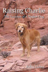
Raising Charlie: The Lessons of a Perfect Dog by John Lichty
Blog Archive
Followers
Recommended Links
- ATN Sailing Equipment
- ActiveCaptain
- BoatU.S.
- Coconut Grove Sailing Club
- Doyle Sails - Fort Lauderdale
- El Milagro Marina
- John Kretschmer Sailing
- John Vigor's Blog
- Leap Notes
- Noonsite.com
- Notes From Paradise
- Pam Wall, Cruising Consultant
- Practical Sailor
- Project Bluesphere
- Sail Makai
- So Many Beaches
- Windfinder
Showing posts with label Grand Junction. Show all posts
Saturday, October 5, 2013
Tuesday, December 25, 2012
Christmas Letter 2012
Christmas 2012
Dear Family and Friends,
Last year at this time, we were facing the prospect of a non-white Christmas, and winter continued mostly snowless, for one of the worst ski seasons in memory. This year looks to be more promising: we have had two pretty good snowfalls already. As a neighbor said to Nan and me as we walked Scout past his house this morning following last night’s accumulation, “It’s good to see the wet.”
After the season’s first snowfall last weekend, Nan and I ventured up icy roads to the Colorado National Monument for this year’s card photo. Scout couldn’t join us because dogs are not allowed, so we dressed him up in antlers for the letter photo instead. Yes, that is a cane in Nan’s right hand. She underwent bilateral hip replacement surgery on October 26 and has been making a remarkable recovery. Osteoarthritis and thirty-five years of running had used up all her cartilage, leaving her in constant pain. She should not run anymore, but she may now look forward to a future of other activities, like swimming and cycling, free of hip pain. We owe a huge debt of gratitude to Nan’s sister Monica for her tireless, hands-on assistance in the weeks following Nan’s surgery.The year started for us in Isla Mujeres, Mexico, where we celebrated New Year’s Eve with local friends at the island’s all-night fiesta. We have vacationed there almost a dozen times now, but this was our first winter trip. It was chilly and windy, definitely not beach weather, and we were happy to have brought our fleece jackets. We went back again in September for a week of perfect weather, lazing on the beach, finding new things to see and do, and checking out the island’s many marinas for a future sailing trip from Savannah. Our friends Mike and Erika from Aspen joined us for a day from their vacation in Playa del Carmen, and we saw all the sights from a rented golf cart.
In April, my family held a reunion of sorts in Savannah. Mom and Dad hosted sister Jane, her husband Josh, their twins Max and Ben, sister Susan, Nan and me for golf, downtown tours, Tybee Island beach time and long, memorable dinners. Missing were Susan’s husband John, their kids Kirsten and Peter, and brother Stuart and his girlfriend Mayumi. Stuart has not visited the mainland from Hawaii for at least five years, but we’re all hoping to visit him there sometime, maybe for Dad’s eightieth birthday in June.
Nan enjoyed a few quick trips home to Manitowoc this year for family time with her mother, her sister Amy, and other members of the Mullins clan. In May, she helped celebrate her mother’s eighty-ninth birthday and sister Monica’s fiftieth.
Summer in Grand Junction was the hottest on record, with many days above a hundred degrees. Even with his cool “puppy cut,” Scout refused his afternoon walks after scorching his paws on the hot asphalt. Nan and I braved the heat most weekends for bad golf at our local public courses, and I finally hit a hole in one after fifty years of trying, witnessed officially by Nan and our friends Kevin and Lesley.
After many years of writing these Christmas letters, I regret to tell you that this is the last one we will be printing and mailing. Like Newsweek magazine, we are going completely digital in the New Year. If we have your email address, we will send you an electronic version at this time next year. If not, please look for the letter on my blog at whisperingjesse.blogspot.com. In case you don’t already have them, our email addresses are johnallenlichty@gmail.com and nanlichty@hotmail.com.
Wishing you and yours a wonderful, wet holiday season and a peaceful, prosperous New Year!
Love,
Labels:
Christmas,
golf,
Grand Junction,
Isla Mujeres,
sailing,
Savannah,
Scout
Monday, August 20, 2012
Life in Grand Junction: A Close Encounter
On Saturday night, Nan and I went to our local Red Robin for an inexpensive dinner out. It was a nice evening, cooler than it has been, so we opted for a table outside on the patio. We chatted about our upcoming vacation, sipped our wine, ate our burgers, and watched the sun slowly sink behind the Chick-fil-A across the street. Just a typical dining experience. But then it got weird.
The eleven- or twelve-year-old girl sitting with her mother at a table near ours stood up suddenly, went to the table across from us, where a family of five were seated, and yelled at the mother, "Stop staring at me!" Everyone on the patio stopped eating. It got very quiet. The girl returned to her table and sat looking at her mother. Neither said anything.
People looked around at one another with expressions of "What was that all about?!" on their faces. We made eye contact with the man of the family, who said, "She wasn't staring. She was just talking to her son and that girl was behind him." The mother looked shaken and close to tears.
The girl and her mother paid their bill quickly and stood up to leave. The man stood up and intercepted them. He asked why the mother would let her daughter speak to an adult with such disrespect. The mother said, "I don't f--king care." The man stared in disbelief as the girl and her mother walked quickly away.
As he returned to his table, the man announced to everyone within earshot that if he had ever spoken to someone in that way, his father would have whipped his ass right there in the restaurant. There were murmurs of agreement all around. Seated again, the man said, "Did you smell that woman's perfume? It was enough to make me gag! I had to go out and smoke a cigarette just to get away from it. If they thought we were staring at them, then that's why!" He took off his camouflage baseball cap, brushed his hair back with his hand, replaced the cap, and sat back in his chair with a deep sigh.
The man and his family paid their bill and stood to leave. At the exit, he turned and said loudly enough for all to hear, "Y'know, I don't vote Republican!" He paused. "I may be a redneck, but I'm not stupid!" He paused again. "I'm a union member!" He threw up his hands for dramatic effect and then turned to go. Nan and I cheered and clapped, joined by several others.
The eleven- or twelve-year-old girl sitting with her mother at a table near ours stood up suddenly, went to the table across from us, where a family of five were seated, and yelled at the mother, "Stop staring at me!" Everyone on the patio stopped eating. It got very quiet. The girl returned to her table and sat looking at her mother. Neither said anything.
People looked around at one another with expressions of "What was that all about?!" on their faces. We made eye contact with the man of the family, who said, "She wasn't staring. She was just talking to her son and that girl was behind him." The mother looked shaken and close to tears.
The girl and her mother paid their bill quickly and stood up to leave. The man stood up and intercepted them. He asked why the mother would let her daughter speak to an adult with such disrespect. The mother said, "I don't f--king care." The man stared in disbelief as the girl and her mother walked quickly away.
As he returned to his table, the man announced to everyone within earshot that if he had ever spoken to someone in that way, his father would have whipped his ass right there in the restaurant. There were murmurs of agreement all around. Seated again, the man said, "Did you smell that woman's perfume? It was enough to make me gag! I had to go out and smoke a cigarette just to get away from it. If they thought we were staring at them, then that's why!" He took off his camouflage baseball cap, brushed his hair back with his hand, replaced the cap, and sat back in his chair with a deep sigh.
The man and his family paid their bill and stood to leave. At the exit, he turned and said loudly enough for all to hear, "Y'know, I don't vote Republican!" He paused. "I may be a redneck, but I'm not stupid!" He paused again. "I'm a union member!" He threw up his hands for dramatic effect and then turned to go. Nan and I cheered and clapped, joined by several others.
Monday, July 23, 2012
Ute Petroglyphs
Scout and I, and sometimes Nan, have continued to hike the Grand Junction area's desert trails this summer despite the record-setting heat. My interest in petroglyphs has had us hiking new trails almost every weekend in search of ever more impressive examples of the primitive rock art.
Over Memorial Day weekend, Scout and I hiked in the Dominguez Canyon, starting from the Bridgeport end that is accessible from Highway 50, south of town about 20 miles. After crossing the Gunnison River on a beautifully designed steel pedestrian bridge, we passed through the river rafters' campsites and worked our way up into the canyon on a well-used trail. In addition to the petroglyphs I hoped to see, some people we met on the trail told me about an impressive waterfall we should be sure to see that was off the trail about five minutes before the petroglyph area.
The petroglyphs were pecked into rock surfaces immediately adjacent to the trail, so there was no difficulty finding them. I noticed right away that the petroglyphs in these murals seemed much more recent than the ones I have seen around Moab and other places. The contrast between the art and the background was much more pronounced, and the images were more distinctly recognizable as humans, animals and symbolic designs. The biggest clue, though, was that several of the images depicted humans on horseback. Horses were introduced into the New World by Spanish explorers only 500 years ago, so these petroglyphs would have been created by the Native Americans who populated western Colorado in the years since then: the Utes.
The most dramatic of the murals showed several humans on horseback hunting an abstract-looking creature that I interpreted to be a bear based on the paw print associated with it. The lead hunter appears to be wearing an elaborate headdress and riding a larger horse. As is unfortunately the case with most petroglyphs, idiots have added graffiti to the mural in the form of initials and a crude, scratched-in version of a horse. True petroglyphs are pecked into the stone, not scratched.
On our way back down from the petroglyph area, Scout and I kept an eye on the stream that runs through the canyon to see if we could figure out where the waterfall would be. There was a point where the stream appeared to run into a wall of rock, so we left the trail to investigate. We found a spectacular waterfall where the stream took a sharp right turn at the rock wall and the water fell more than 50 feet to the gravel below. The stone surface beneath the stream, leading up to the falls, was well-worn, leaving shallow pools that Scout felt obliged to swim in and cool off.
The following weekend was Nan's and my wedding anniversary, and we celebrated by hiking the Palisade Rim Trail, at the far eastern end of Palisade, east of Grand Junction off Interstate 70 and above the Colorado River. Even with an early morning start, it was a hot and buggy hike. There was a large crew of volunteers working to get the trail into shape for mountain biking, which is the trend in this area: Trails that have been used by hikers and horseback riders for years are discovered by mountain bikers, modified to accommodate their needs, and then overrun by them. I'm not anti-mountain biking, but there are riders out there who could stand to learn some trail etiquette. The main reason I don't ride myself is because I don't think it would be fair to Scout to have him try to keep up with me. So I hike with him instead, and he is happy.
The petroglyphs we found on this hike were not so impressive. The murals were smaller, and there were fewer of them. The petroglyphs appeared to be of the same vintage as the Dominguez Canyon ones and depicted similar scenes, so we guessed that they were also created by the Utes who inhabited the area and perhaps used this remote mesa above the Colorado River as a hunting camp. The primary difference I noticed was that these petroglyphs were mostly of deer and elk, while the Dominguez Canyon ones were mostly of bears and bighorn sheep, leading me to think that the fauna in the two areas were at least somewhat different even though the areas were only 30 miles apart.
On Independence Day, Scout and I returned to Dominguez Canyon, this time with Nan. I wanted to share the petroglyphs and the waterfall with her. It had been very hot since Scout and I had done the hike a few weeks earlier, and the stream in the canyon had dried up. The waterfall was not flowing, and there was only a single pool of water left. It was filled with tadpoles striving to become desert frogs if the pool did not evaporate first.
Nan was having issues with her hips, so the dried-up waterfall was her turnaround point. Scout and I proceeded quickly up the trail from there to snap some photos of the petroglyphs to show Nan what she was missing. When we caught back up with her, she spotted some desert bighorn sheep in the fields on the other side of the canyon. There was a flock of about a dozen, grazing and keeping an eye on us. They were a thrill to see. I found out later that they had been recently reintroduced to the canyon, presumably after being hunted out of existence by the Utes many years before and leaving only their images on the stone walls to show they had once been there.
Over Memorial Day weekend, Scout and I hiked in the Dominguez Canyon, starting from the Bridgeport end that is accessible from Highway 50, south of town about 20 miles. After crossing the Gunnison River on a beautifully designed steel pedestrian bridge, we passed through the river rafters' campsites and worked our way up into the canyon on a well-used trail. In addition to the petroglyphs I hoped to see, some people we met on the trail told me about an impressive waterfall we should be sure to see that was off the trail about five minutes before the petroglyph area.
The petroglyphs were pecked into rock surfaces immediately adjacent to the trail, so there was no difficulty finding them. I noticed right away that the petroglyphs in these murals seemed much more recent than the ones I have seen around Moab and other places. The contrast between the art and the background was much more pronounced, and the images were more distinctly recognizable as humans, animals and symbolic designs. The biggest clue, though, was that several of the images depicted humans on horseback. Horses were introduced into the New World by Spanish explorers only 500 years ago, so these petroglyphs would have been created by the Native Americans who populated western Colorado in the years since then: the Utes.
The most dramatic of the murals showed several humans on horseback hunting an abstract-looking creature that I interpreted to be a bear based on the paw print associated with it. The lead hunter appears to be wearing an elaborate headdress and riding a larger horse. As is unfortunately the case with most petroglyphs, idiots have added graffiti to the mural in the form of initials and a crude, scratched-in version of a horse. True petroglyphs are pecked into the stone, not scratched.
On our way back down from the petroglyph area, Scout and I kept an eye on the stream that runs through the canyon to see if we could figure out where the waterfall would be. There was a point where the stream appeared to run into a wall of rock, so we left the trail to investigate. We found a spectacular waterfall where the stream took a sharp right turn at the rock wall and the water fell more than 50 feet to the gravel below. The stone surface beneath the stream, leading up to the falls, was well-worn, leaving shallow pools that Scout felt obliged to swim in and cool off.
The following weekend was Nan's and my wedding anniversary, and we celebrated by hiking the Palisade Rim Trail, at the far eastern end of Palisade, east of Grand Junction off Interstate 70 and above the Colorado River. Even with an early morning start, it was a hot and buggy hike. There was a large crew of volunteers working to get the trail into shape for mountain biking, which is the trend in this area: Trails that have been used by hikers and horseback riders for years are discovered by mountain bikers, modified to accommodate their needs, and then overrun by them. I'm not anti-mountain biking, but there are riders out there who could stand to learn some trail etiquette. The main reason I don't ride myself is because I don't think it would be fair to Scout to have him try to keep up with me. So I hike with him instead, and he is happy.
The petroglyphs we found on this hike were not so impressive. The murals were smaller, and there were fewer of them. The petroglyphs appeared to be of the same vintage as the Dominguez Canyon ones and depicted similar scenes, so we guessed that they were also created by the Utes who inhabited the area and perhaps used this remote mesa above the Colorado River as a hunting camp. The primary difference I noticed was that these petroglyphs were mostly of deer and elk, while the Dominguez Canyon ones were mostly of bears and bighorn sheep, leading me to think that the fauna in the two areas were at least somewhat different even though the areas were only 30 miles apart.
On Independence Day, Scout and I returned to Dominguez Canyon, this time with Nan. I wanted to share the petroglyphs and the waterfall with her. It had been very hot since Scout and I had done the hike a few weeks earlier, and the stream in the canyon had dried up. The waterfall was not flowing, and there was only a single pool of water left. It was filled with tadpoles striving to become desert frogs if the pool did not evaporate first.
Nan was having issues with her hips, so the dried-up waterfall was her turnaround point. Scout and I proceeded quickly up the trail from there to snap some photos of the petroglyphs to show Nan what she was missing. When we caught back up with her, she spotted some desert bighorn sheep in the fields on the other side of the canyon. There was a flock of about a dozen, grazing and keeping an eye on us. They were a thrill to see. I found out later that they had been recently reintroduced to the canyon, presumably after being hunted out of existence by the Utes many years before and leaving only their images on the stone walls to show they had once been there.
Labels:
Grand Junction,
hiking,
Nan,
Scout
Sunday, June 24, 2012
Hole in one!
Yesterday was not an ideal day for golf. The afternoon temperature reached a withering 104 degrees. Few golfers were out on Chipeta Golf Course, but Nan and I were out there with our friends Kevin and Lesley, playing a 4-person scramble in the intense heat. The plan had been to play 18 holes and then go out for sushi, so the afternoon tee time had seemed like a good idea at the time. At least the best-ball scramble format and the gas-powered carts kept us moving quickly around the course.
We were playing pretty well up through the sixth hole, with a combined score of 1 under par to that point. I was the first to tee off on the seventh hole, a 174-yard par three with a pond right off the front of the tee. I have lost a few balls in that pond during past rounds, so I was playing a shag ball, a scuffed-up Titleist, but I pretty much play shag balls all the time since I lose so many. I had it teed down low and was playing a 4 iron. I took a well-balanced swing and made good contact. As I watched, the ball took a high trajectory with a slight draw that put it right on line for the hole. It bounced twice on the green and disappeared. I turned to Nan, Kevin and Lesley, sitting in the shade in the carts, and said, "I think it went in!" They had not been paying close attention and thought I was kidding, but they saw I was serious and hurried to take their tee shots so we could go see for sure.
I raced our cart down the path to the green, hopped out and rushed to the hole. Sure enough, there was my ball. A hole in one! I raised my arms in triumph and received high fives all around. We took some photos for posterity with my iPhone and then moved on to the eighth tee, now 3 under par. As Nan and I drove up the eighth fairway, she nudged me and said, "You're still smiling." I said, "I can't help it. I've been playing golf for 50 years and never thought I would get a hole in one. It feels pretty good."
We were playing pretty well up through the sixth hole, with a combined score of 1 under par to that point. I was the first to tee off on the seventh hole, a 174-yard par three with a pond right off the front of the tee. I have lost a few balls in that pond during past rounds, so I was playing a shag ball, a scuffed-up Titleist, but I pretty much play shag balls all the time since I lose so many. I had it teed down low and was playing a 4 iron. I took a well-balanced swing and made good contact. As I watched, the ball took a high trajectory with a slight draw that put it right on line for the hole. It bounced twice on the green and disappeared. I turned to Nan, Kevin and Lesley, sitting in the shade in the carts, and said, "I think it went in!" They had not been paying close attention and thought I was kidding, but they saw I was serious and hurried to take their tee shots so we could go see for sure.
I raced our cart down the path to the green, hopped out and rushed to the hole. Sure enough, there was my ball. A hole in one! I raised my arms in triumph and received high fives all around. We took some photos for posterity with my iPhone and then moved on to the eighth tee, now 3 under par. As Nan and I drove up the eighth fairway, she nudged me and said, "You're still smiling." I said, "I can't help it. I've been playing golf for 50 years and never thought I would get a hole in one. It feels pretty good."
Saturday, June 2, 2012
Nan's Good Deed: A Happy Ending
There was an article in the Grand Junction Free Press on Friday, May 25, about the local police department's Homeless Outreach Team (HOT). According to the article, team members are building relationships with the homeless population to ensure that they receive the services that are available through local providers such as Catholic Outreach and the Salvation Army. Nan brought the article to my attention because the accompanying photo featured HOT team members sitting in the riverside camp of her adopted homeless person, Jerry. The photo must have been more than a year old because we have not seen Jerry around town in at least that long.
After the three-part series I wrote three years ago about Nan's relationship with Jerry ("Nan's good deed", "Nan's good deed, part 2" and "Nan's good deed, part 3"), I have been hesitant to write more because I didn't want to report that things were not going well in Jerry's life. First, we heard through an attorney who helped with Jerry's legal problems that he had come into a significant inheritance that would have permanently lifted him out of homelessness. All he needed to do to claim it was to show up in Florida, his home state, with proof of his identity, but he could not get it together to secure an ID card and make the trip. It was easier to remain a drunk in Grand Junction. Nan and I were disappointed, but it didn't change our feelings for Jerry.
What did change our feelings was the second thing that happened. Jerry had a terrible history with Animal Control over his dog Bear-Bear. She was a red-furred chow mix and Jerry's closest friend, and she was the reason why Nan approached Jerry in the first place, out of concern that the dog wasn't getting enough to eat. But Jerry was derelict in keeping Bear-Bear on a leash, and she would occasionally take a nip at people in defense of Jerry. These occurrences would land her in the dog pound, sometimes for extended periods while Jerry panhandled to pay the fines. Finally, Bear-Bear reached her last strike with Animal Control, and the court ordered her to be euthanized. It still makes my eyes water to think of this poor little mutt who never really had a chance, who was loved and looked after by a man who could barely look after himself, and who was condemned to die for doing what dogs do, defending her human companion.
When Jerry disappeared from the streets of Grand Junction shortly after, Nan and I had few misgivings. We had done what we could for him, and we wished him well wherever he was. So it was a pleasant surprise to see Jerry's face in the newspaper photo and to learn from the article that the HOT people had enrolled him in a rehab program called TLC in Phoenix, where he became a group leader and now manages a group home there. When the bus dropped him off in Phoenix, he had no other transportation and had to walk everywhere, so he requested that the HOT people ship his bike to him, which they did. It was the same bike that Nan and I had bought for Jerry more than three years ago.
Jerry, we're proud of how you have turned your life around. We hope you are happy and that you will someday find a puppy to love as much as you loved Bear-Bear.
After the three-part series I wrote three years ago about Nan's relationship with Jerry ("Nan's good deed", "Nan's good deed, part 2" and "Nan's good deed, part 3"), I have been hesitant to write more because I didn't want to report that things were not going well in Jerry's life. First, we heard through an attorney who helped with Jerry's legal problems that he had come into a significant inheritance that would have permanently lifted him out of homelessness. All he needed to do to claim it was to show up in Florida, his home state, with proof of his identity, but he could not get it together to secure an ID card and make the trip. It was easier to remain a drunk in Grand Junction. Nan and I were disappointed, but it didn't change our feelings for Jerry.
What did change our feelings was the second thing that happened. Jerry had a terrible history with Animal Control over his dog Bear-Bear. She was a red-furred chow mix and Jerry's closest friend, and she was the reason why Nan approached Jerry in the first place, out of concern that the dog wasn't getting enough to eat. But Jerry was derelict in keeping Bear-Bear on a leash, and she would occasionally take a nip at people in defense of Jerry. These occurrences would land her in the dog pound, sometimes for extended periods while Jerry panhandled to pay the fines. Finally, Bear-Bear reached her last strike with Animal Control, and the court ordered her to be euthanized. It still makes my eyes water to think of this poor little mutt who never really had a chance, who was loved and looked after by a man who could barely look after himself, and who was condemned to die for doing what dogs do, defending her human companion.
When Jerry disappeared from the streets of Grand Junction shortly after, Nan and I had few misgivings. We had done what we could for him, and we wished him well wherever he was. So it was a pleasant surprise to see Jerry's face in the newspaper photo and to learn from the article that the HOT people had enrolled him in a rehab program called TLC in Phoenix, where he became a group leader and now manages a group home there. When the bus dropped him off in Phoenix, he had no other transportation and had to walk everywhere, so he requested that the HOT people ship his bike to him, which they did. It was the same bike that Nan and I had bought for Jerry more than three years ago.
Jerry, we're proud of how you have turned your life around. We hope you are happy and that you will someday find a puppy to love as much as you loved Bear-Bear.
Sunday, May 20, 2012
Eclipse
Nan and I followed the annular eclipse throughout this evening from our home in Grand Junction. We weren't in the "ring of fire" zone, but according to a diagram I found on the Discovery.com website, we were right at the edge of the ninety percent zone. It was still very impressive.
We experimented with a few different ways to view the eclipse. I built a simple pin-hole viewer out of a shoe box, but the projected image was really small. The photo below shows Nan holding it as the eclipse approached local totality. If you click the photo, you should be able to see the tiny crescent shape more clearly. We also projected the eclipse through binoculars onto our backyard fence, but the image was a little fuzzy. We had the greatest success stacking three layers of photographic negatives together and holding them up about a foot in front of our eyes to view the eclipse directly. This is probably a no-no, but if you don't think ahead and buy a pair of "eclipse glasses," then you try to make do. The photo above was taken through the negatives and shows an unusual effect, multiple images of the eclipse radiating out from the bright central image. The only explanation for this that I can think of is that the sunlight was refracting and reflecting between the three different layers of film. If anyone has a better explanation, I'd like to hear it. Again, if you click the photo, you should be able to see the eclipse images more clearly.
It's a busy few weeks for astronomical phenomena. Coming up on Wednesday, June 5, Venus will perform a transit across the face of the sun. We'll try to come up with a better projection system for that one and share the photos. In the meantime, happy stargazing!
We experimented with a few different ways to view the eclipse. I built a simple pin-hole viewer out of a shoe box, but the projected image was really small. The photo below shows Nan holding it as the eclipse approached local totality. If you click the photo, you should be able to see the tiny crescent shape more clearly. We also projected the eclipse through binoculars onto our backyard fence, but the image was a little fuzzy. We had the greatest success stacking three layers of photographic negatives together and holding them up about a foot in front of our eyes to view the eclipse directly. This is probably a no-no, but if you don't think ahead and buy a pair of "eclipse glasses," then you try to make do. The photo above was taken through the negatives and shows an unusual effect, multiple images of the eclipse radiating out from the bright central image. The only explanation for this that I can think of is that the sunlight was refracting and reflecting between the three different layers of film. If anyone has a better explanation, I'd like to hear it. Again, if you click the photo, you should be able to see the eclipse images more clearly.
It's a busy few weeks for astronomical phenomena. Coming up on Wednesday, June 5, Venus will perform a transit across the face of the sun. We'll try to come up with a better projection system for that one and share the photos. In the meantime, happy stargazing!
Monday, May 14, 2012
Critters
I was cutting our meager lawn on Saturday morning and almost ran over a baby rattlesnake with the lawn mower. I may have clipped him with a wheel on the previous pass because he was coiled up in a posture of pain when I noticed him and stopped the mower. As I approached for a better look, he withdrew his spade-shaped head and lunged at me repeatedly with fangs extended. It would have been intimidating if he weren't only a foot long. I needed to move him out of the way, but I wasn't going to get my hands anywhere near him. I went in the garage to get the pooper-scooper, carefully scooped him up, and deposited him over the fence into the neighbor's yard. Hey, at least over there I wouldn't run him over again. I looked in on him with every pass, and I worried that I really had injured him because he stayed in his coil of pain for quite a while, but eventually he extended his head, and on the next pass he was gone.
We have lived in Grand Junction for seven years now, and this was my first experience with a rattlesnake. Scout and I occasionally scare up garden snakes on our walks, but they slither quickly away. This little fellow bravely stood his ground. I was so surprised to see him that it didn't occur to me to try to kill him even though he could someday be a threat to neighborhood kids, dogs and cats.
It's not in my nature to harm living things. If anything, I try to encourage the presence of local wildlife. Finches, mourning doves and hummingbirds visit our feeders. Chipmunks and mice eat spilled seeds. Lizards of all shapes and sizes bask on our patio. Toads burrow into the edges of our lawn. Mule deer graze the scrub grass behind our house. Foxes and coyotes dash past during early morning walks. Scorpions startle us in dark corners. And praying mantises and walking stick insects live in our summertime flower pots. For me, the word "desert" used to conjure up images of barren, desolate spaces devoid of life, but living here, I know better.
It didn't occur to me to get a photo of the baby rattlesnake, so the desert scene above will need to suffice. It's from a hike that Scout and I did on Sunday morning while checking out potential camping spots for the upcoming Memorial Day weekend. The view is looking south toward the Uncompahgre Plateau from a sandstone ridge high above the Gunnison River, with a flowering silver cholla cactus in the foreground. Click the image to see it full-size.
We have lived in Grand Junction for seven years now, and this was my first experience with a rattlesnake. Scout and I occasionally scare up garden snakes on our walks, but they slither quickly away. This little fellow bravely stood his ground. I was so surprised to see him that it didn't occur to me to try to kill him even though he could someday be a threat to neighborhood kids, dogs and cats.
It's not in my nature to harm living things. If anything, I try to encourage the presence of local wildlife. Finches, mourning doves and hummingbirds visit our feeders. Chipmunks and mice eat spilled seeds. Lizards of all shapes and sizes bask on our patio. Toads burrow into the edges of our lawn. Mule deer graze the scrub grass behind our house. Foxes and coyotes dash past during early morning walks. Scorpions startle us in dark corners. And praying mantises and walking stick insects live in our summertime flower pots. For me, the word "desert" used to conjure up images of barren, desolate spaces devoid of life, but living here, I know better.
It didn't occur to me to get a photo of the baby rattlesnake, so the desert scene above will need to suffice. It's from a hike that Scout and I did on Sunday morning while checking out potential camping spots for the upcoming Memorial Day weekend. The view is looking south toward the Uncompahgre Plateau from a sandstone ridge high above the Gunnison River, with a flowering silver cholla cactus in the foreground. Click the image to see it full-size.
Labels:
Grand Junction,
Life,
Scout
Tuesday, April 3, 2012
Moqui Steps
On Sunday morning, my friend John Sasso, my dog Scout and I hiked the Rough Canyon trail south of town, in the Bangs Canyon area off Little Park Road. Scout and I tried to do the same hike last summer, but we were forced to turn around due to wet conditions and some difficult scrambling that I felt was beyond Scout's safety level. We didn't experience the same trouble this time. After our mild winter and extremely dry spring, the going was much easier.
I showed John the petroglyphs that Scout and I had found on a canyon wall the last time, and I was angered to see even more graffiti had been added, some of it practically on top of the ancient rock art. John had done a number of rock climbs in the canyon, and he pointed them out as we worked our way down the canyon's stream bed. Scout made a number of athletic moves through the scrambling sections and rewarded himself with quick swims in the many muddy pools.
We eventually reached Rough Canyon Falls, where Scout and I had searched for the elusive moqui steps (sometimes spelled moki steps) during a hike last summer that brought us to the falls from the rim trail that runs above and parallel to the Rough Canyon trail. I told John about the moqui steps during our hike and said that I was hoping to find them that day. He walked up to the edge of the cliff next to the dry stone groove of the falls, pointed down and said, "They're right there!" I joined him and couldn't believe it. I had looked at that same wall the year before and seen nothing unusual, but John saw them right away. I must have been expecting something different the last time, because there was no mistaking them this time. I climbed around the two huge cottonwood trunks that are wedged into the falls to get a better angle for some photos. John looked for a way to get down to the bottom where the steps started, but the only way was to use the steps, which was too dangerous to try without the pool below having enough water to break a fall.
Being an avid rock climber, John proposed that we come back another time with a climbing rope and set an anchor using one of the juniper trees on the rim. We could take turns rappelling down to the bottom and then safely climbing the moqui steps back up while on a belay. After giving it some thought, I would guess that the ancient people who carved the moqui steps must have had a hand-woven rope that they used in conjunction with the steps to make it easier to get up and down, especially if they were carrying water containers. The fact that the first step was about four feet above the bottom made me think that the steps were intended to be used when the pool was full of water. During a dry spell, the shaded pool may have been the only local source for fresh water.
I showed John the petroglyphs that Scout and I had found on a canyon wall the last time, and I was angered to see even more graffiti had been added, some of it practically on top of the ancient rock art. John had done a number of rock climbs in the canyon, and he pointed them out as we worked our way down the canyon's stream bed. Scout made a number of athletic moves through the scrambling sections and rewarded himself with quick swims in the many muddy pools.
We eventually reached Rough Canyon Falls, where Scout and I had searched for the elusive moqui steps (sometimes spelled moki steps) during a hike last summer that brought us to the falls from the rim trail that runs above and parallel to the Rough Canyon trail. I told John about the moqui steps during our hike and said that I was hoping to find them that day. He walked up to the edge of the cliff next to the dry stone groove of the falls, pointed down and said, "They're right there!" I joined him and couldn't believe it. I had looked at that same wall the year before and seen nothing unusual, but John saw them right away. I must have been expecting something different the last time, because there was no mistaking them this time. I climbed around the two huge cottonwood trunks that are wedged into the falls to get a better angle for some photos. John looked for a way to get down to the bottom where the steps started, but the only way was to use the steps, which was too dangerous to try without the pool below having enough water to break a fall.
Being an avid rock climber, John proposed that we come back another time with a climbing rope and set an anchor using one of the juniper trees on the rim. We could take turns rappelling down to the bottom and then safely climbing the moqui steps back up while on a belay. After giving it some thought, I would guess that the ancient people who carved the moqui steps must have had a hand-woven rope that they used in conjunction with the steps to make it easier to get up and down, especially if they were carrying water containers. The fact that the first step was about four feet above the bottom made me think that the steps were intended to be used when the pool was full of water. During a dry spell, the shaded pool may have been the only local source for fresh water.
Labels:
Grand Junction,
hiking,
John Sasso,
Scout
Wednesday, March 14, 2012
Still hoping for change?
Monday morning on my way to work, I spotted a new billboard. It showed a close-up photo of some guy's torso in t-shirt and blue jeans, with his hands pulling his front pockets inside out. The wording in front of the photo said in large white letters, "STILL HOPING FOR CHANGE?" And the "O" in "HOPING" was replaced with President Obama's familiar campaign symbol. At the bottom of the billboard was the Web address for the responsible party, Compass Colorado, which I will not link to from my blog.
This billboard didn't anger me nearly as much as the one I saw almost two years ago (http://whisperingjesse.blogspot.com/2010/03/welcome-to-grand-junction.html), which showed former President Jimmy Carter thinking, "They can't call me the worst president anymore!" Still, it riled me enough that I checked out Compass Colorado's website. Its message is clear: "Call the White House and demand President Obama stop the spending and save Colorado jobs." What is not so clear is how those two demands are related. Digging deeper, I found: "Colorado’s economy has stagnated due to failed policies on the local, state and national levels. Tax hikes, reckless spending, and burdensome regulations have created an uncertain economic climate and stifled economic recovery and job creation."
To my way of thinking, that argument is completely backwards. Economic recovery and job creation have been slowed by lack of demand, not by government policies. Higher prices and lower wages, for those lucky enough to have jobs, have pinched people to the point where they don't have any money to spend except on basic necessities. Our consumer-driven economy suffers as a result. The tax hikes, so-called reckless spending and burdensome regulations are the successful policies that are facilitating economic recovery while preserving our environment for future generations. The government has created incentives that have saved thousands of jobs while at the same time imposing rules and regulations to prevent the greedy practices that crashed the economy in the first place.
The timing of the billboard's placement is suspicious. The economy has been improving steadily over the last few months, so the associated website's gloom-and-doom message seems a little late. More likely, the billboard is what it seemed to be when I first saw it, an anti-Obama campaign message. That, too, seems a little late. With the Republicans failing to present a credible challenger, President Obama appears destined for re-election, which will keep alive his message of hope and change for another four years.
This billboard didn't anger me nearly as much as the one I saw almost two years ago (http://whisperingjesse.blogspot.com/2010/03/welcome-to-grand-junction.html), which showed former President Jimmy Carter thinking, "They can't call me the worst president anymore!" Still, it riled me enough that I checked out Compass Colorado's website. Its message is clear: "Call the White House and demand President Obama stop the spending and save Colorado jobs." What is not so clear is how those two demands are related. Digging deeper, I found: "Colorado’s economy has stagnated due to failed policies on the local, state and national levels. Tax hikes, reckless spending, and burdensome regulations have created an uncertain economic climate and stifled economic recovery and job creation."
To my way of thinking, that argument is completely backwards. Economic recovery and job creation have been slowed by lack of demand, not by government policies. Higher prices and lower wages, for those lucky enough to have jobs, have pinched people to the point where they don't have any money to spend except on basic necessities. Our consumer-driven economy suffers as a result. The tax hikes, so-called reckless spending and burdensome regulations are the successful policies that are facilitating economic recovery while preserving our environment for future generations. The government has created incentives that have saved thousands of jobs while at the same time imposing rules and regulations to prevent the greedy practices that crashed the economy in the first place.
The timing of the billboard's placement is suspicious. The economy has been improving steadily over the last few months, so the associated website's gloom-and-doom message seems a little late. More likely, the billboard is what it seemed to be when I first saw it, an anti-Obama campaign message. That, too, seems a little late. With the Republicans failing to present a credible challenger, President Obama appears destined for re-election, which will keep alive his message of hope and change for another four years.
Labels:
Barack Obama,
Grand Junction,
presidential election
Monday, January 30, 2012
Devil's Canyon Hike
One of the best things about living in Grand Junction is the mild winter climate. Great skiing is less than an hour away up at Powderhorn, yet there is very little snow down below. It is possible to hike year round on trails that receive sufficient sun to melt the scant snow, and Devil's Canyon is one of those trails. It is located just to the west of the Colorado National Monument's western boundary, so it is open to dogs, unlike the Monument itself. If I'm going to take a hike, I want to include my dog Scout because he enjoys hiking even more than I do.
Early on Saturday morning, Scout and I left home and drove west on Broadway/Highway 340 to just past the Monument's western entrance, took a left at King's View Road and then another left onto Devil's Canyon Road to reach the trailhead parking lot. My hiking buddy John Sasso showed up a few minutes later, dropped off by his wife D on her way to the annual Beer Run, a 9.3 mile race in the Fruita area that ends at the Hot Tomato Cafe. John, Scout and I didn't waste much time getting underway because it was windy and still below freezing. We followed trail D1 to D4 to D3 to work our way up the sunny western side of the canyon. There is a network of well-marked trails that loops all over the area, but they can be confusing, so it's a good idea to check the trail map inside the shelter at the trailhead before heading out. There are also maps that are free for the taking from a metal box a few yards up the main trail.
In the canyon, out of the wind, we were soon shedding shells and gloves to keep from overheating. Scout was warm, too, and backtracked frequently for squirts of water from my CamelBak. We paused frequently to admire the Wingate Sandstone walls and spires, and the occasional granite extrusions that are rare in this largely sedimentary area. John speculated about the "climbability" of some of the cracks and chimneys we passed and guessed that most of them had already been climbed. Off in the distance, above the top of the canyon's box end, I could see the antenna farm that dots Black Ridge. It is the highest point in the area, so high that I can see it easily from my office window at work several miles away on the north side of town, near the airport.
About an hour and a half into the hike, the trail dropped and climbed through a series of side drainages and then curved left into a flat area where there sat an old shepherd's cabin. Scout ran ahead to investigate but we were the only ones around. There was a campfire ring and log benches in front of the cabin, and the area smelled of old, wet cinders. The cabin was made of weathered wood covered with tar paper, and the cracks were chinked with new-looking spray foam. It appeared to be at least fifty years old and looks to have been maintained in a somewhat haphazard fashion, with new pieces of wood nailed into place as needed over the years. Remarkably, the glass windows on either end are still intact. At the south end of the cabin was a small, roofed corral that must have been used to protect sheep at one time. Inside the cabin, there was a small table, some shelves, a sheet metal woodstove and a built-in plywood bunk bed but no mattresses. There was also a large collection of relics and graffiti left by previous travelers. I commented that it looked like a cozy place to spend a night but John didn't think so.
Instead of backtracking down the trail we had come up, we went down the trail on the eastern side of the canyon. It receives less sun than the western side, so we needed to contend with occasional patches of snow and mud. John was carrying a hiking pole and I wished that I had thought to bring one myself after a few slips in the wet conditions. Scout used the snow as an opportunity to cool off, rolling on his back and grunting his pleasure. In an hour, we found ourselves back at the point where the western and eastern trails split, completing the loop that had ended at the cabin. From there, it was an easy hike out the way we had come in. We passed small groups of hikers and dogs along the way. They were getting a later, warmer start than we had experienced when we started a little more than three hours earlier.
Back at the trailhead, Scout still had the energy to jump into the back of the SUV. Then we were off to meet up with the Beer Run finishers at the Hot Tomato Cafe and join them for a slice of pizza and a well-deserved beer.
Early on Saturday morning, Scout and I left home and drove west on Broadway/Highway 340 to just past the Monument's western entrance, took a left at King's View Road and then another left onto Devil's Canyon Road to reach the trailhead parking lot. My hiking buddy John Sasso showed up a few minutes later, dropped off by his wife D on her way to the annual Beer Run, a 9.3 mile race in the Fruita area that ends at the Hot Tomato Cafe. John, Scout and I didn't waste much time getting underway because it was windy and still below freezing. We followed trail D1 to D4 to D3 to work our way up the sunny western side of the canyon. There is a network of well-marked trails that loops all over the area, but they can be confusing, so it's a good idea to check the trail map inside the shelter at the trailhead before heading out. There are also maps that are free for the taking from a metal box a few yards up the main trail.
In the canyon, out of the wind, we were soon shedding shells and gloves to keep from overheating. Scout was warm, too, and backtracked frequently for squirts of water from my CamelBak. We paused frequently to admire the Wingate Sandstone walls and spires, and the occasional granite extrusions that are rare in this largely sedimentary area. John speculated about the "climbability" of some of the cracks and chimneys we passed and guessed that most of them had already been climbed. Off in the distance, above the top of the canyon's box end, I could see the antenna farm that dots Black Ridge. It is the highest point in the area, so high that I can see it easily from my office window at work several miles away on the north side of town, near the airport.
About an hour and a half into the hike, the trail dropped and climbed through a series of side drainages and then curved left into a flat area where there sat an old shepherd's cabin. Scout ran ahead to investigate but we were the only ones around. There was a campfire ring and log benches in front of the cabin, and the area smelled of old, wet cinders. The cabin was made of weathered wood covered with tar paper, and the cracks were chinked with new-looking spray foam. It appeared to be at least fifty years old and looks to have been maintained in a somewhat haphazard fashion, with new pieces of wood nailed into place as needed over the years. Remarkably, the glass windows on either end are still intact. At the south end of the cabin was a small, roofed corral that must have been used to protect sheep at one time. Inside the cabin, there was a small table, some shelves, a sheet metal woodstove and a built-in plywood bunk bed but no mattresses. There was also a large collection of relics and graffiti left by previous travelers. I commented that it looked like a cozy place to spend a night but John didn't think so.
Instead of backtracking down the trail we had come up, we went down the trail on the eastern side of the canyon. It receives less sun than the western side, so we needed to contend with occasional patches of snow and mud. John was carrying a hiking pole and I wished that I had thought to bring one myself after a few slips in the wet conditions. Scout used the snow as an opportunity to cool off, rolling on his back and grunting his pleasure. In an hour, we found ourselves back at the point where the western and eastern trails split, completing the loop that had ended at the cabin. From there, it was an easy hike out the way we had come in. We passed small groups of hikers and dogs along the way. They were getting a later, warmer start than we had experienced when we started a little more than three hours earlier.
Back at the trailhead, Scout still had the energy to jump into the back of the SUV. Then we were off to meet up with the Beer Run finishers at the Hot Tomato Cafe and join them for a slice of pizza and a well-deserved beer.
Labels:
Grand Junction,
hiking,
John Sasso,
Scout
Sunday, December 25, 2011
Christmas Letter 2011
Christmas 2011
Dear Family and Friends,
Where we live now, on the high plateau just to the west of Colorado’s Rocky Mountains, autumn sometimes extends all the way to Christmas, or at least that’s how it feels. Sure, it gets cold at night and the leaves are off the trees, but the days are sunny, warm and dry. What’s missing from our early winters here is the snow. Our card photo, taken on December 10, would have looked pretty much the same, except for the jackets, if it had been taken back in September. It shows the three of us standing at the top of a hill in the Tabeguache area, about a mile from our home. In the background are downtown Grand Junction, Mt. Garfield, Chalk Mountain and the Grand Mesa—but no snow!
Nan and I are fully settled in Grand Junction now, both living and working. I started a new job in January as a programmer analyst with Quality Health Network, and Nan started in the spring as a pharmacy technician at St. Mary’s Hospital. It’s good to know that in our recessed economy, there is always demand in healthcare. Scout has settled into a new routine of his own, spending Tuesdays and Thursdays at doggie daycare, where he romps all day with his dog buddies. The refit project on our sailboat took several months longer than expected. I flew out to Solomons, Maryland to check on it in May, and then Nan and I both flew out there in July for Nan’s first-ever look at the boat. The photo above shows her climbing a ladder to the boat while it was out of the water.
By September the boat was almost ready to go. Two friends from Aspen, Mike and Kurt, flew out with me to help make final preparations to move the boat to Savannah, Georgia. We departed a week later, three days later than planned, sailing overnight on Chesapeake Bay to Norfolk, Virginia. Then it was three days of motoring through the Intracoastal Waterway, emerging into the Atlantic Ocean at Morehead City, North Carolina. We sailed continuously to make up lost time, but we were overrun by a terrible storm on the second morning and pulled up short in Charleston, North Carolina. Mike and I flew out a month later to finish the move, sailing overnight to Savannah, where Whispering Jesse is now slipped at a marina near my folks’ vacation home on Skidaway Island. Plans are now in the works for a Lichty family rendez-vous there next spring, featuring day sails and bad golf.
Nan made a few trips home to Manitowoc, Wisconsin during the year to visit family and friends, most recently in October, when she attended the wedding of her niece. Congratulations to Laura and Chris! The next day, she and her friend Gail ventured to Lambeau Field to watch the Packers add to their undefeated streak with a victory over the Denver Broncos.
Until a few days ago, we were reconciled to a brown Christmas. But then there was an overnight dusting. And last night there were a few fresh inches. Now it seems we’re on course for a real white Christmas, our annual wish come true. Here’s hoping all your wishes come true this holiday season and in the coming year.
Love,
Labels:
Christmas,
Grand Junction,
Isla Mujeres,
Savannah,
Whispering Jesse
Thursday, August 25, 2011
Rough Canyon Falls hike
It has been a hot summer here in Grand Junction, but the thermometer didn't get up to triple digits until Wednesday. With the temperatures only in the mid-nineties and the humidity near zero, it has been reasonably comfortable to take long weekend hikes with Scout provided there was some shade and I carried plenty of ice cubes and water in my CamelBak.
This past weekend, Scout and I drove over to the Bangs Canyon area off Little Park Road, just a few miles from home, and hiked about two miles to Rough Canyon Falls, an intermittent waterfall in a pristine sandstone canyon. There are two ways to get to the falls from the Bangs Canyon parking lot, and we had tried the more scenic Rough Canyon route a couple of weekends earlier without success. There had been a fair amount of rain, and the scoured floor of the canyon had held it in muddy pools that required skirting around the edges over some difficult boulders, at least for me. Scout waded and swam through many of the pools, but I didn't want to risk a fall on the slippery bottoms. We finally reached a point where I would need to scramble down a steep pitch using both hands and feet, and I decided we should turn around. Scout might have made it down, but he wouldn't have made it back up.
As we backtracked, I noticed one of those brown fiberglass stake signs. I hadn't seen it earlier because we had been on a different track of the braided trail. It warned against defacing the site, which I took to mean that there was something worth seeing along the short spur leading away from the sign. Sure enough, on a sandstone face beneath a huge overhang, there were some impressive petroglyphs of humanoid characters and a design of circles that reminded me of the map petroglyph in Hidden Valley, south of Moab. Of course, against the wishes of the sign, there was graffiti all around the petroglyphs. I don't understand why people can't just leave well enough alone.
That day, we could have continued back to the trailhead and taken the easier canyon rim route to the falls, but we opted to continue up the canyon past the turnoff to the parking lot and do the Mica Mine hike instead. Nan and I had done it once a few years ago with Charlie and later learned that we had turned around before reaching the actual mine, thinking that the large piles of mica tailings we spotted were the mine's remnants. I wanted to see what we had missed, and we still had plenty of water, so off we went. The trail was really just an old jeep road that the miners had painstakingly forged through the canyon. It was easy hiking and there was plenty of shade. Within a half-hour, we had passed the tailings and reached the actual mine, which is more of a large, excavated cave. There were still plenty of mica extrusions covering the walls, and I wondered if the miners had been trying to extract it in certain-sized plates, because there were fingernail-sized pieces of mica covering the ground all around the mine. I put a piece in my pocket, took photos of Scout, and then hiked out.
The rim route to Rough Canyon Falls, which doubles as a four-wheel drive slickrock road, delivered us to the falls without difficulty this past hot and sunny Sunday. Scout and I got a late start, and there was little shade, so we were happy for a slight breeze and a downhill course. I had hiked to the falls with Scout a couple of years ago because I had heard that there were petroglyphs and moqui steps to be seen, but we had seen only the falls themselves, though we carefully searched the area around the top of the falls, which were not flowing that day. I had mentioned this hike to Kelly, my guitar instructor, and he had said that there were indeed petroglyphs and moqui steps at the falls; we must have missed them somehow.
I tried to remember exactly where Kelly had said the sights were located as we hiked the two miles to the falls, but I couldn't. He had made their location sound so obvious, I figured we would find them easily. Well, I was wrong. The rim route dumps hikers at a spur that takes them to the top of the falls, just like the canyon route does. Scout and I searched that area thoroughly without finding anything noteworthy except for some nice muddy pools for Scout to cool off in. We worked our way down as far as we could, to the place where two old cottonwood trunks are wedged together in the narrow slot of the falls, and figured that if there were going to be any moqui steps, this is where they would be, going up the walls next to the falls. But they weren't there and the falls weren't flowing. We backtracked, looking for a way to get down to the very bottom of the falls, but it was a sheer twenty-foot drop all along the lower rim. There is a way to get down there by continuing along the rim route to where it crosses the creek bed and then hiking up the creek bed to the falls, but that was almost another mile of hiking and we were running low on water.
We slogged back up to the trailhead in the afternoon heat, Scout seeking shade and drinking from my CamelBak. I was thinking that the petroglyphs and moqui steps must be on the lower walls that we couldn't see from that lower rim. Maybe we'll get a cool, early morning start this coming weekend and see if we can't finally find them. I have a guitar lesson on Friday, so I'll try to get more exact directions from Kelly. Third try's the charm!
This past weekend, Scout and I drove over to the Bangs Canyon area off Little Park Road, just a few miles from home, and hiked about two miles to Rough Canyon Falls, an intermittent waterfall in a pristine sandstone canyon. There are two ways to get to the falls from the Bangs Canyon parking lot, and we had tried the more scenic Rough Canyon route a couple of weekends earlier without success. There had been a fair amount of rain, and the scoured floor of the canyon had held it in muddy pools that required skirting around the edges over some difficult boulders, at least for me. Scout waded and swam through many of the pools, but I didn't want to risk a fall on the slippery bottoms. We finally reached a point where I would need to scramble down a steep pitch using both hands and feet, and I decided we should turn around. Scout might have made it down, but he wouldn't have made it back up.
As we backtracked, I noticed one of those brown fiberglass stake signs. I hadn't seen it earlier because we had been on a different track of the braided trail. It warned against defacing the site, which I took to mean that there was something worth seeing along the short spur leading away from the sign. Sure enough, on a sandstone face beneath a huge overhang, there were some impressive petroglyphs of humanoid characters and a design of circles that reminded me of the map petroglyph in Hidden Valley, south of Moab. Of course, against the wishes of the sign, there was graffiti all around the petroglyphs. I don't understand why people can't just leave well enough alone.
That day, we could have continued back to the trailhead and taken the easier canyon rim route to the falls, but we opted to continue up the canyon past the turnoff to the parking lot and do the Mica Mine hike instead. Nan and I had done it once a few years ago with Charlie and later learned that we had turned around before reaching the actual mine, thinking that the large piles of mica tailings we spotted were the mine's remnants. I wanted to see what we had missed, and we still had plenty of water, so off we went. The trail was really just an old jeep road that the miners had painstakingly forged through the canyon. It was easy hiking and there was plenty of shade. Within a half-hour, we had passed the tailings and reached the actual mine, which is more of a large, excavated cave. There were still plenty of mica extrusions covering the walls, and I wondered if the miners had been trying to extract it in certain-sized plates, because there were fingernail-sized pieces of mica covering the ground all around the mine. I put a piece in my pocket, took photos of Scout, and then hiked out.
The rim route to Rough Canyon Falls, which doubles as a four-wheel drive slickrock road, delivered us to the falls without difficulty this past hot and sunny Sunday. Scout and I got a late start, and there was little shade, so we were happy for a slight breeze and a downhill course. I had hiked to the falls with Scout a couple of years ago because I had heard that there were petroglyphs and moqui steps to be seen, but we had seen only the falls themselves, though we carefully searched the area around the top of the falls, which were not flowing that day. I had mentioned this hike to Kelly, my guitar instructor, and he had said that there were indeed petroglyphs and moqui steps at the falls; we must have missed them somehow.
I tried to remember exactly where Kelly had said the sights were located as we hiked the two miles to the falls, but I couldn't. He had made their location sound so obvious, I figured we would find them easily. Well, I was wrong. The rim route dumps hikers at a spur that takes them to the top of the falls, just like the canyon route does. Scout and I searched that area thoroughly without finding anything noteworthy except for some nice muddy pools for Scout to cool off in. We worked our way down as far as we could, to the place where two old cottonwood trunks are wedged together in the narrow slot of the falls, and figured that if there were going to be any moqui steps, this is where they would be, going up the walls next to the falls. But they weren't there and the falls weren't flowing. We backtracked, looking for a way to get down to the very bottom of the falls, but it was a sheer twenty-foot drop all along the lower rim. There is a way to get down there by continuing along the rim route to where it crosses the creek bed and then hiking up the creek bed to the falls, but that was almost another mile of hiking and we were running low on water.
We slogged back up to the trailhead in the afternoon heat, Scout seeking shade and drinking from my CamelBak. I was thinking that the petroglyphs and moqui steps must be on the lower walls that we couldn't see from that lower rim. Maybe we'll get a cool, early morning start this coming weekend and see if we can't finally find them. I have a guitar lesson on Friday, so I'll try to get more exact directions from Kelly. Third try's the charm!
Labels:
Grand Junction,
hiking,
Scout
Wednesday, July 6, 2011
Liberty Cap hike
On Sunday, in keeping with the spirit of Independence Day, I hiked the Liberty Cap trail with Rich, Wes and Rita, who were also on Saturday's rafting trip. It was only my third time on the trail, mostly because it is inside the boundary of the Colorado National Monument and dogs are not allowed. If I'm going to go for a hike, I want to take my dog Scout with me, so I normally hike outside the Monument.
The four of us got off to a fairly early start, leaving the trailhead off Wildwood Drive before 9:30. The temperature was already in the mid-80s, so I was glad I had my CamelBak full of ice and water and not just a water bottle. The distance to the top is two miles and we made it up there in about 40 minutes, stopping along the way to drink water, take photos and admire the view.
When we reached the top of the trail and were standing next to the Liberty Cap, which is a giant, impressive-looking petrified sand dune, I mentioned that some people take the hike to its natural conclusion and climb up the Cap itself. Wes and Rich immediately started trying to figure out how that could be done. The Cap is shaped like a breast, or like a rounded, lopsided cone, and the trail ends at the steeper side of it, which would be a dangerous free climb. So we all worked our way around to the less steep side to see if there was an easier way up. While Rita watched, Rich and Wes tested some foot and handholds, and I went back around to read the Liberty Cap's sign, which for some reason is a good 75 yards from the Cap. Screwed to the main sign was a smaller one that warned people not to attempt the Ladder Route up the Cap due to damage to the rock and rungs. This was news to me, that there was a named route up the Cap and that it had permanent rungs.
As I started to walk back to meet the others, Wes called my name and I looked up to see him standing on top of the Cap. He had discovered the Ladder Route on his own and risked the climb. When I caught up with Rita and Rich, they were on the back side of the Cap, on the other side of a big crack I had never jumped over before, and they were watching Wes carefully pick his way back down. I could see why the route was supposed to be closed, because there was only one rung left, it was more like a bent rod, and it was at least ten feet up. Wes had shoved his fingers into the holes in the sandstone left by the missing rungs and kicked his way up. Now he was using Rich's shoulders for footholds as he climbed back down. We took more photos, admired the views one last time and then made a hasty retreat as the biting gnats were making it uncomfortable to stand still and there was no wind to keep them away.
Happy Independence Day!
One of the reasons I wanted to do the hike, even though it meant leaving Scout with Nan at home, is because I see the Liberty Cap every morning from my bedroom window and because it involves some unusual terrain. Near the top, there is a series of switchbacks up narrow sandstone ledges, which has caused me to refer to the trail as "the miniature golf course of hiking trails." It's like taking a regular hiking trail and compressing it down to its most basic elements.
When we reached the top of the trail and were standing next to the Liberty Cap, which is a giant, impressive-looking petrified sand dune, I mentioned that some people take the hike to its natural conclusion and climb up the Cap itself. Wes and Rich immediately started trying to figure out how that could be done. The Cap is shaped like a breast, or like a rounded, lopsided cone, and the trail ends at the steeper side of it, which would be a dangerous free climb. So we all worked our way around to the less steep side to see if there was an easier way up. While Rita watched, Rich and Wes tested some foot and handholds, and I went back around to read the Liberty Cap's sign, which for some reason is a good 75 yards from the Cap. Screwed to the main sign was a smaller one that warned people not to attempt the Ladder Route up the Cap due to damage to the rock and rungs. This was news to me, that there was a named route up the Cap and that it had permanent rungs.
As I started to walk back to meet the others, Wes called my name and I looked up to see him standing on top of the Cap. He had discovered the Ladder Route on his own and risked the climb. When I caught up with Rita and Rich, they were on the back side of the Cap, on the other side of a big crack I had never jumped over before, and they were watching Wes carefully pick his way back down. I could see why the route was supposed to be closed, because there was only one rung left, it was more like a bent rod, and it was at least ten feet up. Wes had shoved his fingers into the holes in the sandstone left by the missing rungs and kicked his way up. Now he was using Rich's shoulders for footholds as he climbed back down. We took more photos, admired the views one last time and then made a hasty retreat as the biting gnats were making it uncomfortable to stand still and there was no wind to keep them away.
Happy Independence Day!
Labels:
Colorado,
Grand Junction,
hiking
Sunday, April 3, 2011
Rock climbing in Unaweep Canyon
![]() |
| John and Scout at the base of Lower Sun Tower, with Wilson and "Crack of Don" in the background |
![]() |
| John rappeling down after climbing "Crack of Don." Note the rope going up "Sunup." |
![]() |
| Me grimacing just below the first bolt on "Sunup" |
Except for today's temperatures in the 30s and some rain and snow, the weather here in Grand Junction has been beautiful the last few days, with temperatures in the high 70s yesterday, the day John had picked for our climbs. Scout and I picked him up at noon and the three of us headed down to Unaweep Canyon. We parked along the shoulder of Highway 141, just before the driveway of Bob and Lise Eakle, the owners and caretakers of the property which contains the Sun Towers. We hiked up their nicely maintained trail past their nice log cabin and climbed up the switchbacks to the base of Lower Sun Tower. Two other climbers, Wilson and Conrad, were already there and climbing the Sunup route, which worked well for us because I was hoping to start on the easier route. We geared up with climbing shoes, seat harnesses and helmets, and then John gave me a quick refresher in knots, belaying techniques and climbing protocols. He described how he was going to lead-climb the route up Crack of Don, placing protective cams every dozen or so feet, while I belayed him, and how I would then follow, removing the protection as I climbed, while he belayed me from the top.
![]() |
| John rappeling down "Sunup," with Unaweep Canyon and Highway 141 in the distance |
Away John went up the crack, climbing steadily, placing protection, and making it all look easy. When he reached the top, was off belay, had pulled up the slack rope, and put me on belay, I started to climb. The first few moves were pretty straightforward and felt right, like it was all coming back to me. Soon I was 30 feet off the ground. I looked down to see Scout staring up at me and that made me smile. But then the holds that were available to my right hand petered out and I struggled to keep myself from hinging off until I found better holds to the left of the crack. The verticality eased after that and soon I was standing on top with John. Scout had lost sight of me and was barking far below. John rigged a rappel setup and sent me down first. I kept my eyes on the wall in front of me as I jerkily descended, not wanting to see how high off the ground I still was.
![]() |
| Scout and me with one of Lise Eakle's totem poles. Note "The Twin Owls" rock formation. |
When John had rappeled down, we switched routes with Wilson and Conrad. Sunup presented a whole new set of challenges. There are so few cracks for placing protection that anchor bolts have been drilled into the stone. The first one is almost 12 feet off the ground. John had me spot him until he had secured protection to it and I could begin to belay him as he climbed the rest of the route, again making it look easy. When he reached the top, he rigged up a single-rope rappel and rappeled down while picking up the protection he had attached to the bolts on the way up. This left the rope doubled to set up a top-rope belay so that John could belay me from the ground while coaching me up the difficult climb.
On my first try, I made it only a few feet off the ground before falling. John eased me back to the ground and had me take another look at the first few moves. The key was to move quickly up to a place where I could get my right foot onto a thumb-sized horn. That would give me a resting point from which to figure out the next set of moves, with the help of John's experienced advice. In this way, I moved slowly up the 80-foot face, relearning along the way that I needed to keep my center of gravity as close to the face as possible, and put all my weight on my feet while using my hand holds only for balance. When I reached the top, John cheered and Scout barked. I leaned back against the rope and John lowered me slowly down to the ground. I was whipped, partly from the exertion and partly from the innate fear of falling. But I had made it to the top, and John told me that others he has belayed on Sunup have not made it.
We packed up our gear and hiked back out, pausing to take some photos with one of Lise Eakle's hand-carved totem poles. On the way home, we discussed plans for our next climb, a 3-pitch 5.6 rated climb up "Betty and Ray's Adventure" on the Upper Sun Tower. John wants to see how I do on a multi-pitch climb before we attempt Independence Monument, which is a 5-pitch climb with a 5.8+ overhang at the very top. I'll let you know how it all goes.
Labels:
climbing,
Grand Junction,
John Sasso,
Scout
Tuesday, January 11, 2011
Hiking Serpents Trail
The Colorado National Monument is practically right outside our back door, but we rarely visit because it is a National Park and dogs are not allowed. As conscientious dog owners, we naturally want to go where our dog is welcome. As a result, we have missed many excellent hiking opportunities.
When my friend John Sasso called me on Friday afternoon to ask if I would be interested in hiking Serpents Trail, which is located in the Monument, my first impulse was to say no. It wouldn't be fair to Scout. But I checked with Nan and she said that I should go, that she would take Scout for his afternoon walk in the neighborhood.
John picked me up at around 2:30 and we were at the trailhead off Monument Road less than fifteen minutes later. As we started out, John explained that Serpents Trail was part of the original road that the Monument's earliest advocate, John Otto, had built in the early 1900s to enable transportation from the valley floor to the rim. It was first used as a pack trail for horses and mules but later widened for early automobiles. The "trail" was considerably wider and smoother than I would have guessed it to be, and I could imagine a Model T rumbling slowly up it.
When we reached one of the higher-up hairpin curves, from which the trail undoubtedly gets its name, John pointed out a sloping shelf of sandstone and said it was a shortcut that would reconnect with the trail higher up. I followed him as he walked the steep, narrow shelf, one foot in front of the other, consciously not looking to the left, where the shelf dropped into a deep, dark crack. As John said, "You wouldn't want to fall here."
We did indeed reconnect with the trail, and a little ways later, the trail reconnected with the paved road that has replaced it as the motorized way to the rim. The first photo was taken at that intersection and shows that there is a significant elevation gain in the forty or so minutes that it takes to hike up from the trailhead. That's Grand Mesa over my left shoulder, almost obscured by a "brown cloud" of air pollution on an otherwise crystal clear day.
We turned around and retraced our steps, including the dangerous sandstone shortcut. Back on the trail, around another endless curve, John pointed out the way to what he calls "Otto's Nipple," a breast-shaped cone of sandstone a few hundred yards off the trail. We picked our way carefully through the snow and up a short vertical sandstone pitch to get to it. In his photo, John almost looks like he could launch into freefall from the summit tip. I took the more cautious approach and sat for my photo, which shows a sweeping panorama of the Grand Valley, including the city of Grand Junction and the distant Book Cliffs. Click any of the photos for full-size views.
Now that I have had a little taste of what I have been missing by not hiking in the Monument, I will need to figure out a way to get up there more often. John is an avid rock climber, and he has offered to take me up Independence Monument, a difficult sandstone tower first climbed by--you guessed it--John Otto. I can't wait!
Happy Birthday, Nan!
When my friend John Sasso called me on Friday afternoon to ask if I would be interested in hiking Serpents Trail, which is located in the Monument, my first impulse was to say no. It wouldn't be fair to Scout. But I checked with Nan and she said that I should go, that she would take Scout for his afternoon walk in the neighborhood.
John picked me up at around 2:30 and we were at the trailhead off Monument Road less than fifteen minutes later. As we started out, John explained that Serpents Trail was part of the original road that the Monument's earliest advocate, John Otto, had built in the early 1900s to enable transportation from the valley floor to the rim. It was first used as a pack trail for horses and mules but later widened for early automobiles. The "trail" was considerably wider and smoother than I would have guessed it to be, and I could imagine a Model T rumbling slowly up it.
When we reached one of the higher-up hairpin curves, from which the trail undoubtedly gets its name, John pointed out a sloping shelf of sandstone and said it was a shortcut that would reconnect with the trail higher up. I followed him as he walked the steep, narrow shelf, one foot in front of the other, consciously not looking to the left, where the shelf dropped into a deep, dark crack. As John said, "You wouldn't want to fall here."
We did indeed reconnect with the trail, and a little ways later, the trail reconnected with the paved road that has replaced it as the motorized way to the rim. The first photo was taken at that intersection and shows that there is a significant elevation gain in the forty or so minutes that it takes to hike up from the trailhead. That's Grand Mesa over my left shoulder, almost obscured by a "brown cloud" of air pollution on an otherwise crystal clear day.
We turned around and retraced our steps, including the dangerous sandstone shortcut. Back on the trail, around another endless curve, John pointed out the way to what he calls "Otto's Nipple," a breast-shaped cone of sandstone a few hundred yards off the trail. We picked our way carefully through the snow and up a short vertical sandstone pitch to get to it. In his photo, John almost looks like he could launch into freefall from the summit tip. I took the more cautious approach and sat for my photo, which shows a sweeping panorama of the Grand Valley, including the city of Grand Junction and the distant Book Cliffs. Click any of the photos for full-size views.
Now that I have had a little taste of what I have been missing by not hiking in the Monument, I will need to figure out a way to get up there more often. John is an avid rock climber, and he has offered to take me up Independence Monument, a difficult sandstone tower first climbed by--you guessed it--John Otto. I can't wait!
Happy Birthday, Nan!
Tuesday, January 4, 2011
Life in Grand Junction
It is a little before 7:00 when Scout jumps off the bed. I hear him plop down at the top of the stairs and let out a soft whine. I roll onto my back and try to gauge the day. It is still mostly dark. Scout whines again. He must have a pressing need. I get up, go to the bathroom and then open the bedroom shades. It is gloomy out, with overcast skies and a new dusting of snow on our next-door neighbor's roof. On the street that runs down the opposite hill to meet the neighborhood's main boulevard, I see the vehicles of early commuters, their headlights off, appearing as shapeless blobs moving slowly down the slippery hill in the pre-dawn darkness. I go into the office to turn on the computer and then give Scout a scratch as I maneuver past him and down the stairs to the kitchen for a cup of coffee. I give him another scratch as I head back up the stairs and into the office to check my email. Nothing new.
As I get dressed, I hear Scout go down the stairs and thump down at the bottom in anticipation of his walk. I follow him down and check the outside thermometer. It reads 14 degrees. Better than the below-zero temperatures of recent days. Must be the cloudy skies, I think. I put on my coat, stocking cap, boots and gloves. I clip Scout to his leash and open the front door. Across the drive of our housing complex, I see our neighbor's Christmas tree lights shining through his patio door and wonder if they have been on all night. Last year, he had his tree up until February. Scout takes an immediate detour onto our snow-covered front lawn and squats to pee. He really did need to go. As I wait, I look at our next-door neighbor's abandoned townhouse. It was for sale; now it is in foreclosure. Two other units in our complex are also in foreclosure, for a total of 3 out of 31. That is nearly ten percent. We never met our neighbor, though we lived next to him for five years. For a few years, we did not even know his name and referred to him simply as Boo, after the character in To Kill a Mockingbird. Our dog takes his name from the same story.
Scout and I walk down the drive to the boulevard and wait for traffic to clear so we can cross. Most of the passing vehicles are pickup trucks, most of them are white, and most have their headlights off. The speed limit is 30, but all are going at least 40. None of the drivers turns to look at us as they pass. We cross the snow-covered grassy median and walk up the bike path on the opposite side. I see deer prints in the thin snow that covers the asphalt. I see prickly pear cactus on the adjacent hillside, half-buried in snow and looking chilled. It reminds me of the school kids I see at the neighborhood bus stop, shivering in their hoodies, nylon shorts and sneakers.
The bike path ends and we turn right onto a residential street. There is no sidewalk so we walk on the left facing traffic. I keep Scout close as vehicles pass. Their headlights are off. The drivers do not make eye contact. The street ends and we are in the desert, walking along a double-track. I unclip Scout from his leash so he can run free to find his pooping spot. He gallops up the track, rolls in the snow, gets up, shakes and takes off again. I see him go into the spinning, squatting hop that signals a poop and reach into my coat pocket for a plastic bag. I bag the poop and tie the ends. I turn and look back at the last house before the street ends. Sometimes I see the woman who lives there glaring at me through her kitchen window. Sometimes I see her Christmas tree lights shining through the shades. This year, they have been shining since before Thanksgiving.
I clip Scout to his leash and we continue along the desert track as it loops around to meet up again with the bike path. The sun begins to show through the clouds to the east. A light snow begins to fall.
As I get dressed, I hear Scout go down the stairs and thump down at the bottom in anticipation of his walk. I follow him down and check the outside thermometer. It reads 14 degrees. Better than the below-zero temperatures of recent days. Must be the cloudy skies, I think. I put on my coat, stocking cap, boots and gloves. I clip Scout to his leash and open the front door. Across the drive of our housing complex, I see our neighbor's Christmas tree lights shining through his patio door and wonder if they have been on all night. Last year, he had his tree up until February. Scout takes an immediate detour onto our snow-covered front lawn and squats to pee. He really did need to go. As I wait, I look at our next-door neighbor's abandoned townhouse. It was for sale; now it is in foreclosure. Two other units in our complex are also in foreclosure, for a total of 3 out of 31. That is nearly ten percent. We never met our neighbor, though we lived next to him for five years. For a few years, we did not even know his name and referred to him simply as Boo, after the character in To Kill a Mockingbird. Our dog takes his name from the same story.
Scout and I walk down the drive to the boulevard and wait for traffic to clear so we can cross. Most of the passing vehicles are pickup trucks, most of them are white, and most have their headlights off. The speed limit is 30, but all are going at least 40. None of the drivers turns to look at us as they pass. We cross the snow-covered grassy median and walk up the bike path on the opposite side. I see deer prints in the thin snow that covers the asphalt. I see prickly pear cactus on the adjacent hillside, half-buried in snow and looking chilled. It reminds me of the school kids I see at the neighborhood bus stop, shivering in their hoodies, nylon shorts and sneakers.
The bike path ends and we turn right onto a residential street. There is no sidewalk so we walk on the left facing traffic. I keep Scout close as vehicles pass. Their headlights are off. The drivers do not make eye contact. The street ends and we are in the desert, walking along a double-track. I unclip Scout from his leash so he can run free to find his pooping spot. He gallops up the track, rolls in the snow, gets up, shakes and takes off again. I see him go into the spinning, squatting hop that signals a poop and reach into my coat pocket for a plastic bag. I bag the poop and tie the ends. I turn and look back at the last house before the street ends. Sometimes I see the woman who lives there glaring at me through her kitchen window. Sometimes I see her Christmas tree lights shining through the shades. This year, they have been shining since before Thanksgiving.
I clip Scout to his leash and we continue along the desert track as it loops around to meet up again with the bike path. The sun begins to show through the clouds to the east. A light snow begins to fall.
Labels:
Grand Junction,
Life,
Scout
Monday, September 13, 2010
Dog Days 2010
I was walking back from dumping lawn clippings into the dumpster yesterday when my neighbors Rich, Diane and Mim pulled up in Rich's truck with Kola, Rich and Diane's schnauzer. They said they were on their way to Dog Days at the city swimming pool and that Scout and I should join them. If I paid more attention to our local news, I would have known about the event, which I have attended several times in the past with both Charlie and Scout.
I finished up the yardwork, put Scout in the car and drove over to Lincoln Park. Even though the event had been going on for two hours by that time, there were still plenty of wet dogs and damp owners in attendance. It took me a few minutes to locate my neighbors at the kiddie pool, encouraging Kola to swim after the tennis balls floating on the surface. I pointed at a ball for Scout to go after, but he just stood at the edge looking at it, so I gave him a nudge. After that, he belly-flopped off the edge after balls until he wore himself out. When they weren't swimming, Scout and Kola played keep-away with the other dogs, even though there were more than enough balls to go around.
After an hour, the dogs had had enough. Rich suggested that we go to Dairy Queen to get Blizzards for the adults and kiddie ice cream cones for the dogs. Scout had never had more than a taste of ice cream, so I thought, why not. Scout finished his cone in about two minutes, so quickly that I wondered if dogs get "ice cream headaches" the way people do. Apparently not, because when he was done, he wanted some of Kola's, too.
Subscribe to:
Posts (Atom)