Nan, Scout and I were in Moab again over the weekend. Nan was running in the annual Canyonlands five-mile race on Saturday morning, so Scout and I went along to do a hike. The hotels in Moab time their high-season rates to begin the weekend of the big race, which means the normally reasonable La Quinta zooms up to almost $200 a night. We spent the night at home instead and left in the dark at 5:30 to arrive by 7:30. After dropping Nan off with the hundreds of other runners, Scout and I headed north out of town. We had planned to hike Negro Bill Canyon for the first time, but the access to it off Highway 128 was closed due to the race. So we proceeded a little farther north, turned left onto Highway 279 and drove the couple of miles down to the Poison Spider Trail's trailhead.
I rode the Poison Spider Trail on my dirt bike years ago, and Charlie and I hiked it once--probably while Nan was running a race--but he and I had not gone far enough to see what I was hoping to see with Scout, the section of slickrock ledges that I remember being really difficult to get up and over on my dirt bike. We started out at 8:15, hiking up a series of rocky switchbacks in a blustery wind. The trail eventually leveled out heading west and then curved around to the north into a familiar-looking sand wash canyon with steep sandstone cliffs on either side. Where the deep sand ended, the steep slickrock ledges began. Scout leaped nimbly up them while I stood below trying to calculate the smoothest line to take if I was on my dirt bike. I remember needing to get off my dirt bike and do the same thing years ago, and even then, it took a couple of tries to get up some of the trickier sections.
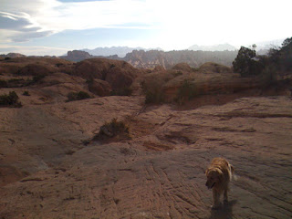
The trail leveled out again above the slickrock ledges and provided the view you see in the photo above of the Moab Rim across the Colorado River and the snow-dusted La Sal Mountains beyond. Please click the photo for a full-size view. The lenticular clouds and Scout's blowing fur give a good idea of how windy it was. We needed to meet Nan at the finish area before noon, so this was our turnaround point at 10:30.
On the way back toward Moab on Highway 279, there were many groups of rock climbers scaling the sandstone faces that drop vertically to the shoulder of the narrow two-lane highway as it runs along the river. This must have been a popular area as well with the Native Americans who left their petroglyphs on the faces several feet above the ground. In the past, the lighter areas of stone below the rock art must have been covered by deep sand bars from the river that have since eroded away. The unintended effect is that the petroglyphs have been preserved out of reach of vandals and graffiti artists. Again, please click the photo for a full-size view.
This blog is an account of the pursuit of a dream, to sail around the world. It is named after the sailboat that will fulfill that dream one day, Whispering Jesse. If you share the dream, please join me and we'll take the journey together.
For Charlie and Scout
For Charlie and Scout
About Me

- John Lichty
- Savannah,
Georgia, USA
"Go confidently in the direction of your dreams. Live the life you have imagined." --Henry David Thoreau
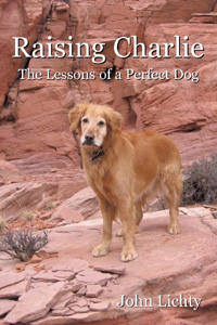
 Raising Charlie: The Lessons of a Perfect Dog by John Lichty
Blog Archive
Followers

Recommended Links
- ATN Sailing Equipment
- ActiveCaptain
- BoatU.S.
- Coconut Grove Sailing Club
- Doyle Sails - Fort Lauderdale
- El Milagro Marina
- John Kretschmer Sailing
- John Vigor's Blog
- Leap Notes
- Noonsite.com
- Notes From Paradise
- Pam Wall, Cruising Consultant
- Practical Sailor
- Project Bluesphere
- Sail Makai
- So Many Beaches
- Windfinder
Thursday, March 22, 2012
Subscribe to:
Post Comments (Atom)


No comments:
Post a Comment