
On Saturday, May 2, my friend Jon Anderson and I attempted something I had been dreaming about for several years, to ride Kokopelli's Trail from Rabbit Valley west of Grand Junction to Moab, Utah. It's a 120-mile ride, and we planned to do it in one day.
I was riding my 2002 Yamaha WR426F and Jon was riding a Kawasaki KLR650 he borrowed from a co-worker. The KLR is a rally bike, designed for mostly street and highway use, with occasional off-road use. At more than 400 pounds, not counting the metal saddlebags full of Jon's gear, it is not exactly "flickable," as my riding buddy Andy would say. The KLR's major advantage was that Jon could ride it at freeway speeds on I-70 to get to the trailhead while I needed to trailer my bike to get it there.

We were only going to ride one way, so the plan called for Nan and Scout to drive the "sag wagon" with the empty trailer behind it and meet us in Moab. Along the way, she would drop off some gas and Gatorade at Dewey Bridge, just off Highway 128, since there was a chance I would run out of gas otherwise.

After posing for the top photo (click for full-size views), we departed the parking lot at Rabbit Valley at about 8:45 AM. We headed out the marked #2 loop, which becomes Kokopelli's Trail farther out, and I promptly dumped my bike. I thought I could ride a rocky uphill section in second gear, but my front wheel dropped into a gap near the top and I stalled, falling over on my right side. Jon and I had never ridden together before, so I'm sure he wasn't feeling overly confident about my ability at that point. A few minutes later, we reached another rocky uphill, this time a sidecut singletrack. I was able to make it up with occasional dabs, but Jon lost his momentum and we needed to bulldog the KLR the rest of the way up with Jon pushing on the handlebars and me pushing from behind. By the time we reached the top, the radiator was boiling. Fortunately, the singletrack was soon over and we were able to get up some speed on the Westwater road to cool off the bikes.
The weather forecast called for all-day rain, and the sky to the west definitely looked threatening. It soon started to drizzle, which made the clay tracks of the road extremely slick, limiting our speed. When we reached a stretch of asphalt on the way to Fish Ford, the drizzle gave way to rain and hail, and we needed to stop and put on our rain gear.

We turned west off the asphalt and followed a dirt road down into a canyon and then up and out again to where it ended at the Colorado River, in an area called McGraw Bottom. The trail marker indicated that we should follow a singletrack in the direction of the river, but it was very difficult. I managed to bulldog my bike through big rocks up to a plateau and park it, but Jon didn't even attempt it. He parked the KLR and walked up to where I was parked to see what lay ahead. After a sharp drop off the plateau, there was a steep, loose uphill and then more difficult terrain beyond that. We stood at the top of the uphill section and Jon said, "Y'know, if I lose my momentum coming up this hill, my front brake won't hold me." I tried to imagine that. Jon would need to put both feet down to keep his balance, negating his back brake. If he didn't fall, he would slide backwards all the way back to the bottom. It was too big a risk. We would need to go around.
We backtracked to the turnoff for the Cisco Takeout and then continued on through Cisco and picked up Highway 128. After the McGraw Bottom section, the trail crosses Highway 128 from east to west and goes through Yellowjacket Canyon, but we skipped that section as we rode by and headed straight to Dewey Bridge, or what's left of the bridge after it burned last year. I had not passed by this way since the fire, and I was overwhelmed by the damage. The large cottonwood tree I had told Nan to put the gas and Gatorade under was burned to a crisp, so she had left everything under a different, still living cottonwood tree near a picnic table. We hung out our wet gear to dry while we ate peanut butter and jelly sandwiches and washed them down with cold Gatorade. In Jon's case, everything in his aluminum saddlebags was also wet after the pop-top water bottles he had bought at the gas station that morning exploded from all the bouncing around. As we ate, black clouds and lightning were building to the west. We gassed up the bikes, packed up everything and headed out again just as it started to pour.

The trail went back east up Entrada Road and then forked off to the right to make a shortcut through Cottonwood Canyon, except that the "shortcut" is a serious thrashing through steep, loose, nasty broken rock, as the fourth photo clearly shows. Again, there was no way the KLR was going to make it. We looked at the map and saw that if we had stayed on Entrada Road, we could have avoided this nightmare altogether, so we backtracked a second time and went around.
When we reached the bottom of the second Cottonwood Canyon (Yes, there are two different canyons with the same name.), I stopped abruptly. In front of us was a series of badly eroded sandstone ledges extending up as far as I could see, and they were wet and slippery. I pulled out the map. There it was: "Steep difficult trail." No kidding. Jon parked and walked up to take a look. He started laughing. We both knew that this was the end of the road for us. There was no other way to continue on to the La Sal Loop and Sand Flats sections that end at Moab. We would need to turn around and backtrack yet again.

We passed Dewey Bridge this time without stopping and turned left onto Highway 128. After thirty miles of smooth asphalt, we arrived in Moab. It was 5:15 PM. We had been riding almost continuously for 8.5 hours. I checked my odometer: 136 miles. Nan and Scout were happy to see us. We were happy to be off the bikes.
Later, over Mexican food and margaritas, I asked Jon if he would consider giving it another go sometime with a lighter bike. He said he didn't need to try it again. He was happy with asphalt and didn't care if he ever rode another trail. Not me. I'm trying to talk my neighbor Dale into riding Kokopelli's Trail with me some weekend soon before it gets too hot. I hope this description doesn't scare him off!

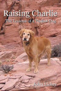 Raising Charlie: The Lessons of a Perfect Dog


 For the holidays this year, Nan and I are house and dog sitting for our friends, the Vaughns, in Aspen. They are in Costa Rica with family and we are looking after things back home. Their dog Hannah and our dog Scout get along well, romping in the snow together and competing for our affection, so the Vaughns are happy to have us stay here instead of having to board her.
 Later, Jon and I caught the shuttle bus back to Aspen Highlands and met Nan, who had earlier taken Scout and Hannah for a cross-country ski up Maroon Creek Road, for an end-of-day top-to-bottom ski run. I wanted to get a good ski photo of Nan and me, and Jon suggested the new Ski Patrol hut at the top of the mountain for its amazing views. The sun was low in the sky and directly behind us, but Jon's photo turned out nicely, with the sun's flare coming from between Pyramid Peak and the Maroon Bells in the distant background.


