A few weeks ago, Nan and I were in Moab for a race she wanted to run. It was a cold, wet and miserable Saturday morning, but she seemed upbeat and excited when Scout and I dropped her off in the muddy campground parking lot off Kane Creek Road. I told her we would pick her up in a couple of hours and then backtracked up the road to the parking lot at the trailhead of the Moab Rim Trail. It's the trail that connects with the Hidden Valley Trail, which I have hiked several times as an "out and back," first with Charlie and then with
Scout. There is a chapter in my book,
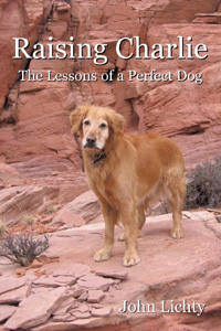
Raising Charlie, that details Charlie's and my last hike together on the Hidden Valley Trail, just weeks before he died.
As Scout and I hiked through the drizzle up the steeply sloping slickrock, I thought about what it would take to hike the entire distance of Hidden Valley and Moab Rim. It would be six to seven miles one way, so having a car or an arranged ride at each end would be necessary. When Scout and I reached the top of the Rim, where the trail overlooks the city of Moab, I tried to gauge the distance and direction to the Hidden Valley trailhead, far out of sight around the Rim to the south, off Highway 191. Looking out ahead to where the trail would lead us if we had more time, I saw that it disappeared quickly among a series of loaf-shaped sandstone bluffs. Someday, I thought.
Well, someday came quickly. Last Saturday, Scout and I, along with my friend John Sasso, did the entire Hidden Valley to Moab Rim hike. Nan and John's wife D were running the annual Moab Winter Sun 10K, and we drove down separately, so we had the two cars we needed. I had asked John earlier in the week if he would be interested, knowing that he's always up for a hike, and then it was just a matter of working out the logistics.

We dropped the wives off at the race and left John and D's car at the finish area, then drove down Highway 191 to the Hidden Valley trailhead, off Angel Rock Road. It felt good to be hiking the trail again. It had been since the same weekend last year while Nan was running the same race that Scout and I had hiked it. There had been snow that day, but only wind and cold on this day. It had been months since John and I had talked, so we used our hiking time together to catch up. Before I knew it, we were at the top of the initial steep, rocky section of the trail and standing in front of the juniper tree where Charlie and I had stopped for a drink on our last hike. It made me feel melancholy to picture him again sitting under the tree and smiling at me. I gave Scout a drink from my CamelBak and we continued up the trail and into the first of two giant sagebrush meadows.
Before long, we reached the side trail to the wall of petroglyphs, where I took the cover photo for
Raising Charlie. John was impressed by the figure of a single man etched into the rock and asked me how old I thought it was. I guessed, at least a thousand years, knowing that the Anasazi who lived in this area had moved on more than eight hundred years ago when the climate became too arid. I asked John to take a photo of Scout and me in front of the "map" petroglyph, which I believe is a representation of the access trail and two meadows that lead up to the wall from the valley floor below. Then I took one of John, with the valley and the La Sal Mountains in the background. I stopped and turned around as we were leaving the wall, again picturing Charlie as he had been that day. I will always associate him with this special place.

We backtracked to the main trail and then, instead of heading back down the way we had come, as I had done so many times before, we continued up and over a low pass to the Moab Rim Trail for the very first time. At this point, I was no longer on familiar terrain and needed to pay close attention to the trail, even though it quickly turned into a double-track, because it wound crazily over and around extensive slickrock sections. Off in the distance, we saw three jeeps negotiating difficult spur trails, but they were the only other human activity we had seen to that point. We had been hiking for more than two hours when the trail seemed to loop back upon itself and head in an uphill direction, contrary to what I was expecting. But then we came around a curve and I spotted the trail sign that Scout and I had marked as our turnaround point on the Moab Rim hike a few weeks before.
The three of us paused to admire the view of Moab from the overlook and then headed down the steep slickrock toward the trailhead. I was looking ahead to see if Nan and D might be waiting for us down there, but I didn't see them. John had only one bar on his Verizon cell phone when we reached the parking lot, but he was able to call Nan and D and ask them to pick us up. John, Scout and I walked up Kane Creek Road a ways to meet them, piled into John and D's car, drove around to pick up our car at the Hidden Valley trailhead, and then drove back to the Moab Brewery for a well-deserved lunch before heading back home.

 Raising Charlie: The Lessons of a Perfect Dog


No comments:
Post a Comment