Showing posts with label John Sasso. Show all posts

Tuesday, May 8, 2012

Fisher Towers Hike

Ancient Art and Stolen Chimney - Look closely for the climbers!
Before the heat of summer renders it too miserable, I want to try to hike as many of the nearby desert trails as possible. Scout and I were thwarted in our attempt to hike the Negro Bill Canyon trail near Moab back in March and ended up hiking the Poison Spider trail instead. So when I emailed my friend John Sasso to see if he would be interested in taking a hike this past Saturday, I was thinking Negro Bill. But John emailed me back to say there was too much poison ivy along the trail and that he knew about it from painful personal experience. I checked DiscoverMoab.com and came up with two alternatives, Fisher Towers or Corona Arch. Of course, John had already hiked both, and in the case of Fisher Towers, he had actually climbed the Titan tower. I have driven Highway 128, which is the scenic way to Moab from I-70, and passed Fisher Towers many times but never stopped to get a closer look. This would be a good opportunity.

The Cobra, with Ancient Art and Stolen Chimney in the background
Scout and I picked John up at the crack of 9:45 and headed west out of Grand Junction. John had suggested that we get some lunch at the Hogi Yogi in Moab, and I misunderstood him to mean that we would do this after the hike, not before. When I said so, he said that I should stop at one of the truck stops so he could pick up a sandwich, but the closest one was at the Highway 191 exit, which is the non-scenic way to Moab. I had eaten a big breakfast before picking him up, so a nasty truck-stop sandwich was the last thing I wanted. We reached a compromise and drove all the way in to Moab, only to find that the Hogi Yogi, which has been in operation at least since Nan and I started going to Moab in 1992, is now the Cabo Grill. In disappointment, John and I continued south and turned in at a... truck stop. But it turned out to be a truck stop that offered huge custom-made sandwiches, at great prices, while you waited. Who knew?

The Titan - John Sasso bivouacked at the base of the gendarme 'thumb' when he climbed it
We reversed course and took the turn onto Highway 128 at the north edge of town. We passed Negro Bill Canyon, and I was happy we weren't hiking it that day because the parking lot at the trailhead was full and people were parking along the highway. Pedestrians were taking their chances crossing the highway, and I could just imagine what a nightmare the trail would be. We continued until we reached a turn-off for Fisher Valley and Onion Creek, which we quickly discovered was wrong when we reached a stream crossing. I hadn't printed out the directions to the trailhead because I figured John knew where we were going, but he was a little fuzzy on exactly how to get there. Back on the highway, we reached another turn-off just a few hundred yards farther up, and John announced that we were on the right track. We parked in a spot right at the trailhead, and John ate his sandwich in the shade of a juniper tree while Scout and I got organized for the hike.

Scout's ears flying in the wind - Note his summer puppy cut and the Titan sign
It was hang-on-to-your-hat windy, which helped to keep it somewhat cool considering our nearly 1:00 starting time. I heard voices on the wind and looked around to see where they were coming from. I craned my neck and looked straight up to see climbers on a familiar-looking rock formation. I asked John if it was the one from the Citi TV commercial, featuring climbers Katie Brown and Alex Honnold, and he said that of course it was; he had already told me all about it on the drive. That's news to me, I thought, but what a sight! The trail angled around the formation, called Ancient Art, giving us a better perspective of the climbers and the Stolen Chimney route they had climbed to reach the final pitch featured in the TV commercial.

Along the climber's trail below Ancient Art, there were a few dramatic-looking hoodoos. According to John, the one with the thinnest neck is called The Cobra and it has been climbed successfully. To look at it, you would think anyone putting their weight on it would snap the top of it right off.

'Now what?!' - Scout at the top of the Fisher Towers ladder
The trail rounded a windy corner with excellent views of the Titan tower and proceeded onto a narrow ledge below sheer walls of converging sandstone. The trail abruptly ended at a metal ladder leading down several rungs to where the trail began again. There was no way Scout was going to climb down a ladder. John went down to look for an alternative route farther up into the notch formed by the converging walls. A minute later, he popped out on the sandstone above us and said he thought Scout could make it down the way he had come up. Scout and I followed him back to where a five-foot drop led through a narrow slot to the bottom of the ladder. John went down first and I followed, but when I whistled Scout to come, he realized that I intended to hoist him down and he backed out of reach. The more I coaxed him, the farther he backed away. I could have had John climb up and get behind Scout to herd him to me, but we decided against it and turned around instead. Maybe next time.

Trail looping around canyon notch, with Castle Rock and The Rectory in the distance
As we passed Ancient Art again on our return, we heard whooping from other hikers on the trail. One of the climbers had just stood up on the tiny summit, like Katie Brown in the dizzying final moments of the TV commercial. We just missed seeing it, but I felt I already had an idea of what it would be like.

Tuesday, April 3, 2012

Moqui Steps

Moqui steps climbing up the sandstone walls of Rough Canyon Falls
On Sunday morning, my friend John Sasso, my dog Scout and I hiked the Rough Canyon trail south of town, in the Bangs Canyon area off Little Park Road. Scout and I tried to do the same hike last summer, but we were forced to turn around due to wet conditions and some difficult scrambling that I felt was beyond Scout's safety level. We didn't experience the same trouble this time. After our mild winter and extremely dry spring, the going was much easier.

I showed John the petroglyphs that Scout and I had found on a canyon wall the last time, and I was angered to see even more graffiti had been added, some of it practically on top of the ancient rock art. John had done a number of rock climbs in the canyon, and he pointed them out as we worked our way down the canyon's stream bed. Scout made a number of athletic moves through the scrambling sections and rewarded himself with quick swims in the many muddy pools.

Scout standing on the rim next to Rough Canyon Falls where the moqui steps emerge
We eventually reached Rough Canyon Falls, where Scout and I had searched for the elusive moqui steps (sometimes spelled moki steps) during a hike last summer that brought us to the falls from the rim trail that runs above and parallel to the Rough Canyon trail. I told John about the moqui steps during our hike and said that I was hoping to find them that day. He walked up to the edge of the cliff next to the dry stone groove of the falls, pointed down and said, "They're right there!" I joined him and couldn't believe it. I had looked at that same wall the year before and seen nothing unusual, but John saw them right away. I must have been expecting something different the last time, because there was no mistaking them this time. I climbed around the two huge cottonwood trunks that are wedged into the falls to get a better angle for some photos. John looked for a way to get down to the bottom where the steps started, but the only way was to use the steps, which was too dangerous to try without the pool below having enough water to break a fall.

Being an avid rock climber, John proposed that we come back another time with a climbing rope and set an anchor using one of the juniper trees on the rim. We could take turns rappelling down to the bottom and then safely climbing the moqui steps back up while on a belay. After giving it some thought, I would guess that the ancient people who carved the moqui steps must have had a hand-woven rope that they used in conjunction with the steps to make it easier to get up and down, especially if they were carrying water containers. The fact that the first step was about four feet above the bottom made me think that the steps were intended to be used when the pool was full of water. During a dry spell, the shaded pool may have been the only local source for fresh water.

Monday, January 30, 2012

Devil's Canyon Hike

Scout with his nose into the wind at the Devil's Canyon trailhead
One of the best things about living in Grand Junction is the mild winter climate. Great skiing is less than an hour away up at Powderhorn, yet there is very little snow down below. It is possible to hike year round on trails that receive sufficient sun to melt the scant snow, and Devil's Canyon is one of those trails. It is located just to the west of the Colorado National Monument's western boundary, so it is open to dogs, unlike the Monument itself. If I'm going to take a hike, I want to include my dog Scout because he enjoys hiking even more than I do.

John and Scout working their way up to the Wingate Sandstone spires of Devil's Canyon
Early on Saturday morning, Scout and I left home and drove west on Broadway/Highway 340 to just past the Monument's western entrance, took a left at King's View Road and then another left onto Devil's Canyon Road to reach the trailhead parking lot. My hiking buddy John Sasso showed up a few minutes later, dropped off by his wife D on her way to the annual Beer Run, a 9.3 mile race in the Fruita area that ends at the Hot Tomato Cafe. John, Scout and I didn't waste much time getting underway because it was windy and still below freezing. We followed trail D1 to D4 to D3 to work our way up the sunny western side of the canyon. There is a network of well-marked trails that loops all over the area, but they can be confusing, so it's a good idea to check the trail map inside the shelter at the trailhead before heading out. There are also maps that are free for the taking from a metal box a few yards up the main trail.

In the canyon, out of the wind, we were soon shedding shells and gloves to keep from overheating. Scout was warm, too, and backtracked frequently for squirts of water from my CamelBak. We paused frequently to admire the Wingate Sandstone walls and spires, and the occasional granite extrusions that are rare in this largely sedimentary area. John speculated about the "climbability" of some of the cracks and chimneys we passed and guessed that most of them had already been climbed. Off in the distance, above the top of the canyon's box end, I could see the antenna farm that dots Black Ridge. It is the highest point in the area, so high that I can see it easily from my office window at work several miles away on the north side of town, near the airport.

Posing with Scout in front of a 'climbable' chimney in Devil's Canyon
About an hour and a half into the hike, the trail dropped and climbed through a series of side drainages and then curved left into a flat area where there sat an old shepherd's cabin. Scout ran ahead to investigate but we were the only ones around. There was a campfire ring and log benches in front of the cabin, and the area smelled of old, wet cinders. The cabin was made of weathered wood covered with tar paper, and the cracks were chinked with new-looking spray foam. It appeared to be at least fifty years old and looks to have been maintained in a somewhat haphazard fashion, with new pieces of wood nailed into place as needed over the years. Remarkably, the glass windows on either end are still intact. At the south end of the cabin was a small, roofed corral that must have been used to protect sheep at one time. Inside the cabin, there was a small table, some shelves, a sheet metal woodstove and a built-in plywood bunk bed but no mattresses. There was also a large collection of relics and graffiti left by previous travelers. I commented that it looked like a cozy place to spend a night but John didn't think so.

John and Scout at the shepherd's cabin in Devil's Canyon
Instead of backtracking down the trail we had come up, we went down the trail on the eastern side of the canyon. It receives less sun than the western side, so we needed to contend with occasional patches of snow and mud. John was carrying a hiking pole and I wished that I had thought to bring one myself after a few slips in the wet conditions. Scout used the snow as an opportunity to cool off, rolling on his back and grunting his pleasure. In an hour, we found ourselves back at the point where the western and eastern trails split, completing the loop that had ended at the cabin. From there, it was an easy hike out the way we had come in. We passed small groups of hikers and dogs along the way. They were getting a later, warmer start than we had experienced when we started a little more than three hours earlier.

The Hot Tomato Cafe in Fruita -- Woot! Woot!
Back at the trailhead, Scout still had the energy to jump into the back of the SUV. Then we were off to meet up with the Beer Run finishers at the Hot Tomato Cafe and join them for a slice of pizza and a well-deserved beer.

Tuesday, December 6, 2011

Hidden Valley to Moab Rim Trail

Scout and me hiking the Hidden Valley Trail in Moab
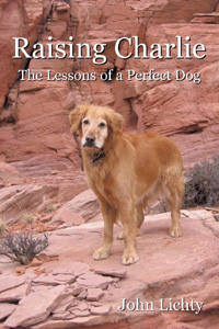
A few weeks ago, Nan and I were in Moab for a race she wanted to run. It was a cold, wet and miserable Saturday morning, but she seemed upbeat and excited when Scout and I dropped her off in the muddy campground parking lot off Kane Creek Road. I told her we would pick her up in a couple of hours and then backtracked up the road to the parking lot at the trailhead of the Moab Rim Trail. It's the trail that connects with the Hidden Valley Trail, which I have hiked several times as an "out and back," first with Charlie and then with Scout. There is a chapter in my book, Raising Charlie, that details Charlie's and my last hike together on the Hidden Valley Trail, just weeks before he died.

Hidden Valley petroglyphs - note the human figure in the lower right
As Scout and I hiked through the drizzle up the steeply sloping slickrock, I thought about what it would take to hike the entire distance of Hidden Valley and Moab Rim. It would be six to seven miles one way, so having a car or an arranged ride at each end would be necessary. When Scout and I reached the top of the Rim, where the trail overlooks the city of Moab, I tried to gauge the distance and direction to the Hidden Valley trailhead, far out of sight around the Rim to the south, off Highway 191. Looking out ahead to where the trail would lead us if we had more time, I saw that it disappeared quickly among a series of loaf-shaped sandstone bluffs. Someday, I thought.

Well, someday came quickly. Last Saturday, Scout and I, along with my friend John Sasso, did the entire Hidden Valley to Moab Rim hike. Nan and John's wife D were running the annual Moab Winter Sun 10K, and we drove down separately, so we had the two cars we needed. I had asked John earlier in the week if he would be interested, knowing that he's always up for a hike, and then it was just a matter of working out the logistics.

Scout and me in front of the 'map' petroglyph
We dropped the wives off at the race and left John and D's car at the finish area, then drove down Highway 191 to the Hidden Valley trailhead, off Angel Rock Road. It felt good to be hiking the trail again. It had been since the same weekend last year while Nan was running the same race that Scout and I had hiked it. There had been snow that day, but only wind and cold on this day. It had been months since John and I had talked, so we used our hiking time together to catch up. Before I knew it, we were at the top of the initial steep, rocky section of the trail and standing in front of the juniper tree where Charlie and I had stopped for a drink on our last hike. It made me feel melancholy to picture him again sitting under the tree and smiling at me. I gave Scout a drink from my CamelBak and we continued up the trail and into the first of two giant sagebrush meadows.

Before long, we reached the side trail to the wall of petroglyphs, where I took the cover photo for Raising Charlie. John was impressed by the figure of a single man etched into the rock and asked me how old I thought it was. I guessed, at least a thousand years, knowing that the Anasazi who lived in this area had moved on more than eight hundred years ago when the climate became too arid. I asked John to take a photo of Scout and me in front of the "map" petroglyph, which I believe is a representation of the access trail and two meadows that lead up to the wall from the valley floor below. Then I took one of John, with the valley and the La Sal Mountains in the background. I stopped and turned around as we were leaving the wall, again picturing Charlie as he had been that day. I will always associate him with this special place.

John Sasso at the Hidden Valley petroglyphs
We backtracked to the main trail and then, instead of heading back down the way we had come, as I had done so many times before, we continued up and over a low pass to the Moab Rim Trail for the very first time. At this point, I was no longer on familiar terrain and needed to pay close attention to the trail, even though it quickly turned into a double-track, because it wound crazily over and around extensive slickrock sections. Off in the distance, we saw three jeeps negotiating difficult spur trails, but they were the only other human activity we had seen to that point. We had been hiking for more than two hours when the trail seemed to loop back upon itself and head in an uphill direction, contrary to what I was expecting. But then we came around a curve and I spotted the trail sign that Scout and I had marked as our turnaround point on the Moab Rim hike a few weeks before.

The three of us paused to admire the view of Moab from the overlook and then headed down the steep slickrock toward the trailhead. I was looking ahead to see if Nan and D might be waiting for us down there, but I didn't see them. John had only one bar on his Verizon cell phone when we reached the parking lot, but he was able to call Nan and D and ask them to pick us up. John, Scout and I walked up Kane Creek Road a ways to meet them, piled into John and D's car, drove around to pick up our car at the Hidden Valley trailhead, and then drove back to the Moab Brewery for a well-deserved lunch before heading back home.

Sunday, April 3, 2011

Rock climbing in Unaweep Canyon

John and Scout at the base of Lower Sun
Tower, with Wilson and "Crack of Don"
in the background 
Back in January, when I was hiking Serpents Trail with my friend John Sasso, we talked about doing some rock climbing together. John is an avid climber and gets out every chance he has. Me, I haven't rock climbed in 25 years, not since moving to Colorado from Wisconsin almost twenty-five years ago. Friends and I used to go up to Devil's Lake State Park, a little ways south of Baraboo, and top-rope the nice quartzite faces in the Bedroom Amphitheater west of Rainy Wednesday Tower. At that time, I could make it up climbs with a difficulty rating up to 5.8. Since then, the only rock-type climbing I have done has been in some tight situations while climbing all 54 of Colorado's 14ers, where I was thankful for the earlier experience with using dicey hand and foot holds.

John rappeling down after climbing "Crack of
Don." Note the rope going up "Sunup."
So last week, when John proposed that we go rock climbing this weekend, with the idea of getting in some fairly difficult training climbs before tackling the moderately difficult Independence Monument, a climb we had discussed during our Serpents Trail hike, I wondered if I was up to it after all these years. John emailed me Mountain Project links to descriptions and photos of the climbs he wanted us to do, and they didn't look too bad. Both are in the Lower Sun Tower area of Unaweep Canyon, about 20 miles south of Grand Junction. "Crack of Don" is a 5.6 climb that follows a meandering crack, as the name implies, up 80 feet of good granite. "Sunup" is a 5.8 climb that runs parallel to Crack of Don but without the advantage, from my viewpoint, of the big crack.

Me grimacing just below the first bolt
on "Sunup"
Except for today's temperatures in the 30s and some rain and snow, the weather here in Grand Junction has been beautiful the last few days, with temperatures in the high 70s yesterday, the day John had picked for our climbs. Scout and I picked him up at noon and the three of us headed down to Unaweep Canyon. We parked along the shoulder of Highway 141, just before the driveway of Bob and Lise Eakle, the owners and caretakers of the property which contains the Sun Towers. We hiked up their nicely maintained trail past their nice log cabin and climbed up the switchbacks to the base of Lower Sun Tower. Two other climbers, Wilson and Conrad, were already there and climbing the Sunup route, which worked well for us because I was hoping to start on the easier route. We geared up with climbing shoes, seat harnesses and helmets, and then John gave me a quick refresher in knots, belaying techniques and climbing protocols. He described how he was going to lead-climb the route up Crack of Don, placing protective cams every dozen or so feet, while I belayed him, and how I would then follow, removing the protection as I climbed, while he belayed me from the top.

John rappeling down "Sunup," with Unaweep
Canyon and Highway 141 in the distance
Away John went up the crack, climbing steadily, placing protection, and making it all look easy. When he reached the top, was off belay, had pulled up the slack rope, and put me on belay, I started to climb. The first few moves were pretty straightforward and felt right, like it was all coming back to me. Soon I was 30 feet off the ground. I looked down to see Scout staring up at me and that made me smile. But then the holds that were available to my right hand petered out and I struggled to keep myself from hinging off until I found better holds to the left of the crack. The verticality eased after that and soon I was standing on top with John. Scout had lost sight of me and was barking far below. John rigged a rappel setup and sent me down first. I kept my eyes on the wall in front of me as I jerkily descended, not wanting to see how high off the ground I still was.

Scout and me with one of Lise Eakle's totem
poles. Note "The Twin Owls" rock formation.
When John had rappeled down, we switched routes with Wilson and Conrad. Sunup presented a whole new set of challenges. There are so few cracks for placing protection that anchor bolts have been drilled into the stone. The first one is almost 12 feet off the ground. John had me spot him until he had secured protection to it and I could begin to belay him as he climbed the rest of the route, again making it look easy. When he reached the top, he rigged up a single-rope rappel and rappeled down while picking up the protection he had attached to the bolts on the way up. This left the rope doubled to set up a top-rope belay so that John could belay me from the ground while coaching me up the difficult climb.

On my first try, I made it only a few feet off the ground before falling. John eased me back to the ground and had me take another look at the first few moves. The key was to move quickly up to a place where I could get my right foot onto a thumb-sized horn. That would give me a resting point from which to figure out the next set of moves, with the help of John's experienced advice. In this way, I moved slowly up the 80-foot face, relearning along the way that I needed to keep my center of gravity as close to the face as possible, and put all my weight on my feet while using my hand holds only for balance. When I reached the top, John cheered and Scout barked. I leaned back against the rope and John lowered me slowly down to the ground. I was whipped, partly from the exertion and partly from the innate fear of falling. But I had made it to the top, and John told me that others he has belayed on Sunup have not made it.

We packed up our gear and hiked back out, pausing to take some photos with one of Lise Eakle's hand-carved totem poles. On the way home, we discussed plans for our next climb, a 3-pitch 5.6 rated climb up "Betty and Ray's Adventure" on the Upper Sun Tower. John wants to see how I do on a multi-pitch climb before we attempt Independence Monument, which is a 5-pitch climb with a 5.8+ overhang at the very top. I'll let you know how it all goes.