

On Thursday morning, Nan and I are off to Panama to begin the sailing trip I wrote about last August in "A change in plans". Since I wrote it, there have been other changes in the plans. Instead of sailing from May 1 to 15, we will be sailing from April 24 to May 7, and instead of ending the trip in Key West, Florida, we will be ending it in Isla Mujeres, Mexico. The shorter distance means that we can take our time and explore more areas of coastal Central America.
According to Captain John, the for-sure stops are Providencia, a small Colombian island off the coast of Nicaragua; Roatan in the Bay Islands off Honduras; and South Water Cay and Placencia in Belize. With our added time, other likely stops could include Corn Island, off Nicaragua; Cayos Cochinos in the Bay Islands of Honduras; Banco Chinchorro and Cozumel, islands off the east coast of Mexico's Yucatan Peninsula; and Punta Allen, along that same coast.
Our starting point will be Bocas del Toro, Panama, where John left his cutter-rigged Kaufman 47 sailboat, Quetzal, after his last trip. Bocas is on the Caribbean side of Panama, close to the border with Costa Rica, but we can't fly there directly from the United States, so we will be flying into Panama City and spending a night at a hotel right on the Panama Canal. I hope to do a tour of the Canal the next day since we don't catch our puddle jumper to Bocas until mid-afternoon. We'll meet up with the rest of the crew and spend the night on the boat before taking care of final provisioning and shoving off by noon on Saturday.
We're looking forward to returning to Isla Mujeres again, at the end of our trip, after our month-long stay there last fall. We have asked John if we could arrive a day earlier than planned so we can spend a little more time with our friends there. I am still working on Los Sabores de Isla Mujeres (Tastes of Isla Mujeres) with Juan and Paula, and we would like to take a look at Teresa and Luis's apartment on Laguna Macax as a possible future rental.
It is my hope to update this blog with photos and descriptions over the course of our trip, depending on the availability of Internet access, so please check back starting later this week. Away we go!
About Me

- John Lichty
- Savannah,
Georgia, USA
"Go confidently in the direction of your dreams. Live the life you have imagined." --Henry David Thoreau
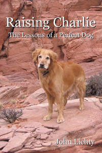 Raising Charlie: The Lessons of a Perfect Dog by John Lichty
Subscribe To

Monday, April 19, 2010
Monday, April 12, 2010
Climbing Mt. Garfield
 The skyline to the northeast of Grand Junction is dominated by Mt. Garfield, western Colorado's version of the Rock of Gibraltar. Anyone who has ever driven through the area on Interstate 70 is familiar with this imposing peak. I have driven past it hundreds of times myself and wondered how hard it would be to climb. Yesterday, I finally found out. (Click the photos for full-size views.)
Last week, my friend and neighbor, Rich, who had already climbed Mt. Garfield three times before, invited Nan, Scout and me to climb it with him. Nan declined because she knew her legs would be sore after a trail race she was scheduled to run on Saturday, but I was up for it and Scout is always up for anything.
 The weather was perfect when we arrived at the trailhead, sunny and warm but with a cool breeze. Rich with his hiking poles and Scout with his doggie enthusiasm quickly pulled ahead going up the steep lower slopes. I splayed out my feet, leaned into the slope and grunted upwards until my calves and glutes were screaming. I stopped for a long pull off my CamelBak and looked up the trail to see how Rich and Scout were doing. They were already standing at the top of the first plateau, in the shade of a large hoodoo, waiting for me.
 From where I caught up to Rich and Scout, the trail flattened out somewhat as it wound up through large broken rocks. That stretch gave way to a beautiful meadow and then a long traverse across the face below the summit. When the trail turned right into a wide, deep gully for the final approach, the rocky climbing began again. At one point, we reached a place where Scout couldn't figure out how to get up a rocky ledge. He paced back and forth whining until I climbed back down and gave him a boost.
  The trail gradually leveled out and we found ourselves walking along the top of the sheer cliff that forms Mt. Garfield's distinctive summit. It was extremely windy, so we didn't risk getting close enough to be blown over the edge. Scout, with his ears blowing out like wings and his tongue flapping in the corner of his mouth, danced fearlessly along the edge until we called him back.
There is an old, bare flagpole that marks the summit. As windy as it is up there, a flag would be blown to shreds in a matter of days. We managed to find a calm spot and sat down to eat lunch. There wasn't any shade, so Scout hung out in my shadow to cool down. Rich and I shared our lunch with him, admired the views, took more photos and then headed back down the way we had come up, taking small to steps to avoid slipping on the grit that covered the dry slopes.
 It took about an hour and a half to get to the top and another hour to get down, not too bad for a climb that covers two thousand vertical feet in just two miles. If you get a chance to try it yourself, try to pick a cool, cloudy day and take plenty of water for you and your dog. The entire climb is up south-facing slopes that could turn into a reflector oven on hot days. It's also not a place you would want to be in a thunderstorm. Take care and have fun.
Subscribe to:
Posts (Atom)
