Sunday, December 25, 2011

Christmas Letter 2011

Christmas 2011 photo taken at Tabeguache area south of Grand Junction

Christmas 2011

Dear Family and Friends,

Where we live now, on the high plateau just to the west of Colorado’s Rocky Mountains, autumn sometimes extends all the way to Christmas, or at least that’s how it feels. Sure, it gets cold at night and the leaves are off the trees, but the days are sunny, warm and dry. What’s missing from our early winters here is the snow. Our card photo, taken on December 10, would have looked pretty much the same, except for the jackets, if it had been taken back in September. It shows the three of us standing at the top of a hill in the Tabeguache area, about a mile from our home. In the background are downtown Grand Junction, Mt. Garfield, Chalk Mountain and the Grand Mesa—but no snow!

Nan climbing a ladder to Whispering JesseNan and I are fully settled in Grand Junction now, both living and working. I started a new job in January as a programmer analyst with Quality Health Network, and Nan started in the spring as a pharmacy technician at St. Mary’s Hospital. It’s good to know that in our recessed economy, there is always demand in healthcare. Scout has settled into a new routine of his own, spending Tuesdays and Thursdays at doggie daycare, where he romps all day with his dog buddies.

With the new jobs, we didn’t get to travel as much this year. We spent a quick week at the end of April in what is becoming our home away from home, Isla Mujeres, Mexico, where we hung out with our local friends, tried new restaurants, and read novels on the beach. We also checked out the accommodations at the local marinas, with the idea of sailing Whispering Jesse down there in a couple of years.

The refit project on our sailboat took several months longer than expected. I flew out to Solomons, Maryland to check on it in May, and then Nan and I both flew out there in July for Nan’s first-ever look at the boat. The photo above shows her climbing a ladder to the boat while it was out of the water.

By September the boat was almost ready to go. Two friends from Aspen, Mike and Kurt, flew out with me to help make final preparations to move the boat to Savannah, Georgia. We departed a week later, three days later than planned, sailing overnight on Chesapeake Bay to Norfolk, Virginia. Then it was three days of motoring through the Intracoastal Waterway, emerging into the Atlantic Ocean at Morehead City, North Carolina. We sailed continuously to make up lost time, but we were overrun by a terrible storm on the second morning and pulled up short in Charleston, North Carolina. Mike and I flew out a month later to finish the move, sailing overnight to Savannah, where Whispering Jesse is now slipped at a marina near my folks’ vacation home on Skidaway Island. Plans are now in the works for a Lichty family rendez-vous there next spring, featuring day sails and bad golf.

Nan made a few trips home to Manitowoc, Wisconsin during the year to visit family and friends, most recently in October, when she attended the wedding of her niece. Congratulations to Laura and Chris! The next day, she and her friend Gail ventured to Lambeau Field to watch the Packers add to their undefeated streak with a victory over the Denver Broncos.

Until a few days ago, we were reconciled to a brown Christmas. But then there was an overnight dusting. And last night there were a few fresh inches. Now it seems we’re on course for a real white Christmas, our annual wish come true. Here’s hoping all your wishes come true this holiday season and in the coming year.

Love,

Friday, December 23, 2011

Midship cleats?

Whispering Jesse docked at Spring Cove Marina in September 2011
With Whispering Jesse safely slipped at the Delegal Creek Marina in Savannah, my thoughts have turned to boat improvement projects. The list is long, but one of the simpler projects would be to add midship cleats for securing spring lines.

Unlike most modern sailboats, which feature a toe rail mounted around the perimeter of the deck, our 1980 Valiant 40 features a full cap rail. It essentially lowers the deck about six inches below the top level of the hullsides, offering protection from slips as well as a place to stand on the leeward beam when the boat is heeling. There are hawseholes at the bow and stern to accommodate bow and stern cleats for securing dock lines, but there are no hawseholes at the beam, obviously, because the beam is frequently underwater while the boat is underway.

Thus, there are no cleats amidship, and spring lines must be rigged from the bow or stern, as shown in the photo above. This is inconvenient for a couple of reasons. In some docking situations, the spring lines end up being excessively long, reducing their effectiveness at holding the boat in place. And because of their position, the spring lines tend to rub against the hull and cause minor damage, especially when they are occasionally dipping into the water, picking up sediment and sea life. Before Mike and I moved Whispering Jesse to an adjacent slip at Delegal Creek Marina the morning after our arrival there, the overnight rubbing of a spring line caused some damage to the boat's adhesive name letters on the port side near the stern. So adding a pair of midship cleats might not be a bad idea.

Stainless steel cleat manufactured by New Found Metals
Searching the Internet, I found that New Found Metals (http://www.newfoundmetals.com/), the manufacturer of our boat's spiffy new stainless steel portlights, also makes ten-inch stainless steel cleats that look just like our boat's stock ones. I'm thinking they could be attached directly to the cap rails, but I will get advice from a boatyard first. It might be more prudent to mount them to the deck, near the closely-spaced chainplates on either beam, and then also attach chocks on the cap rail to limit chafing.

It's looking like Nan and I will be headed out to Savannah in early April, along with assorted family members, to work on the boat and do some sailing to nearby destinations, perhaps Tybee Island or Hilton Head Island. I will keep you posted on plans for the trip, as well as on other future boat projects.

Tuesday, December 6, 2011

Hidden Valley to Moab Rim Trail

Scout and me hiking the Hidden Valley Trail in Moab
A few weeks ago, Nan and I were in Moab for a race she wanted to run. It was a cold, wet and miserable Saturday morning, but she seemed upbeat and excited when Scout and I dropped her off in the muddy campground parking lot off Kane Creek Road. I told her we would pick her up in a couple of hours and then backtracked up the road to the parking lot at the trailhead of the Moab Rim Trail. It's the trail that connects with the Hidden Valley Trail, which I have hiked several times as an "out and back," first with Charlie and then with Scout. There is a chapter in my book, Raising Charlie, that details Charlie's and my last hike together on the Hidden Valley Trail, just weeks before he died.

Hidden Valley petroglyphs - note the human figure in the lower right
As Scout and I hiked through the drizzle up the steeply sloping slickrock, I thought about what it would take to hike the entire distance of Hidden Valley and Moab Rim. It would be six to seven miles one way, so having a car or an arranged ride at each end would be necessary. When Scout and I reached the top of the Rim, where the trail overlooks the city of Moab, I tried to gauge the distance and direction to the Hidden Valley trailhead, far out of sight around the Rim to the south, off Highway 191. Looking out ahead to where the trail would lead us if we had more time, I saw that it disappeared quickly among a series of loaf-shaped sandstone bluffs. Someday, I thought.

Well, someday came quickly. Last Saturday, Scout and I, along with my friend John Sasso, did the entire Hidden Valley to Moab Rim hike. Nan and John's wife D were running the annual Moab Winter Sun 10K, and we drove down separately, so we had the two cars we needed. I had asked John earlier in the week if he would be interested, knowing that he's always up for a hike, and then it was just a matter of working out the logistics.

Scout and me in front of the 'map' petroglyph
We dropped the wives off at the race and left John and D's car at the finish area, then drove down Highway 191 to the Hidden Valley trailhead, off Angel Rock Road. It felt good to be hiking the trail again. It had been since the same weekend last year while Nan was running the same race that Scout and I had hiked it. There had been snow that day, but only wind and cold on this day. It had been months since John and I had talked, so we used our hiking time together to catch up. Before I knew it, we were at the top of the initial steep, rocky section of the trail and standing in front of the juniper tree where Charlie and I had stopped for a drink on our last hike. It made me feel melancholy to picture him again sitting under the tree and smiling at me. I gave Scout a drink from my CamelBak and we continued up the trail and into the first of two giant sagebrush meadows.

Before long, we reached the side trail to the wall of petroglyphs, where I took the cover photo for Raising Charlie. John was impressed by the figure of a single man etched into the rock and asked me how old I thought it was. I guessed, at least a thousand years, knowing that the Anasazi who lived in this area had moved on more than eight hundred years ago when the climate became too arid. I asked John to take a photo of Scout and me in front of the "map" petroglyph, which I believe is a representation of the access trail and two meadows that lead up to the wall from the valley floor below. Then I took one of John, with the valley and the La Sal Mountains in the background. I stopped and turned around as we were leaving the wall, again picturing Charlie as he had been that day. I will always associate him with this special place.

John Sasso at the Hidden Valley petroglyphs
We backtracked to the main trail and then, instead of heading back down the way we had come, as I had done so many times before, we continued up and over a low pass to the Moab Rim Trail for the very first time. At this point, I was no longer on familiar terrain and needed to pay close attention to the trail, even though it quickly turned into a double-track, because it wound crazily over and around extensive slickrock sections. Off in the distance, we saw three jeeps negotiating difficult spur trails, but they were the only other human activity we had seen to that point. We had been hiking for more than two hours when the trail seemed to loop back upon itself and head in an uphill direction, contrary to what I was expecting. But then we came around a curve and I spotted the trail sign that Scout and I had marked as our turnaround point on the Moab Rim hike a few weeks before.

The three of us paused to admire the view of Moab from the overlook and then headed down the steep slickrock toward the trailhead. I was looking ahead to see if Nan and D might be waiting for us down there, but I didn't see them. John had only one bar on his Verizon cell phone when we reached the parking lot, but he was able to call Nan and D and ask them to pick us up. John, Scout and I walked up Kane Creek Road a ways to meet them, piled into John and D's car, drove around to pick up our car at the Hidden Valley trailhead, and then drove back to the Moab Brewery for a well-deserved lunch before heading back home.

Saturday, November 19, 2011

Google Maps on the iPhone

iPhone screenshot of Delegal Creek Marina
It didn't occur to me until several hours after Mike and I finally found our way to the Delegal Creek Marina after being somewhat lost up the Vernon River that I had had the technology we could have used to find our way clipped to my belt the whole time: my iPhone.

After the laptop's battery died, I turned to paper charts and my Garmin eTrex Vista handheld GPS for an idea of our position. But the edge of the chart cut off the inland detail we needed and the GPS's tiny black-and-white screen showed only the grossest detail in clunky geometric blocks. Thus, we missed our turn and took a scenic tour up the river until we figured out where we were.

I'm sure I'm not alone in having the tendency to think of my iPhone primarily as a phone instead of as a small computer with almost unlimited capability, including the built-in Google Maps app. If I had pulled out my iPhone instead of squinting at my GPS, we would have known exactly where we were, but that thought never occurred to me or to Mike, who was texting his wife that morning from his own cell phone. Oh, well. It's true what they say: Life is a "live and learn" proposition.

Thursday, November 10, 2011

Tybee Island

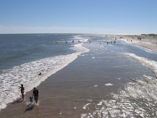
The beach at Tybee Island with the tide going outAfter Mike and I cleaned up and secured Whispering Jesse for long-term storage at the Delegal Creek Marina, we returned to my parents' home for one of my mother's fantastic lunches. Then the four of us headed out to Tybee Island for the afternoon. I had not been out to Savannah's famous beach spot since 1997, when my parents hosted a family reunion shortly after buying their vacation home on Skidaway Island. All I remembered from that visit was the beach, the pier and a little ice cream shop. Tybee Island didn't leave much of an impression that day.

This time, I was very much impressed. Tybee Island reminded me of a smaller, less commercial version of Key West. Even though it was a Monday in mid-October, the beach was busy and the streets were bustling. Of course, the weather was beautiful, so you couldn't blame people for coming out to take advantage of it.

The Tybee Island pier and pavilionMy main purpose in wanting to return to Tybee Island was to scout it out as a possible day-sailing destination. It is only about a twenty-mile sail from Delegal Creek Marina, so I imagined sailing up there, stopping for lunch, and then sailing back. The eastern, oceanfront side of the island is nothing but beach, which would require anchoring and dinghying in, but the western, sound side of the island has a restaurant with its own deepwater dock, A-J's Dockside.

We drove down Butler Avenue, the main drag, peeking toward the beach at each intersection to locate the Tybee Island pier. Unlike most beachfront communities, which have their main drag right next to the beach, the island's was set back a block, making the beach quieter and more inviting. We found a paid parking place on Strand Avenue, near the south end of the island, and walked out to the pier. It was busy with sightseers and fishermen. It's legal to fish off the pier and there were people who looked like regulars, with their wagons and their coolers, manning multiple fishing rods.

The Tybee LighthouseThe tides at Tybee are dramatic. In the time it took us to walk to the end of the pier and back, the ebbing tide revealed almost forty yards of additional beach. Kids were boogie boarding in the retreating water, and families were looking for shells in the wet sand. Mom and Dad went to check out the aquarium display while Mike and I took a walk on the beach.

We regrouped at the car and went to find A-J's on Chatham Avenue. The parking lot was empty, but a man out front was watering the flowers, so we figured they were open. The man informed us that they were not but that they would be promptly at four o'clock. We had an hour to kill, so we went off to see what else the island had to offer. We had spotted the Tybee Lighthouse at the north end of the island on our way to the pier and backtracked to find it. It was impressive but not as impressive as Fort Screven, right across the street. The walls were immense. My dad, who is a history buff, said that when this part of Georgia was contested territory, Fort Pulaski, located almost three miles up the Savannah River, and Fort Screven would fire cannonballs at each other. Mike and I tried to imagine cannon big enough to fire balls that far. No wonder the walls were so thick.

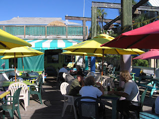
Dad, Mom and Mike on the back deck at A-J's DocksideThe hour went quickly, and we were back at A-J's for their early dinner opening. We took a table on the back deck, overlooking the dock, and ordered beers, a Mexican Sol for me and Yuenglings for everyone else. We ordered the conch fritters appetizer to share and studied the menu. Jimmy Buffett was playing on the sound system, but he was singing someone else's song. I made a comment that was heard by a passing waitress, who rolled her eyes and told us that the restaurant was almost always tuned to "Margaritaville" on the satellite radio. I smiled and kidded her, "All Jimmy, all the time!" She groaned and walked away.

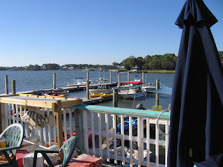
The deepwater dock at A-J's DocksideWhile we waited for our fresh seafood dinners, I got up to check out the docking situation and then to inquire about overnight rates. The manager told me that the rate was $2 per foot per night, which is pretty steep. The marinas we stayed at on the sail down from Solomons ran from $1.50 to $1.75 per foot. I asked what amenities that included besides easy access to the restaurant, and she just smiled. In the summer, she said, the dock was always crowded with boats, implying that the rate was not a factor. I thanked her and told her I would be sailing her way soon, hopefully next spring.

The food was good, the service was excellent, and the atmosphere was mellow, made the more so by the constant Jimmy Buffett assault. We had definitely found our first Savannah day-sailing, or possibly overnight sailing, destination.

Tuesday, November 1, 2011

Charleston to Savannah: A Comedy of Errors

Fort Sumter guards the entrance to Charleston Harbor
Whispering Jesse is now safely slipped at the Delegal Creek Marina on Skidaway Island, southeast of Savannah, Georgia. My crewmate Mike and I sailed her there over the weekend of October 15-16. Mike was a tremendously good sport to join me after last month's storm adventure (Just a Squall? No, not at All!), especially considering that he had had surgery to repair torn thumb ligaments from a work-related accident the previous week and was wearing a cast on his right hand. He had enough trouble holding a fork; I couldn't imagine him trying to work the boat's many lines.

It should have been a simple trip, just a hundred miles down the coast from Charleston, South Carolina, but things started to go wrong before we even started. The plan called for my parents to pick us up at the Savannah airport on Friday evening and drive us up to the City Marina in Charleston, but Mike and I were on separate flights and his arrived more than an hour and a half late, too late to make the drive up to Charleston. We spent the night at Mom and Dad's house in Savannah instead and left early the next morning.

Preparing to turn southwest and follow the sailboat ahead
By the time we thanked my parents for the ride, prepped the boat and checked out of the marina, it was almost noon and the tide had turned. Instead of helping to ease us out of the slip, the current was preventing us from leaving. I needed to back up and to starboard to avoid the boats on the adjacent pier and move out into the seaway, but the current was so strong that it pushed the boat sideways as soon as it cleared the slip, pinning it against the slip's finger pier. I started to wonder when the tide would turn again to free us when two gentlemen who had witnessed our predicament came to our assistance. They helped Mike and me get the boat back into the slip without crashing into the pier and coached us for a more successful exit. I stood on the forward side of the boat's wheel, facing the stern for more effective steering, and put the engine into reverse. The gentlemen released the lines and we motored smoothly backward until we cleared the slip. But as I turned to starboard to miss the catamaran behind us, the current took control and pushed us sideways again, brushing us past the two boats between us and the seaway. Finally free of the pier, I looked for the fuel dock on the other side of the seaway, where we had planned to top off the tank, but there was no way we would have been able to stop there given the current, so we motored on, trusting that the new fuel gauge really was wired backwards, as we suspected, and was reading almost full, not nearly empty.

A passing shrimp boat on Sunday morning
With the strong current, it felt like we were really motoring through Charleston Harbor, but the knotmeter was registering zero. In the quick month that the boat had been slipped at City Marina, the hull must have picked up enough sea creatures to foul the meter's little spinner. It made me wonder about what else might be growing down there. The anemometer wasn't working either. Mike said that he remembered it registering better than 35 knots during last month's storm, right before it stopped working entirely. Well, at least the depth gauge was still functioning. We would be sailing through shallow waters and would be dependent on it.

As we turned southwest at the second or third buoy after passing Fort Sumter, I looked at my watch and tried to figure out how long it would take us to reach Hilton Head Island, our planned stop for the night. At an average speed of five knots (according to my handheld GPS), for a distance of about sixty miles, we would arrive shortly after midnight. So much for that idea. We would be sailing overnight instead, as we had done sailing from Morehead City to Charleston, after negotiating Chesapeake Bay and the ICW from Solomons, Maryland the month before.

Mike and his green cast scout for buoys up the Vernon River--already lost!
The wind was out of the west, and we were able to cut the engine and sail a near reach for a while in the early afternoon. The jib would have been flapping at that angle, so we flew the Yankee-cut staysail instead. It worked reasonably well for a while, until the wind moved to the south and picked up strength. It seems no matter what tack I take, the wind follows around until it is right off my nose. We fired up the engine again and doused the sails. Soon we were crashing directly into three- to five-foot waves.

We hadn't planned on cooking dinner, but Mike is resourceful. He cut up and fried a sausage we had in the cooler and served it on Saltines. Washed down with a beer, it wasn't too bad, just a little salty. We watched the sun set as we finished our beers and then prepared for the long night ahead. We flipped on the running lights, put on warm jackets and checked our position using my laptop's charting software. We agreed on two-hour watches, and I took the first one while Mike napped below.

There is a line of lighted buoys about five miles off the coast, and we spent the night following them while dodging the many shrimp boats. The boat continued to pound into the waves, which worked loose the electrical connection to the bow's portside running light. I hoped the tri-color on the top of the mast would be sufficient for us to be seen by the shrimpers, who were lit up like daylight as they worked the shallow waters off the coast.

Mike and his green cast coil a dock line at Delegal Creek Marina
The night passed uneventfully, though sleeping was a challenge due to the boat's up and down motion through the waves. The wind began to wane toward dawn, and I was able to get a couple of hours of uninterrupted sleep. Mike woke me up at six to take the last watch and I took a quick look at the laptop's chart. We were almost directly across from the entrance to Ossabaw Sound. I flipped on my headlamp to check the full-size paper chart for better detail on the depths we would encounter. There were shoals to be avoided, and they were complicated by the fact that high tide was still six hours away.

When I sighted the first lighted buoy inside the sound, I ran down to check the laptop for a position, but it would not come up. I had not planned on running it all night and the battery had run down. I checked the handheld GPS instead, but the detail was woeful. At least it gave us an idea of where we were, along with our latitude and longitude, which we could check against the paper chart, which unfortunately cut off at the edge of where we hoped to pick up Delegal Creek. The northern track through the sound looked like a narrow slot through treacherous shoals, so I opted for the southern track, south of Raccoon Island, which joined up with a dredged channel that is part of the ICW.

The view of Whispering Jesse in her slip from the observation tower at Delegal Creek Marina
We inadvertently steered to a buoy too far ahead, missing the closer one that was way off to port, and hung up on a sandy shoal. Fortunately, the tide was coming in by now and we managed to bump our way into deeper water, but not before missing the entrance to Delegal Creek. I checked the GPS and it looked nothing like what I was expecting. I kept waiting to see an inlet off to starboard, but it never materialized. We continued to motor up the sound, passing marshes, piers and nice waterfront houses, until I spotted the Diamond Causeway, which is the bridge that connects Skidaway Island to the mainland. We had gone quite a ways up the Vernon River and were now way around on the west side of Skidaway Island. I turned a quick one-eighty in the narrow channel and headed back the way we had come, knowing that if we kept the island to port we would eventually find Delegal Creek.

Almost an hour later, across an expanse of marsh, we spotted the observation tower that marks the Delegal Creek Marina. Mike and I looked at each other with expressions that said, "How could we have missed it?" We both figured we were so busy trying to get off the shoal that we didn't look in the right direction when we should have. We rounded past the signs that mark the marina's entrance and warn of a buried electrical cable, motored up the creek and found an empty slip at the marina. I called my parents to let them know we had arrived safely and to arrange a ride, and Mike and I took our time securing Whispering Jesse in her new home.

Sunday, October 23, 2011

Google Map of the Trip from Charleston to Savannah

Since the intended sailing trip from Solomons, Maryland to Savannah, Georgia came up short due to a bad storm that forced us to end the trip in Charleston, South Carolina, it became necessary to return and finish the trip. Mike and I did just that last weekend, sailing from City Marina in Charleston to Delegal Creek Marina in Savannah in about 24 hours. That wasn't the plan, but like so many complicated undertakings, things went wrong. Again. More about that later. In the meantime, I have put together a Google Map of the SPOT messages we sent out during our quick trip. You can click the map image above to see it.

Sunday, October 16, 2011

Check-in/OK message from Whispering Jesse SPOT Messenger - 10/16/2011 12:07:42 EDT

Whispering Jesse
Latitude:31.89
Longitude:-81.06207
GPS location Date/Time:10/16/2011 12:07:42 EDT

Message:This is the crew of Whispering Jesse checking in. All is well. Click the Google Maps link to see where we are.

Click the link below to see where I am located.
http://fms.ws/6Edon/31.89N/81.06207W

If the above link does not work, try this link:
http://maps.google.com/maps?f=q&hl=en&geocode=&q=31.89,-81.06207&ll=31.89,-81.06207&ie=UTF8&z=12&om=1

Whispering Jesse

You have received this message because Whispering Jesse has added you to their SPOT contact list.

Every day is an Adventure. Share Yours.
http://www.findmespot.com

Check-in/OK message from Whispering Jesse SPOT Messenger - 10/16/2011 09:36:05 EDT

Whispering Jesse
Latitude:31.92109
Longitude:-81.10336
GPS location Date/Time:10/16/2011 09:36:05 EDT

Message:This is the crew of Whispering Jesse checking in. All is well. Click the Google Maps link to see where we are.

Click the link below to see where I am located.
http://fms.ws/6EZnL/31.92109N/81.10336W

If the above link does not work, try this link:
http://maps.google.com/maps?f=q&hl=en&geocode=&q=31.92109,-81.10336&ll=31.92109,-81.10336&ie=UTF8&z=12&om=1

Whispering Jesse

You have received this message because Whispering Jesse has added you to their SPOT contact list.

Every day is an Adventure. Share Yours.
http://www.findmespot.com

Check-in/OK message from Whispering Jesse SPOT Messenger - 10/16/2011 06:25:05 EDT

Whispering Jesse
Latitude:31.85542
Longitude:-80.87424
GPS location Date/Time:10/16/2011 06:25:05 EDT

Message:This is the crew of Whispering Jesse checking in. All is well. Click the Google Maps link to see where we are.

Click the link below to see where I am located.
http://fms.ws/6EWWB/31.85542N/80.87424W

If the above link does not work, try this link:
http://maps.google.com/maps?f=q&hl=en&geocode=&q=31.85542,-80.87424&ll=31.85542,-80.87424&ie=UTF8&z=12&om=1

Whispering Jesse

You have received this message because Whispering Jesse has added you to their SPOT contact list.

Every day is an Adventure. Share Yours.
http://www.findmespot.com

Check-in/OK message from Whispering Jesse SPOT Messenger - 10/16/2011 00:54:59 EDT

Whispering Jesse
Latitude:32.13887
Longitude:-80.53967
GPS location Date/Time:10/16/2011 00:54:59 EDT

Message:This is the crew of Whispering Jesse checking in. All is well. Click the Google Maps link to see where we are.

Click the link below to see where I am located.
http://fms.ws/6ERv-/32.13887N/80.53967W

If the above link does not work, try this link:
http://maps.google.com/maps?f=q&hl=en&geocode=&q=32.13887,-80.53967&ll=32.13887,-80.53967&ie=UTF8&z=12&om=1

Whispering Jesse

You have received this message because Whispering Jesse has added you to their SPOT contact list.

Every day is an Adventure. Share Yours.
http://www.findmespot.com

Saturday, October 15, 2011

Check-in/OK message from Whispering Jesse SPOT Messenger - 10/15/2011 15:52:41 EDT

Whispering Jesse
Latitude:32.5677
Longitude:-79.96671
GPS location Date/Time:10/15/2011 15:52:41 EDT

Message:This is the crew of Whispering Jesse checking in. All is well. Click the Google Maps link to see where we are.

Click the link below to see where I am located.
http://fms.ws/6EEVg/32.5677N/79.96671W

If the above link does not work, try this link:
http://maps.google.com/maps?f=q&hl=en&geocode=&q=32.5677,-79.96671&ll=32.5677,-79.96671&ie=UTF8&z=12&om=1

Whispering Jesse

You have received this message because Whispering Jesse has added you to their SPOT contact list.

Every day is an Adventure. Share Yours.
http://www.findmespot.com

Check-in/OK message from Whispering Jesse SPOT Messenger - 10/15/2011 11:27:59 EDT

Whispering Jesse
Latitude:32.77673
Longitude:-79.95038
GPS location Date/Time:10/15/2011 11:27:59 EDT

Message:This is the crew of Whispering Jesse checking in. All is well. Click the Google Maps link to see where we are.

Click the link below to see where I am located.
http://fms.ws/6E5J1/32.77673N/79.95038W

If the above link does not work, try this link:
http://maps.google.com/maps?f=q&hl=en&geocode=&q=32.77673,-79.95038&ll=32.77673,-79.95038&ie=UTF8&z=12&om=1

Whispering Jesse

You have received this message because Whispering Jesse has added you to their SPOT contact list.

Every day is an Adventure. Share Yours.
http://www.findmespot.com

Saturday, October 8, 2011

Just a Squall? No, not at All!

Mike at the helm and Kurt with the banana ride out the storm off the coast of Charleston
When Mike woke me up shortly before the end of his three-to-six watch, he said, “John, you should come up and look at this.” I was in the cockpit moments later, staring at the wall of darkness off our stern. Even in the pre-dawn light, it looked ominous. I checked the wind. It was still blowing lightly out of the south, enough for us to have the mainsail up in conjunction with the diesel engine to keep us moving southwest toward Savannah.

We were far enough offshore that the VHF weather channel would not come in clearly. Neither Mike nor Kurt, who had joined us in the cockpit, could remember any storm forecasts. It’s just a squall, I thought, like the ones that blow quickly through the Caribbean at this time of year.

Within minutes, the wind had clocked around one hundred eighty degrees and piped up to almost twenty knots. The sail started flapping and I told Mike to steer into the wind to avoid an accidental jibe. The sea lumped up in a hurry, with swells approaching eight to ten feet. Now we were pointed directly into the wind and the sail was flapping like crazy. I had Mike fall slightly off the wind to keep the sail full and the bow pointed into the waves. Cold rain fell like BBs, mixing with the warm spray coming off the waves. As the boat crested, I looked for signs of lightness beneath the dark clouds, but there was only blackness from sea to sky. The sun had come up, but it was not penetrating the clouds anywhere that we could see.

We took turns at the helm as each of us went below to put on rain gear. As time went by, we commented on how much distance we were losing toward our destination. Still there was no lightness below the clouds. Waves crashed over the boat and drove water through the leaky hatches and into the cabin. Everything below was getting soaked. Anything that was not secured had been pitched onto the floor. We could hear the cooler crashing around, but nobody wanted to go below to secure it. We had each thrown up by now, and Mike admitted to having thrown up twice. Going below would only trigger another bout.

After two hours of fore-reaching, we decided it was pointless to believe we would eventually sail out of the storm’s leeward edge. This was no squall. No, not at all! We were about thirty miles away from Charleston Harbor, and I suggested that we try to sail there instead of continuing on to Savannah. I offered to pay for a hotel room if we made it. Thoughts of hot showers, good food and warm beds immediately focused our efforts. To reach Charleston, we would need to turn around and resume a southwesterly heading. But the mainsail would need to come down first.

Mike volunteered to go forward and manage the sail as Kurt lowered it. With the boat pitching wildly, Kurt and I did not envy him. Mike moved carefully to the mast as I steered the boat directly into the wind, causing the sail to flap dangerously. Kurt released the cam on the halyard and it went flying through its brake but hung up on a slipknot when the sail was only halfway down. Mike threw his body over the boom and lashed a sail tie around what he could. I punched the autopilot’s button and ran down the companionway stairs to grab a marlinspike for Kurt. Mike returned to the cockpit and worked with Kurt to untie the knot, then went forward again, but not before putting on a harness and clipping its leash to a lifeline. He had come close to falling overboard the first time and was taking no chances. He managed to get the sail tied well enough and returned to the cockpit.

I turned the boat around and aimed for the sea buoy that marks the beginning of the shipping lane entrance to Charleston Harbor. If the boat had been pitching before, now it was rolling dramatically from side to side as we surfed up and down the faces of huge waves at an angle that was the shortest path to our destination but also uncomfortably close to beam on. We wedged ourselves into corners of the cockpit and trusted the boat to fully right itself before the next wave surged beneath us.

Through it all, the trusty diesel engine kept up a steady two thousand RPMs, moving us to safety at six knots. By late morning, we had spotted the sea buoy, about fifteen miles offshore, and knew we were on course for Charleston Harbor. The red and green buoys that followed were up to a mile apart and difficult to locate. We scanned with the binoculars at wave crests to spot them and adjusted course accordingly. More than an hour later, I spotted the immense Arthur J. Ravenel Bridge through the mist, our first sight of land in almost two days. The sea turned slowly from blue to green, and the waves died down to a point where the boat was no longer surfing but merely lumbering.

I checked the signal strength on my cell phone, then called my parents in Savannah to let them know we were safe but that we would be ending the trip in Charleston. They had not been aware of the bad weather but agreed to drive up and get us the next day.

The stars and stripes that fly above Fort Sumter came into view. I thought about the fort’s historical significance as the place where the Civil War began and tried to imagine cannonballs hurtling toward ships sailing in the same waters we were now motoring through. It was a sobering thought. We continued past the fort and followed the buoys up the Ashley River to City Marina. By three o’clock, we were safely secured in a slip, where Whispering Jesse will stay until Mike and I return to sail the remaining distance to Savannah next week.

Sunday, October 2, 2011

Photos from the Sailing Trip

Here is a selection of photos with captions from the September sailing trip that give an idea of our route and what we experienced along the way. Click the photos to see full-size versions.

The morning of Saturday, September 10. Whispering Jesse is finally ready to go after a week of preparation. My crewmembers, Mike and Kurt, and I departed from Spring Cove Marina at about 11:00, bound for Savannah, Georgia by way of Chesapeake Bay, the Intracoastal Waterway and open ocean.

Sunset on Chesapeake Bay, Saturday, September 10. We sailed overnight to Norfolk, Virginia to make up for starting two days later than planned. Note the almost complete lack of wind. The mainsail was up but we motored through the night.

Mike and Kurt in the cockpit at sunset on Chesapeake Bay. The autopilot was not working for the first two days of the trip, so we needed to steer manually and follow a compass heading.

Sunday, September 11, the tenth anniversary of 9/11. Sailing into Norfolk Harbor, we passed the USS Cole, which was attacked by terrorists on October 12, 2000 while it was in the Yemeni port of Aden. There were many military people and civilians on hand for a ceremony in the harbor to commemorate the attack, with flyovers, and gun and shell salutes.

Whispering Jesse at the Waterside Marina in downtown Norfolk, located at Mile Marker 0 on the Intracoastal Waterway. My old Aspen friend Keith, who lives in Virginia Beach now, met us for breakfast at a local cafe. It was good to see him and catch up after more than twenty years.

After breakfast with Keith, we departed Norfolk Harbor and entered the Intracoastal Waterway. Here we are temporarily tied up to the wall of the  Great Bridge Lock. After the lock filled to the waterline visible in the photo, the gate at the far end opened and we were on our way.

Just a half-mile from the Great Bridge Lock, we passed beneath the Great Bridge Bascule Bridge, which is timed to open in conjunction with the lock. Both the bridge and the lock were damaged by Hurricane Irene in late August, so we were happy to see them both working again.

We spent the night about three miles farther on, at the Centerville Marina, not wanting to negotiate the ICW in the dark, even with a nearly full moon. The next morning, Monday, September 12, when this photo was taken, we were past the Centerville Turnpike Swing Bridge before its rush hour closing at 6:30. The ICW at this point is a narrow canal through swampy wasteland.

One of Mike's photos, taken later in the day as we were motoring in Albemarle Sound. We might have been able to sail if there had been any wind, but the water was extremely shallow. Note the tannin brown color of the water.

Approaching the Alligator River Swing Bridge at dawn on Tuesday, September 13. We spent the previous night at the Alligator River Marina. The little cafe there had the best crab cakes of the entire trip. It rained hard after dark, and there was still significant water on deck the next day. Note the truck headlights on the causeway.

Later in the morning, between East Lake and Belhaven, we encountered a bear swimming across the canal. Mike was at the helm and steered around what he at first thought was a "tree trunk iceberg." The bear was spooked by the boat, turned around and swam back the way he had come. See his nose and ears?

One of Kurt's photos and one of the few of me, probably from earlier in the trip, that shows the boat's new bimini and sunshade as seen from the companionway.

Another of Kurt's photos, an artistic self-portrait reflected off one of the dorade cowls.

We left the ICW behind at Morehead City, North Carolina and entered the open ocean on Wednesday, September 14. After five straight days of motoring through calm water, there was finally some wind. It was a joy to hoist the sails and turn off the engine. We celebrated with a Captain's Hour at sunset.

Thursday, September 22, 2011

Google Map of the Trip from Solomons to Savannah

Over the course of Whispering Jesse's sailing trip from Solomons to Savannah, I sent out fifteen SPOT messages to give people on my email list and readers of this blog an idea of where we were and let them know that we were safe. Now I have put them together into a Google Map that shows the entire trip. Click the map image to the left to see the full-size version.

You might notice that the trip appears to end in Charleston instead of in Savannah. We encountered some terrible weather and huge seas on Friday, September 16, starting at about 5:30 AM, and we decided it was best to cut the trip short. The SPOT off the coast from Charleston was to let people who were following the weather know that we were OK and give them the idea that we were heading in to Charleston. The final SPOT is from the next day, at City Marina, where Whispering Jesse will be slipped until we can return next month to finish the trip to Savannah.

Check back for more details about the trip in upcoming posts.

Saturday, September 17, 2011

Check-in/OK message from Whispering Jesse SPOT Messenger - 09/17/2011 09:38:11 EDT

Whispering Jesse
Latitude:32.77676
Longitude:-79.95038
GPS location Date/Time:09/17/2011 09:38:11 EDT

Message:This is the crew of Whispering Jesse checking in. All is well. Click the Google Maps link to see where we are.

Click the link below to see where I am located.
http://fms.ws/5_CRG/32.77676N/79.95038W

If the above link does not work, try this link:
http://maps.google.com/maps?f=q&hl=en&geocode=&q=32.77676,-79.95038&ll=32.77676,-79.95038&ie=UTF8&z=12&om=1

Whispering Jesse

You have received this message because Whispering Jesse has added you to their SPOT contact list.

Every day is an Adventure. Share Yours.
http://www.findmespot.com

Friday, September 16, 2011

Check-in/OK message from Whispering Jesse SPOT Messenger - 09/16/2011 09:19:03 EDT

Whispering Jesse
Latitude:32.63605
Longitude:-79.20432
GPS location Date/Time:09/16/2011 09:19:03 EDT

Message:This is the crew of Whispering Jesse checking in. All is well. Click the Google Maps link to see where we are.

Click the link below to see where I am located.
http://fms.ws/5-cMh/32.63605N/79.20432W

If the above link does not work, try this link:
http://maps.google.com/maps?f=q&hl=en&geocode=&q=32.63605,-79.20432&ll=32.63605,-79.20432&ie=UTF8&z=12&om=1

Whispering Jesse

You have received this message because Whispering Jesse has added you to their SPOT contact list.

Every day is an Adventure. Share Yours.
http://www.findmespot.com

Thursday, September 15, 2011

Check-in/OK message from Whispering Jesse SPOT Messenger - 09/15/2011 20:25:11 EDT

Whispering Jesse
Latitude:33.23375
Longitude:-78.69977
GPS location Date/Time:09/15/2011 20:25:11 EDT

Message:This is the crew of Whispering Jesse checking in. All is well. Click the Google Maps link to see where we are.

Click the link below to see where I am located.
http://fms.ws/5-Nqf/33.23375N/78.69977W

If the above link does not work, try this link:
http://maps.google.com/maps?f=q&hl=en&geocode=&q=33.23375,-78.69977&ll=33.23375,-78.69977&ie=UTF8&z=12&om=1

Whispering Jesse

You have received this message because Whispering Jesse has added you to their SPOT contact list.

Every day is an Adventure. Share Yours.
http://www.findmespot.com

Check-in/OK message from Whispering Jesse SPOT Messenger - 09/15/2011 07:20:09 EDT

Whispering Jesse
Latitude:33.78738
Longitude:-77.5267
GPS location Date/Time:09/15/2011 07:20:09 EDT

Message:This is the crew of Whispering Jesse checking in. All is well. Click the Google Maps link to see where we are.

Click the link below to see where I am located.
http://fms.ws/5z-Ec/33.78738N/77.5267W

If the above link does not work, try this link:
http://maps.google.com/maps?f=q&hl=en&geocode=&q=33.78738,-77.5267&ll=33.78738,-77.5267&ie=UTF8&z=12&om=1

Whispering Jesse

You have received this message because Whispering Jesse has added you to their SPOT contact list.

Every day is an Adventure. Share Yours.
http://www.findmespot.com

Wednesday, September 14, 2011

Check-in/OK message from Whispering Jesse SPOT Messenger - 09/14/2011 16:46:27 EDT

Whispering Jesse
Latitude:34.64853
Longitude:-76.73019
GPS location Date/Time:09/14/2011 16:46:27 EDT

Message:This is the crew of Whispering Jesse checking in. All is well. Click the Google Maps link to see where we are.

Click the link below to see where I am located.
http://fms.ws/5zhXZ/34.64853N/76.73019W

If the above link does not work, try this link:
http://maps.google.com/maps?f=q&hl=en&geocode=&q=34.64853,-76.73019&ll=34.64853,-76.73019&ie=UTF8&z=12&om=1

Whispering Jesse

You have received this message because Whispering Jesse has added you to their SPOT contact list.

Every day is an Adventure. Share Yours.
http://www.findmespot.com

Check-in/OK message from Whispering Jesse SPOT Messenger - 09/14/2011 13:23:59 EDT

Whispering Jesse
Latitude:34.80564
Longitude:-76.68488
GPS location Date/Time:09/14/2011 13:23:59 EDT

Message:This is the crew of Whispering Jesse checking in. All is well. Click the Google Maps link to see where we are.

Click the link below to see where I am located.
http://fms.ws/5zZsf/34.80564N/76.68488W

If the above link does not work, try this link:
http://maps.google.com/maps?f=q&hl=en&geocode=&q=34.80564,-76.68488&ll=34.80564,-76.68488&ie=UTF8&z=12&om=1

Whispering Jesse

You have received this message because Whispering Jesse has added you to their SPOT contact list.

Every day is an Adventure. Share Yours.
http://www.findmespot.com

Check-in/OK message from Whispering Jesse SPOT Messenger - 09/14/2011 05:56:40 EDT

Whispering Jesse
Latitude:35.24487
Longitude:-76.5914
GPS location Date/Time:09/14/2011 05:56:40 EDT

Message:This is the crew of Whispering Jesse checking in. All is well. Click the Google Maps link to see where we are.

Click the link below to see where I am located.
http://fms.ws/5zNYq/35.24487N/76.5914W

If the above link does not work, try this link:
http://maps.google.com/maps?f=q&hl=en&geocode=&q=35.24487,-76.5914&ll=35.24487,-76.5914&ie=UTF8&z=12&om=1

Whispering Jesse

You have received this message because Whispering Jesse has added you to their SPOT contact list.

Every day is an Adventure. Share Yours.
http://www.findmespot.com

Tuesday, September 13, 2011

Check-in/OK message from Whispering Jesse SPOT Messenger - 09/13/2011 14:33:11 EDT

Whispering Jesse
Latitude:35.52255
Longitude:-76.577
GPS location Date/Time:09/13/2011 14:33:11 EDT

Message:This is the crew of Whispering Jesse checking in. All is well. Click the Google Maps link to see where we are.

Click the link below to see where I am located.
http://fms.ws/5z0L5/35.52255N/76.577W

If the above link does not work, try this link:
http://maps.google.com/maps?f=q&hl=en&geocode=&q=35.52255,-76.577&ll=35.52255,-76.577&ie=UTF8&z=12&om=1

Whispering Jesse

You have received this message because Whispering Jesse has added you to their SPOT contact list.

Every day is an Adventure. Share Yours.
http://www.findmespot.com

Monday, September 12, 2011

Check-in/OK message from Whispering Jesse SPOT Messenger - 09/12/2011 18:09:28 EDT

Whispering Jesse
Latitude:35.90555
Longitude:-76.02869
GPS location Date/Time:09/12/2011 18:09:28 EDT

Message:This is the crew of Whispering Jesse checking in. All is well. Click the Google Maps link to see where we are.

Click the link below to see where I am located.
http://fms.ws/5ya23/35.90555N/76.02869W

If the above link does not work, try this link:
http://maps.google.com/maps?f=q&hl=en&geocode=&q=35.90555,-76.02869&ll=35.90555,-76.02869&ie=UTF8&z=12&om=1

Whispering Jesse

You have received this message because Whispering Jesse has added you to their SPOT contact list.

Every day is an Adventure. Share Yours.
http://www.findmespot.com

Check-in/OK message from Whispering Jesse SPOT Messenger - 09/12/2011 08:52:41 EDT

Whispering Jesse
Latitude:36.61044
Longitude:-76.05319
GPS location Date/Time:09/12/2011 08:52:41 EDT

Message:This is the crew of Whispering Jesse checking in. All is well. Click the Google Maps link to see where we are.

Click the link below to see where I am located.
http://fms.ws/5yHei/36.61044N/76.05319W

If the above link does not work, try this link:
http://maps.google.com/maps?f=q&hl=en&geocode=&q=36.61044,-76.05319&ll=36.61044,-76.05319&ie=UTF8&z=12&om=1

Whispering Jesse

You have received this message because Whispering Jesse has added you to their SPOT contact list.

Every day is an Adventure. Share Yours.
http://www.findmespot.com

Sunday, September 11, 2011

Check-in/OK message from Whispering Jesse SPOT Messenger - 09/11/2011 17:17:39 EDT

Whispering Jesse
Latitude:36.72388
Longitude:-76.18741
GPS location Date/Time:09/11/2011 17:17:39 EDT

Message:This is the crew of Whispering Jesse checking in. All is well. Click the Google Maps link to see where we are.

Click the link below to see where I am located.
http://fms.ws/5x-os/36.72388N/76.18741W

If the above link does not work, try this link:
http://maps.google.com/maps?f=q&hl=en&geocode=&q=36.72388,-76.18741&ll=36.72388,-76.18741&ie=UTF8&z=12&om=1

Whispering Jesse

You have received this message because Whispering Jesse has added you to their SPOT contact list.

Every day is an Adventure. Share Yours.
http://www.findmespot.com

Check-in/OK message from Whispering Jesse SPOT Messenger - 09/11/2011 09:13:42 EDT

Whispering Jesse
Latitude:36.84395
Longitude:-76.29269
GPS location Date/Time:09/11/2011 09:13:42 EDT

Message:This is the crew of Whispering Jesse checking in. All is well. Click the Google Maps link to see where we are.

Click the link below to see where I am located.
http://fms.ws/5xiQq/36.84395N/76.29269W

If the above link does not work, try this link:
http://maps.google.com/maps?f=q&hl=en&geocode=&q=36.84395,-76.29269&ll=36.84395,-76.29269&ie=UTF8&z=12&om=1

Whispering Jesse

You have received this message because Whispering Jesse has added you to their SPOT contact list.

Every day is an Adventure. Share Yours.
http://www.findmespot.com

Saturday, September 10, 2011

Check-in/OK message from Whispering Jesse SPOT Messenger - 09/10/2011 21:02:04 EDT

Whispering Jesse
Latitude:37.62304
Longitude:-76.16904
GPS location Date/Time:09/10/2011 21:02:04 EDT

Message:This is the crew of Whispering Jesse checking in. All is well. Click the Google Maps link to see where we are.

Click the link below to see where I am located.
http://fms.ws/5xUzA/37.62304N/76.16904W

If the above link does not work, try this link:
http://maps.google.com/maps?f=q&hl=en&geocode=&q=37.62304,-76.16904&ll=37.62304,-76.16904&ie=UTF8&z=12&om=1

Whispering Jesse

You have received this message because Whispering Jesse has added you to their SPOT contact list.

Every day is an Adventure. Share Yours.
http://www.findmespot.com

Check-in/OK message from Whispering Jesse SPOT Messenger - 09/10/2011 13:00:58 EDT

Whispering Jesse
Latitude:38.28648
Longitude:-76.33246
GPS location Date/Time:09/10/2011 13:00:58 EDT

Message:This is the crew of Whispering Jesse checking in. All is well. Click the Google Maps link to see where we are.

Click the link below to see where I am located.
http://fms.ws/5xC2z/38.28648N/76.33246W

If the above link does not work, try this link:
http://maps.google.com/maps?f=q&hl=en&geocode=&q=38.28648,-76.33246&ll=38.28648,-76.33246&ie=UTF8&z=12&om=1

Whispering Jesse

You have received this message because Whispering Jesse has added you to their SPOT contact list.

Every day is an Adventure. Share Yours.
http://www.findmespot.com

Check-in/OK message from Whispering Jesse SPOT Messenger - 09/10/2011 07:34:05 EDT

Whispering Jesse
Latitude:38.33403
Longitude:-76.4624
GPS location Date/Time:09/10/2011 07:34:05 EDT

Message:This is the crew of Whispering Jesse checking in. All is well. Click the Google Maps link to see where we are.

Click the link below to see where I am located.
http://fms.ws/5x0rJ/38.33403N/76.4624W

If the above link does not work, try this link:
http://maps.google.com/maps?f=q&hl=en&geocode=&q=38.33403,-76.4624&ll=38.33403,-76.4624&ie=UTF8&z=12&om=1

Whispering Jesse

You have received this message because Whispering Jesse has added you to their SPOT contact list.

Every day is an Adventure. Share Yours.
http://www.findmespot.com

Friday, September 9, 2011

Almost ready to go

Don and Chas working on last-minute details for Whispering Jesse's trip to Savannah
Mike and I have been out in Solomons now for almost a week, taking care of a million details to get the boat ready for our trip down to Savannah. On Wednesday, I picked up Kurt, with the original idea of departing on Thursday, which was yesterday. But we are still here, partly because of the final boat work being done by the Spring Cove Boatyard people but mostly because of the weather, which has sucked. The tail-end of Tropical Storm Lee has been lingering here for the last five days, alternating between light sprinkles and tremendous thunderstorms.

Today is the final day for work on the boat. Don, the boatyard manager, and Chas, his mechanic, are installing some hatch hardware and fine tuning the standing rigging. We were able to get the sails rigged yesterday during a lull in the rain, so we're pretty close to being ready to go.

I wrote the first two paragraphs of this post earlier today. Since then, we have completed a sea trial with Chas, just out into the mouth of the Patuxent River, where it meets up with Chesapeake Bay, to run the new engine through its paces and calibrate the autopilot. Chas also gave us an engine maintenance orientation and showed us how the pump-out for the waste system works.

Now it looks as though we will be ready to set sail at around ten o'clock tomorrow, Saturday. On Don's advice, we will be sailing through the day and overnight to Norfolk, skipping our earlier planned stop in Deltaville. This will help us make up for one of the days we are behind schedule. I hope to meet my old friend Keith and his wife Patti for breakfast there before we push on for the ICW.

Friday, September 2, 2011

Good night, Irene!

Whispering Jesse survived Hurricane Irene without damage. The eye of the storm passed within fifty miles of Spring Cove Marina, with high winds and plenty of rain, but the storm surge rose only to the level of the piers. Two trees were blown down, and one damaged a truck, but according to Lindsay at the marina, who I called on Sunday morning, there was no other damage. Of course, now Hurricane Katia is looming out in the Atlantic gathering strength for a push westward and northward, hopefully more northward than westward so it doesn't interfere with our upcoming sailing trip from Solomons, Maryland to Savannah, Georgia.

I spoke with Steve from Creative Canvas today about the final work he is doing on the dodger and bimini. He said he had been over at the boat and had taken some photos with his camera phone to give me an idea of how everything was coming together. They are a little blurry, but I think they give a more complete picture of the boat than the launching and mast stepping photos I posted earlier:

Steve's photos are meant to show how the dodger, bimini and other canvas are looking. Here is a view of the nearly finished bimini--there will be a mesh sunshade off the back--and the dodger's frame. Note the nice canvas covers over the port hatches. Also, the boom, which was not installed in the earlier photos, is in place now.

A view of the dodger frame from the cockpit, with ropes holding it in place to give an idea of how it will be positioned when the canvas is in place. Note all the new running rigging and the new traveler.

A view of the cabin top and decks looking aft, with Steve's canvas hatch covers in place. Note the new standing rigging, the new chainplates, the new whisker pole on the mast, and the new lifelines.

A view further aft showing the view slot between the dodger and the bimini. Steve has it designed for easy viewing over the dodger while standing and through the dodger's windshield while sitting.

Crewmember Mike and I fly out on Saturday, and Kurt flies out next Wednesday. There is still a long list of things that need to be done and items that need to be bought before we are ready to set sail on Thursday, September 8. I'm hoping we can find time for a quick sea trial. Don, the boatyard manager, emailed me this afternoon that he and Chas are going to take the boat out tomorrow to test the new engine. The sails are not back yet from Quantum Sails or I'm sure they would be testing those as well.

Thursday, August 25, 2011

Whispering Jesse has been launched!

Whispering Jesse was launched this past Tuesday. The boat had been out of the water for over a year, undergoing an extensive refit project that is finally nearing completion. Don, the boatyard manager at Spring Cove Marina, emailed me last week that they had fixed the damage to the keel and rudder and that they were about to apply bottom paint in anticipation of the launch. It was difficult for me to imagine until I received photos from John Simonton, my friend who lives on his boat at the marina. Here are his photos with explanatory captions, and don't forget to click them for full-size views:

Whispering Jesse in the paint shed with her newly applied name and hailing port. Thank you, Marty! The old bottom paint was an uneven light green. The new bottom paint is black and makes the boat look like a large sleek whale.

A final shot of Whispering Jesse at rest on her supports in the paint shed.


The Travelift and slings are in place for the move out of the paint shed and into the water.


Touching up the bottom paint out in the boatyard. Note the nicely cleaned-up folding two-blade propeller and shaft. Thank you, Chas!


Applying bottom paint to the bare spots where the supports pressed against the hull. The launch ramp that the Travelift travels down is visible in the background.


Whispering Jesse is in the water! Note the nicely cleaned-up manual windlass. Thanks again, Chas! And also the new Plexiglas on the foredeck hatch. Thanks, Don!


A shot of the cockpit showing the new engine panel protected by a sheet of Plexiglas. Thanks yet again, Chas!


Don, in the red tee-shirt, and his crew move the mast into place. The paint shed is visible in the background.


The mast in the process of being stepped. I'm guessing Don is down below moving the bottom end into position.


Don and crew attaching the new shrouds to the new chainplates. Thanks, Collin! Note the Valiant 42, Vespers, in the background.


The mast and shrouds are in place, but the boom and the new lifelines still need to be installed. According to Don, Whispering Jesse will stay in this safe slip until Hurricane Irene has passed, which should happen sometime on Sunday. We're hoping it doesn't become necessary to haul out again so soon after launch. Keep your fingers crossed!

John promised more photos when I get out there next week. Thank you, John!