One of the best things about living in Grand Junction is the mild winter climate. Great skiing is less than an hour away up at Powderhorn, yet there is very little snow down below. It is possible to hike year round on trails that receive sufficient sun to melt the scant snow, and Devil's Canyon is one of those trails. It is located just to the west of the Colorado National Monument's western boundary, so it is open to dogs, unlike the Monument itself. If I'm going to take a hike, I want to include my dog Scout because he enjoys hiking even more than I do.
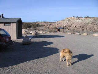
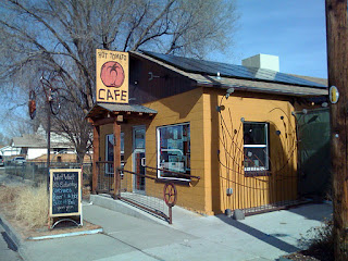
Early on Saturday morning, Scout and I left home and drove west on Broadway/Highway 340 to just past the Monument's western entrance, took a left at King's View Road and then another left onto Devil's Canyon Road to reach the trailhead parking lot. My hiking buddy John Sasso showed up a few minutes later, dropped off by his wife D on her way to the annual Beer Run, a 9.3 mile race in the Fruita area that ends at the Hot Tomato Cafe. John, Scout and I didn't waste much time getting underway because it was windy and still below freezing. We followed trail D1 to D4 to D3 to work our way up the sunny western side of the canyon. There is a network of well-marked trails that loops all over the area, but they can be confusing, so it's a good idea to check the trail map inside the shelter at the trailhead before heading out. There are also maps that are free for the taking from a metal box a few yards up the main trail.
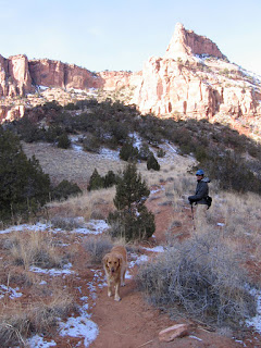
In the canyon, out of the wind, we were soon shedding shells and gloves to keep from overheating. Scout was warm, too, and backtracked frequently for squirts of water from my CamelBak. We paused frequently to admire the Wingate Sandstone walls and spires, and the occasional granite extrusions that are rare in this largely sedimentary area. John speculated about the "climbability" of some of the cracks and chimneys we passed and guessed that most of them had already been climbed. Off in the distance, above the top of the canyon's box end, I could see the antenna farm that dots Black Ridge. It is the highest point in the area, so high that I can see it easily from my office window at work several miles away on the north side of town, near the airport.
About an hour and a half into the hike, the trail dropped and climbed through a series of side drainages and then curved left into a flat area where there sat an old shepherd's cabin. Scout ran ahead to investigate but we were the only ones around. There was a campfire ring and log benches in front of the cabin, and the area smelled of old, wet cinders. The cabin was made of weathered wood covered with tar paper, and the cracks were chinked with new-looking spray foam. It appeared to be at least fifty years old and looks to have been maintained in a somewhat haphazard fashion, with new pieces of wood nailed into place as needed over the years. Remarkably, the glass windows on either end are still intact. At the south end of the cabin was a small, roofed corral that must have been used to protect sheep at one time. Inside the cabin, there was a small table, some shelves, a sheet metal woodstove and a built-in plywood bunk bed but no mattresses. There was also a large collection of relics and graffiti left by previous travelers. I commented that it looked like a cozy place to spend a night but John didn't think so.
Instead of backtracking down the trail we had come up, we went down the trail on the eastern side of the canyon. It receives less sun than the western side, so we needed to contend with occasional patches of snow and mud. John was carrying a hiking pole and I wished that I had thought to bring one myself after a few slips in the wet conditions. Scout used the snow as an opportunity to cool off, rolling on his back and grunting his pleasure. In an hour, we found ourselves back at the point where the western and eastern trails split, completing the loop that had ended at the cabin. From there, it was an easy hike out the way we had come in. We passed small groups of hikers and dogs along the way. They were getting a later, warmer start than we had experienced when we started a little more than three hours earlier.
Back at the trailhead, Scout still had the energy to jump into the back of the SUV. Then we were off to meet up with the Beer Run finishers at the Hot Tomato Cafe and join them for a slice of pizza and a well-deserved beer.
This blog is an account of the pursuit of a dream, to sail around the world. It is named after the sailboat that will fulfill that dream one day, Whispering Jesse. If you share the dream, please join me and we'll take the journey together.
For Charlie and Scout
For Charlie and Scout
About Me

- John Lichty
- Savannah,
Georgia, USA
"Go confidently in the direction of your dreams. Live the life you have imagined." --Henry David Thoreau
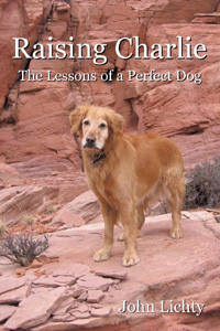 Raising Charlie: The Lessons of a Perfect Dog by John Lichty
Blog Archive
Followers

Recommended Links
- ATN Sailing Equipment
- ActiveCaptain
- BoatU.S.
- Coconut Grove Sailing Club
- Doyle Sails - Fort Lauderdale
- El Milagro Marina
- John Kretschmer Sailing
- John Vigor's Blog
- Leap Notes
- Noonsite.com
- Notes From Paradise
- Pam Wall, Cruising Consultant
- Practical Sailor
- Project Bluesphere
- Sail Makai
- So Many Beaches
- Windfinder
Monday, January 30, 2012
Subscribe to:
Post Comments (Atom)





No comments:
Post a Comment