This blog is an account of the pursuit of a dream, to sail around the world. It is named after the sailboat that will fulfill that dream one day, Whispering Jesse. If you share the dream, please join me and we'll take the journey together.
For Charlie and Scout
About Me
- John Lichty
- Savannah,
Georgia, USA
"Go confidently in the direction of your dreams. Live the life you have imagined." --Henry David Thoreau
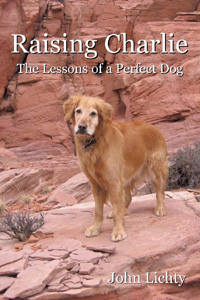
Raising Charlie: The Lessons of a Perfect Dog by John Lichty
Blog Archive
Followers
Recommended Links
- ATN Sailing Equipment
- ActiveCaptain
- BoatU.S.
- Coconut Grove Sailing Club
- Doyle Sails - Fort Lauderdale
- El Milagro Marina
- John Kretschmer Sailing
- John Vigor's Blog
- Leap Notes
- Noonsite.com
- Notes From Paradise
- Pam Wall, Cruising Consultant
- Practical Sailor
- Project Bluesphere
- Sail Makai
- So Many Beaches
- Windfinder
Showing posts with label hiking. Show all posts
Monday, November 24, 2014
Trip to Ireland
Nan and I celebrated our 25th wedding anniversary with a trip to Ireland in September. Nan's sister Monica and her partner Vicky joined us for a few days in Dublin followed by a five-day Wayfarers "Ring of Kerry" walk in southwestern Ireland. We had a wonderful time, drank too much Guinness, and took too many photos. It has taken me almost two months to put the best ones together into a slideshow. Click the photo above of our Wayfarers guide Alan hiking along a country lane, with Ireland's highest peaks in the distance, to launch the slideshow (which is no longer available).
Labels:
hiking,
Ireland,
Ring of Kerry,
Wayfarers
Tuesday, August 14, 2012
Storm King Mountain Memorial Trail
Our friends, the Shepherds, were in Colorado last weekend for their annual summer visit. They have a timeshare in Avon that they use twice a year, a week in the winter for skiing and another in the summer for hiking and biking. On Sunday morning, Nan, Scout and I met them at the Dairy Queen in West Glenwood, which is a fair distance compromise between Avon and Grand Junction. From there, we proceeded west on I-70 to Canyon Creek exit 109 and then doubled back on the north-side frontage road to where it dead-ends at the parking lot for the Storm King Mountain Memorial Trail's trailhead.
On July 6, 1994, fourteen firefighters died while battling the South Canyon Fire when high winds caused the flames to blow up suddenly, trapping them on an isolated slope. The memorial trail was created by friends and family wishing to visit the place where their loved ones lost their lives. It has since been improved by the Bureau of Land Management and the U.S. Forest Service, but it retains its original characteristics as a steep, rugged climb of a thousand vertical feet in a mile and a half. Hikers can't help but think of the brave young men and women who labored up this same slope, carrying heavy firefighting equipment, for the purpose of controlling a fire which threatened the nearby community of Canyon Creek.
The temperature was at least 93 degrees when we arrived at the trailhead in the early afternoon. We each carried CamelBaks full of ice and water, which we generously shared with Scout, who hurried quickly between shady spots while dancing over the hot dust of the well-worn trail. We stopped frequently to rest in the shade and to read the many informational signs along the way, which pointed out the sights and explained how forest fires are fought. The trail eventually leveled out and followed a hot, treeless ridge line to an observation point across from the deadly slope.
In my mind, I had imagined this place many times in the eighteen years since the fire, but it was nothing like I thought it would be. Instead of a canopy of evergreen trees, the steep slopes were covered in chest-high brush and junipers, and I pictured it engulfed in wind-driven flames, racing directly at the firefighters. There would have been nowhere to run and nowhere to hide. Twelve of the firefighters died just below the opposite ridge and two others in a wash a few hundred yards away, directly below the peak of Storm King Mountain. If it had not been so hot, we would have continued our hike to those locations, where memorials have been erected, to pay our respects. We will need to return sometime soon to do so. You should too.
On July 6, 1994, fourteen firefighters died while battling the South Canyon Fire when high winds caused the flames to blow up suddenly, trapping them on an isolated slope. The memorial trail was created by friends and family wishing to visit the place where their loved ones lost their lives. It has since been improved by the Bureau of Land Management and the U.S. Forest Service, but it retains its original characteristics as a steep, rugged climb of a thousand vertical feet in a mile and a half. Hikers can't help but think of the brave young men and women who labored up this same slope, carrying heavy firefighting equipment, for the purpose of controlling a fire which threatened the nearby community of Canyon Creek.
The temperature was at least 93 degrees when we arrived at the trailhead in the early afternoon. We each carried CamelBaks full of ice and water, which we generously shared with Scout, who hurried quickly between shady spots while dancing over the hot dust of the well-worn trail. We stopped frequently to rest in the shade and to read the many informational signs along the way, which pointed out the sights and explained how forest fires are fought. The trail eventually leveled out and followed a hot, treeless ridge line to an observation point across from the deadly slope.
In my mind, I had imagined this place many times in the eighteen years since the fire, but it was nothing like I thought it would be. Instead of a canopy of evergreen trees, the steep slopes were covered in chest-high brush and junipers, and I pictured it engulfed in wind-driven flames, racing directly at the firefighters. There would have been nowhere to run and nowhere to hide. Twelve of the firefighters died just below the opposite ridge and two others in a wash a few hundred yards away, directly below the peak of Storm King Mountain. If it had not been so hot, we would have continued our hike to those locations, where memorials have been erected, to pay our respects. We will need to return sometime soon to do so. You should too.
Labels:
hiking,
John Shepherd,
Nan,
Scout
Monday, July 23, 2012
Ute Petroglyphs
Scout and I, and sometimes Nan, have continued to hike the Grand Junction area's desert trails this summer despite the record-setting heat. My interest in petroglyphs has had us hiking new trails almost every weekend in search of ever more impressive examples of the primitive rock art.
Over Memorial Day weekend, Scout and I hiked in the Dominguez Canyon, starting from the Bridgeport end that is accessible from Highway 50, south of town about 20 miles. After crossing the Gunnison River on a beautifully designed steel pedestrian bridge, we passed through the river rafters' campsites and worked our way up into the canyon on a well-used trail. In addition to the petroglyphs I hoped to see, some people we met on the trail told me about an impressive waterfall we should be sure to see that was off the trail about five minutes before the petroglyph area.
The petroglyphs were pecked into rock surfaces immediately adjacent to the trail, so there was no difficulty finding them. I noticed right away that the petroglyphs in these murals seemed much more recent than the ones I have seen around Moab and other places. The contrast between the art and the background was much more pronounced, and the images were more distinctly recognizable as humans, animals and symbolic designs. The biggest clue, though, was that several of the images depicted humans on horseback. Horses were introduced into the New World by Spanish explorers only 500 years ago, so these petroglyphs would have been created by the Native Americans who populated western Colorado in the years since then: the Utes.
The most dramatic of the murals showed several humans on horseback hunting an abstract-looking creature that I interpreted to be a bear based on the paw print associated with it. The lead hunter appears to be wearing an elaborate headdress and riding a larger horse. As is unfortunately the case with most petroglyphs, idiots have added graffiti to the mural in the form of initials and a crude, scratched-in version of a horse. True petroglyphs are pecked into the stone, not scratched.
On our way back down from the petroglyph area, Scout and I kept an eye on the stream that runs through the canyon to see if we could figure out where the waterfall would be. There was a point where the stream appeared to run into a wall of rock, so we left the trail to investigate. We found a spectacular waterfall where the stream took a sharp right turn at the rock wall and the water fell more than 50 feet to the gravel below. The stone surface beneath the stream, leading up to the falls, was well-worn, leaving shallow pools that Scout felt obliged to swim in and cool off.
The following weekend was Nan's and my wedding anniversary, and we celebrated by hiking the Palisade Rim Trail, at the far eastern end of Palisade, east of Grand Junction off Interstate 70 and above the Colorado River. Even with an early morning start, it was a hot and buggy hike. There was a large crew of volunteers working to get the trail into shape for mountain biking, which is the trend in this area: Trails that have been used by hikers and horseback riders for years are discovered by mountain bikers, modified to accommodate their needs, and then overrun by them. I'm not anti-mountain biking, but there are riders out there who could stand to learn some trail etiquette. The main reason I don't ride myself is because I don't think it would be fair to Scout to have him try to keep up with me. So I hike with him instead, and he is happy.
The petroglyphs we found on this hike were not so impressive. The murals were smaller, and there were fewer of them. The petroglyphs appeared to be of the same vintage as the Dominguez Canyon ones and depicted similar scenes, so we guessed that they were also created by the Utes who inhabited the area and perhaps used this remote mesa above the Colorado River as a hunting camp. The primary difference I noticed was that these petroglyphs were mostly of deer and elk, while the Dominguez Canyon ones were mostly of bears and bighorn sheep, leading me to think that the fauna in the two areas were at least somewhat different even though the areas were only 30 miles apart.
On Independence Day, Scout and I returned to Dominguez Canyon, this time with Nan. I wanted to share the petroglyphs and the waterfall with her. It had been very hot since Scout and I had done the hike a few weeks earlier, and the stream in the canyon had dried up. The waterfall was not flowing, and there was only a single pool of water left. It was filled with tadpoles striving to become desert frogs if the pool did not evaporate first.
Nan was having issues with her hips, so the dried-up waterfall was her turnaround point. Scout and I proceeded quickly up the trail from there to snap some photos of the petroglyphs to show Nan what she was missing. When we caught back up with her, she spotted some desert bighorn sheep in the fields on the other side of the canyon. There was a flock of about a dozen, grazing and keeping an eye on us. They were a thrill to see. I found out later that they had been recently reintroduced to the canyon, presumably after being hunted out of existence by the Utes many years before and leaving only their images on the stone walls to show they had once been there.
Over Memorial Day weekend, Scout and I hiked in the Dominguez Canyon, starting from the Bridgeport end that is accessible from Highway 50, south of town about 20 miles. After crossing the Gunnison River on a beautifully designed steel pedestrian bridge, we passed through the river rafters' campsites and worked our way up into the canyon on a well-used trail. In addition to the petroglyphs I hoped to see, some people we met on the trail told me about an impressive waterfall we should be sure to see that was off the trail about five minutes before the petroglyph area.
The petroglyphs were pecked into rock surfaces immediately adjacent to the trail, so there was no difficulty finding them. I noticed right away that the petroglyphs in these murals seemed much more recent than the ones I have seen around Moab and other places. The contrast between the art and the background was much more pronounced, and the images were more distinctly recognizable as humans, animals and symbolic designs. The biggest clue, though, was that several of the images depicted humans on horseback. Horses were introduced into the New World by Spanish explorers only 500 years ago, so these petroglyphs would have been created by the Native Americans who populated western Colorado in the years since then: the Utes.
The most dramatic of the murals showed several humans on horseback hunting an abstract-looking creature that I interpreted to be a bear based on the paw print associated with it. The lead hunter appears to be wearing an elaborate headdress and riding a larger horse. As is unfortunately the case with most petroglyphs, idiots have added graffiti to the mural in the form of initials and a crude, scratched-in version of a horse. True petroglyphs are pecked into the stone, not scratched.
On our way back down from the petroglyph area, Scout and I kept an eye on the stream that runs through the canyon to see if we could figure out where the waterfall would be. There was a point where the stream appeared to run into a wall of rock, so we left the trail to investigate. We found a spectacular waterfall where the stream took a sharp right turn at the rock wall and the water fell more than 50 feet to the gravel below. The stone surface beneath the stream, leading up to the falls, was well-worn, leaving shallow pools that Scout felt obliged to swim in and cool off.
The following weekend was Nan's and my wedding anniversary, and we celebrated by hiking the Palisade Rim Trail, at the far eastern end of Palisade, east of Grand Junction off Interstate 70 and above the Colorado River. Even with an early morning start, it was a hot and buggy hike. There was a large crew of volunteers working to get the trail into shape for mountain biking, which is the trend in this area: Trails that have been used by hikers and horseback riders for years are discovered by mountain bikers, modified to accommodate their needs, and then overrun by them. I'm not anti-mountain biking, but there are riders out there who could stand to learn some trail etiquette. The main reason I don't ride myself is because I don't think it would be fair to Scout to have him try to keep up with me. So I hike with him instead, and he is happy.
The petroglyphs we found on this hike were not so impressive. The murals were smaller, and there were fewer of them. The petroglyphs appeared to be of the same vintage as the Dominguez Canyon ones and depicted similar scenes, so we guessed that they were also created by the Utes who inhabited the area and perhaps used this remote mesa above the Colorado River as a hunting camp. The primary difference I noticed was that these petroglyphs were mostly of deer and elk, while the Dominguez Canyon ones were mostly of bears and bighorn sheep, leading me to think that the fauna in the two areas were at least somewhat different even though the areas were only 30 miles apart.
On Independence Day, Scout and I returned to Dominguez Canyon, this time with Nan. I wanted to share the petroglyphs and the waterfall with her. It had been very hot since Scout and I had done the hike a few weeks earlier, and the stream in the canyon had dried up. The waterfall was not flowing, and there was only a single pool of water left. It was filled with tadpoles striving to become desert frogs if the pool did not evaporate first.
Nan was having issues with her hips, so the dried-up waterfall was her turnaround point. Scout and I proceeded quickly up the trail from there to snap some photos of the petroglyphs to show Nan what she was missing. When we caught back up with her, she spotted some desert bighorn sheep in the fields on the other side of the canyon. There was a flock of about a dozen, grazing and keeping an eye on us. They were a thrill to see. I found out later that they had been recently reintroduced to the canyon, presumably after being hunted out of existence by the Utes many years before and leaving only their images on the stone walls to show they had once been there.
Labels:
Grand Junction,
hiking,
Nan,
Scout
Tuesday, May 8, 2012
Fisher Towers Hike
Before the heat of summer renders it too miserable, I want to try to hike as many of the nearby desert trails as possible. Scout and I were thwarted in our attempt to hike the Negro Bill Canyon trail near Moab back in March and ended up hiking the Poison Spider trail instead. So when I emailed my friend John Sasso to see if he would be interested in taking a hike this past Saturday, I was thinking Negro Bill. But John emailed me back to say there was too much poison ivy along the trail and that he knew about it from painful personal experience. I checked DiscoverMoab.com and came up with two alternatives, Fisher Towers or Corona Arch. Of course, John had already hiked both, and in the case of Fisher Towers, he had actually climbed the Titan tower. I have driven Highway 128, which is the scenic way to Moab from I-70, and passed Fisher Towers many times but never stopped to get a closer look. This would be a good opportunity.
Scout and I picked John up at the crack of 9:45 and headed west out of Grand Junction. John had suggested that we get some lunch at the Hogi Yogi in Moab, and I misunderstood him to mean that we would do this after the hike, not before. When I said so, he said that I should stop at one of the truck stops so he could pick up a sandwich, but the closest one was at the Highway 191 exit, which is the non-scenic way to Moab. I had eaten a big breakfast before picking him up, so a nasty truck-stop sandwich was the last thing I wanted. We reached a compromise and drove all the way in to Moab, only to find that the Hogi Yogi, which has been in operation at least since Nan and I started going to Moab in 1992, is now the Cabo Grill. In disappointment, John and I continued south and turned in at a... truck stop. But it turned out to be a truck stop that offered huge custom-made sandwiches, at great prices, while you waited. Who knew?
We reversed course and took the turn onto Highway 128 at the north edge of town. We passed Negro Bill Canyon, and I was happy we weren't hiking it that day because the parking lot at the trailhead was full and people were parking along the highway. Pedestrians were taking their chances crossing the highway, and I could just imagine what a nightmare the trail would be. We continued until we reached a turn-off for Fisher Valley and Onion Creek, which we quickly discovered was wrong when we reached a stream crossing. I hadn't printed out the directions to the trailhead because I figured John knew where we were going, but he was a little fuzzy on exactly how to get there. Back on the highway, we reached another turn-off just a few hundred yards farther up, and John announced that we were on the right track. We parked in a spot right at the trailhead, and John ate his sandwich in the shade of a juniper tree while Scout and I got organized for the hike.
It was hang-on-to-your-hat windy, which helped to keep it somewhat cool considering our nearly 1:00 starting time. I heard voices on the wind and looked around to see where they were coming from. I craned my neck and looked straight up to see climbers on a familiar-looking rock formation. I asked John if it was the one from the Citi TV commercial, featuring climbers Katie Brown and Alex Honnold, and he said that of course it was; he had already told me all about it on the drive. That's news to me, I thought, but what a sight! The trail angled around the formation, called Ancient Art, giving us a better perspective of the climbers and the Stolen Chimney route they had climbed to reach the final pitch featured in the TV commercial.
Along the climber's trail below Ancient Art, there were a few dramatic-looking hoodoos. According to John, the one with the thinnest neck is called The Cobra and it has been climbed successfully. To look at it, you would think anyone putting their weight on it would snap the top of it right off.
The trail rounded a windy corner with excellent views of the Titan tower and proceeded onto a narrow ledge below sheer walls of converging sandstone. The trail abruptly ended at a metal ladder leading down several rungs to where the trail began again. There was no way Scout was going to climb down a ladder. John went down to look for an alternative route farther up into the notch formed by the converging walls. A minute later, he popped out on the sandstone above us and said he thought Scout could make it down the way he had come up. Scout and I followed him back to where a five-foot drop led through a narrow slot to the bottom of the ladder. John went down first and I followed, but when I whistled Scout to come, he realized that I intended to hoist him down and he backed out of reach. The more I coaxed him, the farther he backed away. I could have had John climb up and get behind Scout to herd him to me, but we decided against it and turned around instead. Maybe next time.
As we passed Ancient Art again on our return, we heard whooping from other hikers on the trail. One of the climbers had just stood up on the tiny summit, like Katie Brown in the dizzying final moments of the TV commercial. We just missed seeing it, but I felt I already had an idea of what it would be like.
Scout and I picked John up at the crack of 9:45 and headed west out of Grand Junction. John had suggested that we get some lunch at the Hogi Yogi in Moab, and I misunderstood him to mean that we would do this after the hike, not before. When I said so, he said that I should stop at one of the truck stops so he could pick up a sandwich, but the closest one was at the Highway 191 exit, which is the non-scenic way to Moab. I had eaten a big breakfast before picking him up, so a nasty truck-stop sandwich was the last thing I wanted. We reached a compromise and drove all the way in to Moab, only to find that the Hogi Yogi, which has been in operation at least since Nan and I started going to Moab in 1992, is now the Cabo Grill. In disappointment, John and I continued south and turned in at a... truck stop. But it turned out to be a truck stop that offered huge custom-made sandwiches, at great prices, while you waited. Who knew?
We reversed course and took the turn onto Highway 128 at the north edge of town. We passed Negro Bill Canyon, and I was happy we weren't hiking it that day because the parking lot at the trailhead was full and people were parking along the highway. Pedestrians were taking their chances crossing the highway, and I could just imagine what a nightmare the trail would be. We continued until we reached a turn-off for Fisher Valley and Onion Creek, which we quickly discovered was wrong when we reached a stream crossing. I hadn't printed out the directions to the trailhead because I figured John knew where we were going, but he was a little fuzzy on exactly how to get there. Back on the highway, we reached another turn-off just a few hundred yards farther up, and John announced that we were on the right track. We parked in a spot right at the trailhead, and John ate his sandwich in the shade of a juniper tree while Scout and I got organized for the hike.
It was hang-on-to-your-hat windy, which helped to keep it somewhat cool considering our nearly 1:00 starting time. I heard voices on the wind and looked around to see where they were coming from. I craned my neck and looked straight up to see climbers on a familiar-looking rock formation. I asked John if it was the one from the Citi TV commercial, featuring climbers Katie Brown and Alex Honnold, and he said that of course it was; he had already told me all about it on the drive. That's news to me, I thought, but what a sight! The trail angled around the formation, called Ancient Art, giving us a better perspective of the climbers and the Stolen Chimney route they had climbed to reach the final pitch featured in the TV commercial.
Along the climber's trail below Ancient Art, there were a few dramatic-looking hoodoos. According to John, the one with the thinnest neck is called The Cobra and it has been climbed successfully. To look at it, you would think anyone putting their weight on it would snap the top of it right off.
The trail rounded a windy corner with excellent views of the Titan tower and proceeded onto a narrow ledge below sheer walls of converging sandstone. The trail abruptly ended at a metal ladder leading down several rungs to where the trail began again. There was no way Scout was going to climb down a ladder. John went down to look for an alternative route farther up into the notch formed by the converging walls. A minute later, he popped out on the sandstone above us and said he thought Scout could make it down the way he had come up. Scout and I followed him back to where a five-foot drop led through a narrow slot to the bottom of the ladder. John went down first and I followed, but when I whistled Scout to come, he realized that I intended to hoist him down and he backed out of reach. The more I coaxed him, the farther he backed away. I could have had John climb up and get behind Scout to herd him to me, but we decided against it and turned around instead. Maybe next time.
As we passed Ancient Art again on our return, we heard whooping from other hikers on the trail. One of the climbers had just stood up on the tiny summit, like Katie Brown in the dizzying final moments of the TV commercial. We just missed seeing it, but I felt I already had an idea of what it would be like.
Labels:
hiking,
John Sasso,
Moab,
Scout
Tuesday, April 3, 2012
Moqui Steps
On Sunday morning, my friend John Sasso, my dog Scout and I hiked the Rough Canyon trail south of town, in the Bangs Canyon area off Little Park Road. Scout and I tried to do the same hike last summer, but we were forced to turn around due to wet conditions and some difficult scrambling that I felt was beyond Scout's safety level. We didn't experience the same trouble this time. After our mild winter and extremely dry spring, the going was much easier.
I showed John the petroglyphs that Scout and I had found on a canyon wall the last time, and I was angered to see even more graffiti had been added, some of it practically on top of the ancient rock art. John had done a number of rock climbs in the canyon, and he pointed them out as we worked our way down the canyon's stream bed. Scout made a number of athletic moves through the scrambling sections and rewarded himself with quick swims in the many muddy pools.
We eventually reached Rough Canyon Falls, where Scout and I had searched for the elusive moqui steps (sometimes spelled moki steps) during a hike last summer that brought us to the falls from the rim trail that runs above and parallel to the Rough Canyon trail. I told John about the moqui steps during our hike and said that I was hoping to find them that day. He walked up to the edge of the cliff next to the dry stone groove of the falls, pointed down and said, "They're right there!" I joined him and couldn't believe it. I had looked at that same wall the year before and seen nothing unusual, but John saw them right away. I must have been expecting something different the last time, because there was no mistaking them this time. I climbed around the two huge cottonwood trunks that are wedged into the falls to get a better angle for some photos. John looked for a way to get down to the bottom where the steps started, but the only way was to use the steps, which was too dangerous to try without the pool below having enough water to break a fall.
Being an avid rock climber, John proposed that we come back another time with a climbing rope and set an anchor using one of the juniper trees on the rim. We could take turns rappelling down to the bottom and then safely climbing the moqui steps back up while on a belay. After giving it some thought, I would guess that the ancient people who carved the moqui steps must have had a hand-woven rope that they used in conjunction with the steps to make it easier to get up and down, especially if they were carrying water containers. The fact that the first step was about four feet above the bottom made me think that the steps were intended to be used when the pool was full of water. During a dry spell, the shaded pool may have been the only local source for fresh water.
I showed John the petroglyphs that Scout and I had found on a canyon wall the last time, and I was angered to see even more graffiti had been added, some of it practically on top of the ancient rock art. John had done a number of rock climbs in the canyon, and he pointed them out as we worked our way down the canyon's stream bed. Scout made a number of athletic moves through the scrambling sections and rewarded himself with quick swims in the many muddy pools.
We eventually reached Rough Canyon Falls, where Scout and I had searched for the elusive moqui steps (sometimes spelled moki steps) during a hike last summer that brought us to the falls from the rim trail that runs above and parallel to the Rough Canyon trail. I told John about the moqui steps during our hike and said that I was hoping to find them that day. He walked up to the edge of the cliff next to the dry stone groove of the falls, pointed down and said, "They're right there!" I joined him and couldn't believe it. I had looked at that same wall the year before and seen nothing unusual, but John saw them right away. I must have been expecting something different the last time, because there was no mistaking them this time. I climbed around the two huge cottonwood trunks that are wedged into the falls to get a better angle for some photos. John looked for a way to get down to the bottom where the steps started, but the only way was to use the steps, which was too dangerous to try without the pool below having enough water to break a fall.
Being an avid rock climber, John proposed that we come back another time with a climbing rope and set an anchor using one of the juniper trees on the rim. We could take turns rappelling down to the bottom and then safely climbing the moqui steps back up while on a belay. After giving it some thought, I would guess that the ancient people who carved the moqui steps must have had a hand-woven rope that they used in conjunction with the steps to make it easier to get up and down, especially if they were carrying water containers. The fact that the first step was about four feet above the bottom made me think that the steps were intended to be used when the pool was full of water. During a dry spell, the shaded pool may have been the only local source for fresh water.
Labels:
Grand Junction,
hiking,
John Sasso,
Scout
Thursday, March 22, 2012
Poison Spider Hike
Nan, Scout and I were in Moab again over the weekend. Nan was running in the annual Canyonlands five-mile race on Saturday morning, so Scout and I went along to do a hike. The hotels in Moab time their high-season rates to begin the weekend of the big race, which means the normally reasonable La Quinta zooms up to almost $200 a night. We spent the night at home instead and left in the dark at 5:30 to arrive by 7:30. After dropping Nan off with the hundreds of other runners, Scout and I headed north out of town. We had planned to hike Negro Bill Canyon for the first time, but the access to it off Highway 128 was closed due to the race. So we proceeded a little farther north, turned left onto Highway 279 and drove the couple of miles down to the Poison Spider Trail's trailhead.
I rode the Poison Spider Trail on my dirt bike years ago, and Charlie and I hiked it once--probably while Nan was running a race--but he and I had not gone far enough to see what I was hoping to see with Scout, the section of slickrock ledges that I remember being really difficult to get up and over on my dirt bike. We started out at 8:15, hiking up a series of rocky switchbacks in a blustery wind. The trail eventually leveled out heading west and then curved around to the north into a familiar-looking sand wash canyon with steep sandstone cliffs on either side. Where the deep sand ended, the steep slickrock ledges began. Scout leaped nimbly up them while I stood below trying to calculate the smoothest line to take if I was on my dirt bike. I remember needing to get off my dirt bike and do the same thing years ago, and even then, it took a couple of tries to get up some of the trickier sections.
The trail leveled out again above the slickrock ledges and provided the view you see in the photo above of the Moab Rim across the Colorado River and the snow-dusted La Sal Mountains beyond. Please click the photo for a full-size view. The lenticular clouds and Scout's blowing fur give a good idea of how windy it was. We needed to meet Nan at the finish area before noon, so this was our turnaround point at 10:30.
On the way back toward Moab on Highway 279, there were many groups of rock climbers scaling the sandstone faces that drop vertically to the shoulder of the narrow two-lane highway as it runs along the river. This must have been a popular area as well with the Native Americans who left their petroglyphs on the faces several feet above the ground. In the past, the lighter areas of stone below the rock art must have been covered by deep sand bars from the river that have since eroded away. The unintended effect is that the petroglyphs have been preserved out of reach of vandals and graffiti artists. Again, please click the photo for a full-size view.
I rode the Poison Spider Trail on my dirt bike years ago, and Charlie and I hiked it once--probably while Nan was running a race--but he and I had not gone far enough to see what I was hoping to see with Scout, the section of slickrock ledges that I remember being really difficult to get up and over on my dirt bike. We started out at 8:15, hiking up a series of rocky switchbacks in a blustery wind. The trail eventually leveled out heading west and then curved around to the north into a familiar-looking sand wash canyon with steep sandstone cliffs on either side. Where the deep sand ended, the steep slickrock ledges began. Scout leaped nimbly up them while I stood below trying to calculate the smoothest line to take if I was on my dirt bike. I remember needing to get off my dirt bike and do the same thing years ago, and even then, it took a couple of tries to get up some of the trickier sections.
The trail leveled out again above the slickrock ledges and provided the view you see in the photo above of the Moab Rim across the Colorado River and the snow-dusted La Sal Mountains beyond. Please click the photo for a full-size view. The lenticular clouds and Scout's blowing fur give a good idea of how windy it was. We needed to meet Nan at the finish area before noon, so this was our turnaround point at 10:30.
On the way back toward Moab on Highway 279, there were many groups of rock climbers scaling the sandstone faces that drop vertically to the shoulder of the narrow two-lane highway as it runs along the river. This must have been a popular area as well with the Native Americans who left their petroglyphs on the faces several feet above the ground. In the past, the lighter areas of stone below the rock art must have been covered by deep sand bars from the river that have since eroded away. The unintended effect is that the petroglyphs have been preserved out of reach of vandals and graffiti artists. Again, please click the photo for a full-size view.
Monday, January 30, 2012
Devil's Canyon Hike
One of the best things about living in Grand Junction is the mild winter climate. Great skiing is less than an hour away up at Powderhorn, yet there is very little snow down below. It is possible to hike year round on trails that receive sufficient sun to melt the scant snow, and Devil's Canyon is one of those trails. It is located just to the west of the Colorado National Monument's western boundary, so it is open to dogs, unlike the Monument itself. If I'm going to take a hike, I want to include my dog Scout because he enjoys hiking even more than I do.
Early on Saturday morning, Scout and I left home and drove west on Broadway/Highway 340 to just past the Monument's western entrance, took a left at King's View Road and then another left onto Devil's Canyon Road to reach the trailhead parking lot. My hiking buddy John Sasso showed up a few minutes later, dropped off by his wife D on her way to the annual Beer Run, a 9.3 mile race in the Fruita area that ends at the Hot Tomato Cafe. John, Scout and I didn't waste much time getting underway because it was windy and still below freezing. We followed trail D1 to D4 to D3 to work our way up the sunny western side of the canyon. There is a network of well-marked trails that loops all over the area, but they can be confusing, so it's a good idea to check the trail map inside the shelter at the trailhead before heading out. There are also maps that are free for the taking from a metal box a few yards up the main trail.
In the canyon, out of the wind, we were soon shedding shells and gloves to keep from overheating. Scout was warm, too, and backtracked frequently for squirts of water from my CamelBak. We paused frequently to admire the Wingate Sandstone walls and spires, and the occasional granite extrusions that are rare in this largely sedimentary area. John speculated about the "climbability" of some of the cracks and chimneys we passed and guessed that most of them had already been climbed. Off in the distance, above the top of the canyon's box end, I could see the antenna farm that dots Black Ridge. It is the highest point in the area, so high that I can see it easily from my office window at work several miles away on the north side of town, near the airport.
About an hour and a half into the hike, the trail dropped and climbed through a series of side drainages and then curved left into a flat area where there sat an old shepherd's cabin. Scout ran ahead to investigate but we were the only ones around. There was a campfire ring and log benches in front of the cabin, and the area smelled of old, wet cinders. The cabin was made of weathered wood covered with tar paper, and the cracks were chinked with new-looking spray foam. It appeared to be at least fifty years old and looks to have been maintained in a somewhat haphazard fashion, with new pieces of wood nailed into place as needed over the years. Remarkably, the glass windows on either end are still intact. At the south end of the cabin was a small, roofed corral that must have been used to protect sheep at one time. Inside the cabin, there was a small table, some shelves, a sheet metal woodstove and a built-in plywood bunk bed but no mattresses. There was also a large collection of relics and graffiti left by previous travelers. I commented that it looked like a cozy place to spend a night but John didn't think so.
Instead of backtracking down the trail we had come up, we went down the trail on the eastern side of the canyon. It receives less sun than the western side, so we needed to contend with occasional patches of snow and mud. John was carrying a hiking pole and I wished that I had thought to bring one myself after a few slips in the wet conditions. Scout used the snow as an opportunity to cool off, rolling on his back and grunting his pleasure. In an hour, we found ourselves back at the point where the western and eastern trails split, completing the loop that had ended at the cabin. From there, it was an easy hike out the way we had come in. We passed small groups of hikers and dogs along the way. They were getting a later, warmer start than we had experienced when we started a little more than three hours earlier.
Back at the trailhead, Scout still had the energy to jump into the back of the SUV. Then we were off to meet up with the Beer Run finishers at the Hot Tomato Cafe and join them for a slice of pizza and a well-deserved beer.
Early on Saturday morning, Scout and I left home and drove west on Broadway/Highway 340 to just past the Monument's western entrance, took a left at King's View Road and then another left onto Devil's Canyon Road to reach the trailhead parking lot. My hiking buddy John Sasso showed up a few minutes later, dropped off by his wife D on her way to the annual Beer Run, a 9.3 mile race in the Fruita area that ends at the Hot Tomato Cafe. John, Scout and I didn't waste much time getting underway because it was windy and still below freezing. We followed trail D1 to D4 to D3 to work our way up the sunny western side of the canyon. There is a network of well-marked trails that loops all over the area, but they can be confusing, so it's a good idea to check the trail map inside the shelter at the trailhead before heading out. There are also maps that are free for the taking from a metal box a few yards up the main trail.
In the canyon, out of the wind, we were soon shedding shells and gloves to keep from overheating. Scout was warm, too, and backtracked frequently for squirts of water from my CamelBak. We paused frequently to admire the Wingate Sandstone walls and spires, and the occasional granite extrusions that are rare in this largely sedimentary area. John speculated about the "climbability" of some of the cracks and chimneys we passed and guessed that most of them had already been climbed. Off in the distance, above the top of the canyon's box end, I could see the antenna farm that dots Black Ridge. It is the highest point in the area, so high that I can see it easily from my office window at work several miles away on the north side of town, near the airport.
About an hour and a half into the hike, the trail dropped and climbed through a series of side drainages and then curved left into a flat area where there sat an old shepherd's cabin. Scout ran ahead to investigate but we were the only ones around. There was a campfire ring and log benches in front of the cabin, and the area smelled of old, wet cinders. The cabin was made of weathered wood covered with tar paper, and the cracks were chinked with new-looking spray foam. It appeared to be at least fifty years old and looks to have been maintained in a somewhat haphazard fashion, with new pieces of wood nailed into place as needed over the years. Remarkably, the glass windows on either end are still intact. At the south end of the cabin was a small, roofed corral that must have been used to protect sheep at one time. Inside the cabin, there was a small table, some shelves, a sheet metal woodstove and a built-in plywood bunk bed but no mattresses. There was also a large collection of relics and graffiti left by previous travelers. I commented that it looked like a cozy place to spend a night but John didn't think so.
Instead of backtracking down the trail we had come up, we went down the trail on the eastern side of the canyon. It receives less sun than the western side, so we needed to contend with occasional patches of snow and mud. John was carrying a hiking pole and I wished that I had thought to bring one myself after a few slips in the wet conditions. Scout used the snow as an opportunity to cool off, rolling on his back and grunting his pleasure. In an hour, we found ourselves back at the point where the western and eastern trails split, completing the loop that had ended at the cabin. From there, it was an easy hike out the way we had come in. We passed small groups of hikers and dogs along the way. They were getting a later, warmer start than we had experienced when we started a little more than three hours earlier.
Back at the trailhead, Scout still had the energy to jump into the back of the SUV. Then we were off to meet up with the Beer Run finishers at the Hot Tomato Cafe and join them for a slice of pizza and a well-deserved beer.
Labels:
Grand Junction,
hiking,
John Sasso,
Scout
Tuesday, December 6, 2011
Hidden Valley to Moab Rim Trail
A few weeks ago, Nan and I were in Moab for a race she wanted to run. It was a cold, wet and miserable Saturday morning, but she seemed upbeat and excited when Scout and I dropped her off in the muddy campground parking lot off Kane Creek Road. I told her we would pick her up in a couple of hours and then backtracked up the road to the parking lot at the trailhead of the Moab Rim Trail. It's the trail that connects with the Hidden Valley Trail, which I have hiked several times as an "out and back," first with Charlie and then with Scout. There is a chapter in my book, Raising Charlie, that details Charlie's and my last hike together on the Hidden Valley Trail, just weeks before he died.
As Scout and I hiked through the drizzle up the steeply sloping slickrock, I thought about what it would take to hike the entire distance of Hidden Valley and Moab Rim. It would be six to seven miles one way, so having a car or an arranged ride at each end would be necessary. When Scout and I reached the top of the Rim, where the trail overlooks the city of Moab, I tried to gauge the distance and direction to the Hidden Valley trailhead, far out of sight around the Rim to the south, off Highway 191. Looking out ahead to where the trail would lead us if we had more time, I saw that it disappeared quickly among a series of loaf-shaped sandstone bluffs. Someday, I thought.
Well, someday came quickly. Last Saturday, Scout and I, along with my friend John Sasso, did the entire Hidden Valley to Moab Rim hike. Nan and John's wife D were running the annual Moab Winter Sun 10K, and we drove down separately, so we had the two cars we needed. I had asked John earlier in the week if he would be interested, knowing that he's always up for a hike, and then it was just a matter of working out the logistics.
We dropped the wives off at the race and left John and D's car at the finish area, then drove down Highway 191 to the Hidden Valley trailhead, off Angel Rock Road. It felt good to be hiking the trail again. It had been since the same weekend last year while Nan was running the same race that Scout and I had hiked it. There had been snow that day, but only wind and cold on this day. It had been months since John and I had talked, so we used our hiking time together to catch up. Before I knew it, we were at the top of the initial steep, rocky section of the trail and standing in front of the juniper tree where Charlie and I had stopped for a drink on our last hike. It made me feel melancholy to picture him again sitting under the tree and smiling at me. I gave Scout a drink from my CamelBak and we continued up the trail and into the first of two giant sagebrush meadows.
Before long, we reached the side trail to the wall of petroglyphs, where I took the cover photo for Raising Charlie. John was impressed by the figure of a single man etched into the rock and asked me how old I thought it was. I guessed, at least a thousand years, knowing that the Anasazi who lived in this area had moved on more than eight hundred years ago when the climate became too arid. I asked John to take a photo of Scout and me in front of the "map" petroglyph, which I believe is a representation of the access trail and two meadows that lead up to the wall from the valley floor below. Then I took one of John, with the valley and the La Sal Mountains in the background. I stopped and turned around as we were leaving the wall, again picturing Charlie as he had been that day. I will always associate him with this special place.
We backtracked to the main trail and then, instead of heading back down the way we had come, as I had done so many times before, we continued up and over a low pass to the Moab Rim Trail for the very first time. At this point, I was no longer on familiar terrain and needed to pay close attention to the trail, even though it quickly turned into a double-track, because it wound crazily over and around extensive slickrock sections. Off in the distance, we saw three jeeps negotiating difficult spur trails, but they were the only other human activity we had seen to that point. We had been hiking for more than two hours when the trail seemed to loop back upon itself and head in an uphill direction, contrary to what I was expecting. But then we came around a curve and I spotted the trail sign that Scout and I had marked as our turnaround point on the Moab Rim hike a few weeks before.
The three of us paused to admire the view of Moab from the overlook and then headed down the steep slickrock toward the trailhead. I was looking ahead to see if Nan and D might be waiting for us down there, but I didn't see them. John had only one bar on his Verizon cell phone when we reached the parking lot, but he was able to call Nan and D and ask them to pick us up. John, Scout and I walked up Kane Creek Road a ways to meet them, piled into John and D's car, drove around to pick up our car at the Hidden Valley trailhead, and then drove back to the Moab Brewery for a well-deserved lunch before heading back home.
As Scout and I hiked through the drizzle up the steeply sloping slickrock, I thought about what it would take to hike the entire distance of Hidden Valley and Moab Rim. It would be six to seven miles one way, so having a car or an arranged ride at each end would be necessary. When Scout and I reached the top of the Rim, where the trail overlooks the city of Moab, I tried to gauge the distance and direction to the Hidden Valley trailhead, far out of sight around the Rim to the south, off Highway 191. Looking out ahead to where the trail would lead us if we had more time, I saw that it disappeared quickly among a series of loaf-shaped sandstone bluffs. Someday, I thought.
Well, someday came quickly. Last Saturday, Scout and I, along with my friend John Sasso, did the entire Hidden Valley to Moab Rim hike. Nan and John's wife D were running the annual Moab Winter Sun 10K, and we drove down separately, so we had the two cars we needed. I had asked John earlier in the week if he would be interested, knowing that he's always up for a hike, and then it was just a matter of working out the logistics.
We dropped the wives off at the race and left John and D's car at the finish area, then drove down Highway 191 to the Hidden Valley trailhead, off Angel Rock Road. It felt good to be hiking the trail again. It had been since the same weekend last year while Nan was running the same race that Scout and I had hiked it. There had been snow that day, but only wind and cold on this day. It had been months since John and I had talked, so we used our hiking time together to catch up. Before I knew it, we were at the top of the initial steep, rocky section of the trail and standing in front of the juniper tree where Charlie and I had stopped for a drink on our last hike. It made me feel melancholy to picture him again sitting under the tree and smiling at me. I gave Scout a drink from my CamelBak and we continued up the trail and into the first of two giant sagebrush meadows.
Before long, we reached the side trail to the wall of petroglyphs, where I took the cover photo for Raising Charlie. John was impressed by the figure of a single man etched into the rock and asked me how old I thought it was. I guessed, at least a thousand years, knowing that the Anasazi who lived in this area had moved on more than eight hundred years ago when the climate became too arid. I asked John to take a photo of Scout and me in front of the "map" petroglyph, which I believe is a representation of the access trail and two meadows that lead up to the wall from the valley floor below. Then I took one of John, with the valley and the La Sal Mountains in the background. I stopped and turned around as we were leaving the wall, again picturing Charlie as he had been that day. I will always associate him with this special place.
We backtracked to the main trail and then, instead of heading back down the way we had come, as I had done so many times before, we continued up and over a low pass to the Moab Rim Trail for the very first time. At this point, I was no longer on familiar terrain and needed to pay close attention to the trail, even though it quickly turned into a double-track, because it wound crazily over and around extensive slickrock sections. Off in the distance, we saw three jeeps negotiating difficult spur trails, but they were the only other human activity we had seen to that point. We had been hiking for more than two hours when the trail seemed to loop back upon itself and head in an uphill direction, contrary to what I was expecting. But then we came around a curve and I spotted the trail sign that Scout and I had marked as our turnaround point on the Moab Rim hike a few weeks before.
The three of us paused to admire the view of Moab from the overlook and then headed down the steep slickrock toward the trailhead. I was looking ahead to see if Nan and D might be waiting for us down there, but I didn't see them. John had only one bar on his Verizon cell phone when we reached the parking lot, but he was able to call Nan and D and ask them to pick us up. John, Scout and I walked up Kane Creek Road a ways to meet them, piled into John and D's car, drove around to pick up our car at the Hidden Valley trailhead, and then drove back to the Moab Brewery for a well-deserved lunch before heading back home.
Labels:
Charlie,
hiking,
John Sasso,
Moab,
Scout
Thursday, August 25, 2011
Rough Canyon Falls hike
It has been a hot summer here in Grand Junction, but the thermometer didn't get up to triple digits until Wednesday. With the temperatures only in the mid-nineties and the humidity near zero, it has been reasonably comfortable to take long weekend hikes with Scout provided there was some shade and I carried plenty of ice cubes and water in my CamelBak.
This past weekend, Scout and I drove over to the Bangs Canyon area off Little Park Road, just a few miles from home, and hiked about two miles to Rough Canyon Falls, an intermittent waterfall in a pristine sandstone canyon. There are two ways to get to the falls from the Bangs Canyon parking lot, and we had tried the more scenic Rough Canyon route a couple of weekends earlier without success. There had been a fair amount of rain, and the scoured floor of the canyon had held it in muddy pools that required skirting around the edges over some difficult boulders, at least for me. Scout waded and swam through many of the pools, but I didn't want to risk a fall on the slippery bottoms. We finally reached a point where I would need to scramble down a steep pitch using both hands and feet, and I decided we should turn around. Scout might have made it down, but he wouldn't have made it back up.
As we backtracked, I noticed one of those brown fiberglass stake signs. I hadn't seen it earlier because we had been on a different track of the braided trail. It warned against defacing the site, which I took to mean that there was something worth seeing along the short spur leading away from the sign. Sure enough, on a sandstone face beneath a huge overhang, there were some impressive petroglyphs of humanoid characters and a design of circles that reminded me of the map petroglyph in Hidden Valley, south of Moab. Of course, against the wishes of the sign, there was graffiti all around the petroglyphs. I don't understand why people can't just leave well enough alone.
That day, we could have continued back to the trailhead and taken the easier canyon rim route to the falls, but we opted to continue up the canyon past the turnoff to the parking lot and do the Mica Mine hike instead. Nan and I had done it once a few years ago with Charlie and later learned that we had turned around before reaching the actual mine, thinking that the large piles of mica tailings we spotted were the mine's remnants. I wanted to see what we had missed, and we still had plenty of water, so off we went. The trail was really just an old jeep road that the miners had painstakingly forged through the canyon. It was easy hiking and there was plenty of shade. Within a half-hour, we had passed the tailings and reached the actual mine, which is more of a large, excavated cave. There were still plenty of mica extrusions covering the walls, and I wondered if the miners had been trying to extract it in certain-sized plates, because there were fingernail-sized pieces of mica covering the ground all around the mine. I put a piece in my pocket, took photos of Scout, and then hiked out.
The rim route to Rough Canyon Falls, which doubles as a four-wheel drive slickrock road, delivered us to the falls without difficulty this past hot and sunny Sunday. Scout and I got a late start, and there was little shade, so we were happy for a slight breeze and a downhill course. I had hiked to the falls with Scout a couple of years ago because I had heard that there were petroglyphs and moqui steps to be seen, but we had seen only the falls themselves, though we carefully searched the area around the top of the falls, which were not flowing that day. I had mentioned this hike to Kelly, my guitar instructor, and he had said that there were indeed petroglyphs and moqui steps at the falls; we must have missed them somehow.
I tried to remember exactly where Kelly had said the sights were located as we hiked the two miles to the falls, but I couldn't. He had made their location sound so obvious, I figured we would find them easily. Well, I was wrong. The rim route dumps hikers at a spur that takes them to the top of the falls, just like the canyon route does. Scout and I searched that area thoroughly without finding anything noteworthy except for some nice muddy pools for Scout to cool off in. We worked our way down as far as we could, to the place where two old cottonwood trunks are wedged together in the narrow slot of the falls, and figured that if there were going to be any moqui steps, this is where they would be, going up the walls next to the falls. But they weren't there and the falls weren't flowing. We backtracked, looking for a way to get down to the very bottom of the falls, but it was a sheer twenty-foot drop all along the lower rim. There is a way to get down there by continuing along the rim route to where it crosses the creek bed and then hiking up the creek bed to the falls, but that was almost another mile of hiking and we were running low on water.
We slogged back up to the trailhead in the afternoon heat, Scout seeking shade and drinking from my CamelBak. I was thinking that the petroglyphs and moqui steps must be on the lower walls that we couldn't see from that lower rim. Maybe we'll get a cool, early morning start this coming weekend and see if we can't finally find them. I have a guitar lesson on Friday, so I'll try to get more exact directions from Kelly. Third try's the charm!
This past weekend, Scout and I drove over to the Bangs Canyon area off Little Park Road, just a few miles from home, and hiked about two miles to Rough Canyon Falls, an intermittent waterfall in a pristine sandstone canyon. There are two ways to get to the falls from the Bangs Canyon parking lot, and we had tried the more scenic Rough Canyon route a couple of weekends earlier without success. There had been a fair amount of rain, and the scoured floor of the canyon had held it in muddy pools that required skirting around the edges over some difficult boulders, at least for me. Scout waded and swam through many of the pools, but I didn't want to risk a fall on the slippery bottoms. We finally reached a point where I would need to scramble down a steep pitch using both hands and feet, and I decided we should turn around. Scout might have made it down, but he wouldn't have made it back up.
As we backtracked, I noticed one of those brown fiberglass stake signs. I hadn't seen it earlier because we had been on a different track of the braided trail. It warned against defacing the site, which I took to mean that there was something worth seeing along the short spur leading away from the sign. Sure enough, on a sandstone face beneath a huge overhang, there were some impressive petroglyphs of humanoid characters and a design of circles that reminded me of the map petroglyph in Hidden Valley, south of Moab. Of course, against the wishes of the sign, there was graffiti all around the petroglyphs. I don't understand why people can't just leave well enough alone.
That day, we could have continued back to the trailhead and taken the easier canyon rim route to the falls, but we opted to continue up the canyon past the turnoff to the parking lot and do the Mica Mine hike instead. Nan and I had done it once a few years ago with Charlie and later learned that we had turned around before reaching the actual mine, thinking that the large piles of mica tailings we spotted were the mine's remnants. I wanted to see what we had missed, and we still had plenty of water, so off we went. The trail was really just an old jeep road that the miners had painstakingly forged through the canyon. It was easy hiking and there was plenty of shade. Within a half-hour, we had passed the tailings and reached the actual mine, which is more of a large, excavated cave. There were still plenty of mica extrusions covering the walls, and I wondered if the miners had been trying to extract it in certain-sized plates, because there were fingernail-sized pieces of mica covering the ground all around the mine. I put a piece in my pocket, took photos of Scout, and then hiked out.
The rim route to Rough Canyon Falls, which doubles as a four-wheel drive slickrock road, delivered us to the falls without difficulty this past hot and sunny Sunday. Scout and I got a late start, and there was little shade, so we were happy for a slight breeze and a downhill course. I had hiked to the falls with Scout a couple of years ago because I had heard that there were petroglyphs and moqui steps to be seen, but we had seen only the falls themselves, though we carefully searched the area around the top of the falls, which were not flowing that day. I had mentioned this hike to Kelly, my guitar instructor, and he had said that there were indeed petroglyphs and moqui steps at the falls; we must have missed them somehow.
I tried to remember exactly where Kelly had said the sights were located as we hiked the two miles to the falls, but I couldn't. He had made their location sound so obvious, I figured we would find them easily. Well, I was wrong. The rim route dumps hikers at a spur that takes them to the top of the falls, just like the canyon route does. Scout and I searched that area thoroughly without finding anything noteworthy except for some nice muddy pools for Scout to cool off in. We worked our way down as far as we could, to the place where two old cottonwood trunks are wedged together in the narrow slot of the falls, and figured that if there were going to be any moqui steps, this is where they would be, going up the walls next to the falls. But they weren't there and the falls weren't flowing. We backtracked, looking for a way to get down to the very bottom of the falls, but it was a sheer twenty-foot drop all along the lower rim. There is a way to get down there by continuing along the rim route to where it crosses the creek bed and then hiking up the creek bed to the falls, but that was almost another mile of hiking and we were running low on water.
We slogged back up to the trailhead in the afternoon heat, Scout seeking shade and drinking from my CamelBak. I was thinking that the petroglyphs and moqui steps must be on the lower walls that we couldn't see from that lower rim. Maybe we'll get a cool, early morning start this coming weekend and see if we can't finally find them. I have a guitar lesson on Friday, so I'll try to get more exact directions from Kelly. Third try's the charm!
Labels:
Grand Junction,
hiking,
Scout
Wednesday, July 6, 2011
Liberty Cap hike
On Sunday, in keeping with the spirit of Independence Day, I hiked the Liberty Cap trail with Rich, Wes and Rita, who were also on Saturday's rafting trip. It was only my third time on the trail, mostly because it is inside the boundary of the Colorado National Monument and dogs are not allowed. If I'm going to go for a hike, I want to take my dog Scout with me, so I normally hike outside the Monument.
The four of us got off to a fairly early start, leaving the trailhead off Wildwood Drive before 9:30. The temperature was already in the mid-80s, so I was glad I had my CamelBak full of ice and water and not just a water bottle. The distance to the top is two miles and we made it up there in about 40 minutes, stopping along the way to drink water, take photos and admire the view.
When we reached the top of the trail and were standing next to the Liberty Cap, which is a giant, impressive-looking petrified sand dune, I mentioned that some people take the hike to its natural conclusion and climb up the Cap itself. Wes and Rich immediately started trying to figure out how that could be done. The Cap is shaped like a breast, or like a rounded, lopsided cone, and the trail ends at the steeper side of it, which would be a dangerous free climb. So we all worked our way around to the less steep side to see if there was an easier way up. While Rita watched, Rich and Wes tested some foot and handholds, and I went back around to read the Liberty Cap's sign, which for some reason is a good 75 yards from the Cap. Screwed to the main sign was a smaller one that warned people not to attempt the Ladder Route up the Cap due to damage to the rock and rungs. This was news to me, that there was a named route up the Cap and that it had permanent rungs.
As I started to walk back to meet the others, Wes called my name and I looked up to see him standing on top of the Cap. He had discovered the Ladder Route on his own and risked the climb. When I caught up with Rita and Rich, they were on the back side of the Cap, on the other side of a big crack I had never jumped over before, and they were watching Wes carefully pick his way back down. I could see why the route was supposed to be closed, because there was only one rung left, it was more like a bent rod, and it was at least ten feet up. Wes had shoved his fingers into the holes in the sandstone left by the missing rungs and kicked his way up. Now he was using Rich's shoulders for footholds as he climbed back down. We took more photos, admired the views one last time and then made a hasty retreat as the biting gnats were making it uncomfortable to stand still and there was no wind to keep them away.
Happy Independence Day!
One of the reasons I wanted to do the hike, even though it meant leaving Scout with Nan at home, is because I see the Liberty Cap every morning from my bedroom window and because it involves some unusual terrain. Near the top, there is a series of switchbacks up narrow sandstone ledges, which has caused me to refer to the trail as "the miniature golf course of hiking trails." It's like taking a regular hiking trail and compressing it down to its most basic elements.
When we reached the top of the trail and were standing next to the Liberty Cap, which is a giant, impressive-looking petrified sand dune, I mentioned that some people take the hike to its natural conclusion and climb up the Cap itself. Wes and Rich immediately started trying to figure out how that could be done. The Cap is shaped like a breast, or like a rounded, lopsided cone, and the trail ends at the steeper side of it, which would be a dangerous free climb. So we all worked our way around to the less steep side to see if there was an easier way up. While Rita watched, Rich and Wes tested some foot and handholds, and I went back around to read the Liberty Cap's sign, which for some reason is a good 75 yards from the Cap. Screwed to the main sign was a smaller one that warned people not to attempt the Ladder Route up the Cap due to damage to the rock and rungs. This was news to me, that there was a named route up the Cap and that it had permanent rungs.
As I started to walk back to meet the others, Wes called my name and I looked up to see him standing on top of the Cap. He had discovered the Ladder Route on his own and risked the climb. When I caught up with Rita and Rich, they were on the back side of the Cap, on the other side of a big crack I had never jumped over before, and they were watching Wes carefully pick his way back down. I could see why the route was supposed to be closed, because there was only one rung left, it was more like a bent rod, and it was at least ten feet up. Wes had shoved his fingers into the holes in the sandstone left by the missing rungs and kicked his way up. Now he was using Rich's shoulders for footholds as he climbed back down. We took more photos, admired the views one last time and then made a hasty retreat as the biting gnats were making it uncomfortable to stand still and there was no wind to keep them away.
Happy Independence Day!
Labels:
Colorado,
Grand Junction,
hiking
Tuesday, January 11, 2011
Hiking Serpents Trail
The Colorado National Monument is practically right outside our back door, but we rarely visit because it is a National Park and dogs are not allowed. As conscientious dog owners, we naturally want to go where our dog is welcome. As a result, we have missed many excellent hiking opportunities.
When my friend John Sasso called me on Friday afternoon to ask if I would be interested in hiking Serpents Trail, which is located in the Monument, my first impulse was to say no. It wouldn't be fair to Scout. But I checked with Nan and she said that I should go, that she would take Scout for his afternoon walk in the neighborhood.
John picked me up at around 2:30 and we were at the trailhead off Monument Road less than fifteen minutes later. As we started out, John explained that Serpents Trail was part of the original road that the Monument's earliest advocate, John Otto, had built in the early 1900s to enable transportation from the valley floor to the rim. It was first used as a pack trail for horses and mules but later widened for early automobiles. The "trail" was considerably wider and smoother than I would have guessed it to be, and I could imagine a Model T rumbling slowly up it.
When we reached one of the higher-up hairpin curves, from which the trail undoubtedly gets its name, John pointed out a sloping shelf of sandstone and said it was a shortcut that would reconnect with the trail higher up. I followed him as he walked the steep, narrow shelf, one foot in front of the other, consciously not looking to the left, where the shelf dropped into a deep, dark crack. As John said, "You wouldn't want to fall here."
We did indeed reconnect with the trail, and a little ways later, the trail reconnected with the paved road that has replaced it as the motorized way to the rim. The first photo was taken at that intersection and shows that there is a significant elevation gain in the forty or so minutes that it takes to hike up from the trailhead. That's Grand Mesa over my left shoulder, almost obscured by a "brown cloud" of air pollution on an otherwise crystal clear day.
We turned around and retraced our steps, including the dangerous sandstone shortcut. Back on the trail, around another endless curve, John pointed out the way to what he calls "Otto's Nipple," a breast-shaped cone of sandstone a few hundred yards off the trail. We picked our way carefully through the snow and up a short vertical sandstone pitch to get to it. In his photo, John almost looks like he could launch into freefall from the summit tip. I took the more cautious approach and sat for my photo, which shows a sweeping panorama of the Grand Valley, including the city of Grand Junction and the distant Book Cliffs. Click any of the photos for full-size views.
Now that I have had a little taste of what I have been missing by not hiking in the Monument, I will need to figure out a way to get up there more often. John is an avid rock climber, and he has offered to take me up Independence Monument, a difficult sandstone tower first climbed by--you guessed it--John Otto. I can't wait!
Happy Birthday, Nan!
When my friend John Sasso called me on Friday afternoon to ask if I would be interested in hiking Serpents Trail, which is located in the Monument, my first impulse was to say no. It wouldn't be fair to Scout. But I checked with Nan and she said that I should go, that she would take Scout for his afternoon walk in the neighborhood.
John picked me up at around 2:30 and we were at the trailhead off Monument Road less than fifteen minutes later. As we started out, John explained that Serpents Trail was part of the original road that the Monument's earliest advocate, John Otto, had built in the early 1900s to enable transportation from the valley floor to the rim. It was first used as a pack trail for horses and mules but later widened for early automobiles. The "trail" was considerably wider and smoother than I would have guessed it to be, and I could imagine a Model T rumbling slowly up it.
When we reached one of the higher-up hairpin curves, from which the trail undoubtedly gets its name, John pointed out a sloping shelf of sandstone and said it was a shortcut that would reconnect with the trail higher up. I followed him as he walked the steep, narrow shelf, one foot in front of the other, consciously not looking to the left, where the shelf dropped into a deep, dark crack. As John said, "You wouldn't want to fall here."
We did indeed reconnect with the trail, and a little ways later, the trail reconnected with the paved road that has replaced it as the motorized way to the rim. The first photo was taken at that intersection and shows that there is a significant elevation gain in the forty or so minutes that it takes to hike up from the trailhead. That's Grand Mesa over my left shoulder, almost obscured by a "brown cloud" of air pollution on an otherwise crystal clear day.
We turned around and retraced our steps, including the dangerous sandstone shortcut. Back on the trail, around another endless curve, John pointed out the way to what he calls "Otto's Nipple," a breast-shaped cone of sandstone a few hundred yards off the trail. We picked our way carefully through the snow and up a short vertical sandstone pitch to get to it. In his photo, John almost looks like he could launch into freefall from the summit tip. I took the more cautious approach and sat for my photo, which shows a sweeping panorama of the Grand Valley, including the city of Grand Junction and the distant Book Cliffs. Click any of the photos for full-size views.
Now that I have had a little taste of what I have been missing by not hiking in the Monument, I will need to figure out a way to get up there more often. John is an avid rock climber, and he has offered to take me up Independence Monument, a difficult sandstone tower first climbed by--you guessed it--John Otto. I can't wait!
Happy Birthday, Nan!
Subscribe to:
Posts (Atom)