

There was an article in the Grand Junction Free Press on Friday, May 25, about the local police department's Homeless Outreach Team (HOT). According to the article, team members are building relationships with the homeless population to ensure that they receive the services that are available through local providers such as Catholic Outreach and the Salvation Army. Nan brought the article to my attention because the accompanying photo featured HOT team members sitting in the riverside camp of her adopted homeless person, Jerry. The photo must have been more than a year old because we have not seen Jerry around town in at least that long.
After the three-part series I wrote three years ago about Nan's relationship with Jerry ("Nan's good deed", "Nan's good deed, part 2" and "Nan's good deed, part 3"), I have been hesitant to write more because I didn't want to report that things were not going well in Jerry's life. First, we heard through an attorney who helped with Jerry's legal problems that he had come into a significant inheritance that would have permanently lifted him out of homelessness. All he needed to do to claim it was to show up in Florida, his home state, with proof of his identity, but he could not get it together to secure an ID card and make the trip. It was easier to remain a drunk in Grand Junction. Nan and I were disappointed, but it didn't change our feelings for Jerry.
What did change our feelings was the second thing that happened. Jerry had a terrible history with Animal Control over his dog Bear-Bear. She was a red-furred chow mix and Jerry's closest friend, and she was the reason why Nan approached Jerry in the first place, out of concern that the dog wasn't getting enough to eat. But Jerry was derelict in keeping Bear-Bear on a leash, and she would occasionally take a nip at people in defense of Jerry. These occurrences would land her in the dog pound, sometimes for extended periods while Jerry panhandled to pay the fines. Finally, Bear-Bear reached her last strike with Animal Control, and the court ordered her to be euthanized. It still makes my eyes water to think of this poor little mutt who never really had a chance, who was loved and looked after by a man who could barely look after himself, and who was condemned to die for doing what dogs do, defending her human companion.
When Jerry disappeared from the streets of Grand Junction shortly after, Nan and I had few misgivings. We had done what we could for him, and we wished him well wherever he was. So it was a pleasant surprise to see Jerry's face in the newspaper photo and to learn from the article that the HOT people had enrolled him in a rehab program called TLC in Phoenix, where he became a group leader and now manages a group home there. When the bus dropped him off in Phoenix, he had no other transportation and had to walk everywhere, so he requested that the HOT people ship his bike to him, which they did. It was the same bike that Nan and I had bought for Jerry more than three years ago.
Jerry, we're proud of how you have turned your life around. We hope you are happy and that you will someday find a puppy to love as much as you loved Bear-Bear.
About Me

- John Lichty
- Savannah,
Georgia, USA
"Go confidently in the direction of your dreams. Live the life you have imagined." --Henry David Thoreau
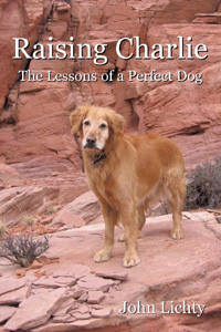 Raising Charlie: The Lessons of a Perfect Dog by John Lichty
Subscribe To

 Posts
All Comments
Posts
All Comments

Saturday, June 2, 2012

Sunday, May 20, 2012
Eclipse

We experimented with a few different ways to view the eclipse. I built a simple pin-hole viewer out of a shoe box, but the projected image was really small. The photo below shows Nan holding it as the eclipse approached local totality. If you click the photo, you should be able to see the tiny crescent shape more clearly. We also projected the eclipse through binoculars onto our backyard fence, but the image was a little fuzzy. We had the greatest success stacking three layers of photographic negatives together and holding them up about a foot in front of our eyes to view the eclipse directly. This is probably a no-no, but if you don't think ahead and buy a pair of "eclipse glasses," then you try to make do. The photo above was taken through the negatives and shows an unusual effect, multiple images of the eclipse radiating out from the bright central image. The only explanation for this that I can think of is that the sunlight was refracting and reflecting between the three different layers of film. If anyone has a better explanation, I'd like to hear it. Again, if you click the photo, you should be able to see the eclipse images more clearly.

Monday, May 14, 2012
Critters

We have lived in Grand Junction for seven years now, and this was my first experience with a rattlesnake. Scout and I occasionally scare up garden snakes on our walks, but they slither quickly away. This little fellow bravely stood his ground. I was so surprised to see him that it didn't occur to me to try to kill him even though he could someday be a threat to neighborhood kids, dogs and cats.
It's not in my nature to harm living things. If anything, I try to encourage the presence of local wildlife. Finches, mourning doves and hummingbirds visit our feeders. Chipmunks and mice eat spilled seeds. Lizards of all shapes and sizes bask on our patio. Toads burrow into the edges of our lawn. Mule deer graze the scrub grass behind our house. Foxes and coyotes dash past during early morning walks. Scorpions startle us in dark corners. And praying mantises and walking stick insects live in our summertime flower pots. For me, the word "desert" used to conjure up images of barren, desolate spaces devoid of life, but living here, I know better.
It didn't occur to me to get a photo of the baby rattlesnake, so the desert scene above will need to suffice. It's from a hike that Scout and I did on Sunday morning while checking out potential camping spots for the upcoming Memorial Day weekend. The view is looking south toward the Uncompahgre Plateau from a sandstone ridge high above the Gunnison River, with a flowering silver cholla cactus in the foreground. Click the image to see it full-size.
Tuesday, May 8, 2012
Fisher Towers Hike


Along the climber's trail below Ancient Art, there were a few dramatic-looking hoodoos. According to John, the one with the thinnest neck is called The Cobra and it has been climbed successfully. To look at it, you would think anyone putting their weight on it would snap the top of it right off.


Friday, April 27, 2012
Radio Show

The show went well. Ben and I started out talking back and forth about the dogs in our lives, what they have meant to us, and what we have learned from them. It may have been because I was on vacation and relaxed, but I wasn't nervous and the conversation flowed smoothly. Ben was nice enough to include some plugs for my book, Raising Charlie: The Lessons of a Perfect Dog, and also for my blog, this blog, "Whispering Jesse". After a break, Ben opened up the conversation to callers, and they shared with us their dog stories. Many were sad, telling of the loss of beloved dogs who had become family members and best friends, but all were joyous, telling of the love and companionship, the lessons learned, and the unparalleled value of having dogs in our lives. I admit to getting choked up over their stories, especially over the poems that callers had written as tributes to their lost dogs.
Ben and I could have taken calls for the rest of the afternoon, but our hour together on the air was over quickly. I hope it was as uplifting and therapeutic for Wisconsin Public Radio's listeners as it was for me. If you would like to listen to the show, it is available in the archives at "At Issue with Ben Merens".
Scout will turn four years old tomorrow. Happy birthday, Scout!
Thursday, April 12, 2012
Greetings from Savannah

The only really alarming issue Dad and I noticed was the large quantity of dirty water in the bilge. I had not plugged the boat into shore power when I left her because I was afraid of a possible electrical short or fire, but apparently the automatic bilge pump ran down the battery and stopped working some time ago. The battery-powered lights still worked, so I wasn't sure right away what the problem was. But on Saturday morning, as soon as I plugged into shore power, the bilge pump kicked in and emptied out the bilge in short order, leaving behind a brown scum. I picked up some concentrated bilge cleaner at the local West Marine store, and it seemed to make a little difference. It may take multiple treatments to get the bilge back to some semblance of clean.
I did the best I could scrubbing off the seagull poop, but like the bilge scum, it will take multiple treatments. After cleaning the decks, I held my breath and turned the key in the engine's ignition. It started right up. I checked the water intake strainer and checked that water was coming out with the exhaust. All seemed good. I let the engine run for about ten minutes while watching the gauges. Everything looked good.
I was pretty confident that the boat would be ready for Dad and me to motor her up to Thunderbolt Marine on Monday morning to get some work done. There were some rigging issues left over from last year's refit that needed to be corrected, and the new diesel engine needed its fifty-hour maintenance. After filling up at the fuel dock, we motored out of Delegal Creek shortly after nine o'clock. About a half-mile out, with the engine running at about two thousand RPMs, I noticed an alarming amount of exhaust smoke blowing out at water level. The temperature gauge was climbing. I reduced the RPMs to idle level and went below to check the water intake. There was hardly any water flowing through the strainer. The through-hull must have been clogged by the growth that had also developed on the hull during its five months in the water. I wondered if I could unclog it with something on board, but the hose makes an S-curve between the strainer and the through-hull, so it would take a drain snake or something similar, which I didn't have. The engine alarm started its piercing cry. There was a significant counter-current and headwind, so I didn't want to turn off the engine or we would find ourselves going backwards. The reduced RPMs allowed the engine to cool enough for the alarm to shut off, and we decided to keep it running until we could make the right turn into Ossabaw Sound at the last Delegal Creek channel marker. At less than one knot of forward headway, it took forever to get out there.
We turned off the engine to let it cool and drifted with the wind and current. Dad was at the helm, and he couldn't get the boat to steer toward the channel markers without any useful headway. The water was too shallow to allow for sailing, or we would have put out a foresail. We would eventually run aground if we continued to drift, so I pulled out my cell phone and called BoatU.S. to arrange a tow. The service works like AAA does for automobiles, and I was awfully glad I had it. The customer service person asked for our boat information and GPS coordinates, and she said a tow boat would be out to meet us within the hour. A few minutes later, Dana from Thunderbolt Marine, the same place where we were headed, called to confirm the tow.
To control our drift, I restarted the engine and kept it at idle speed. We motored along at one knot for over an hour until we saw the red tow boat coming in the distance and received a hailing call on the VHF radio from Capt. Mike. He pulled alongside and tossed a tow rope. I tied it off at the bow, cut the engine and fell in behind for the long tow up to Thunderbolt. We soon passed under the Diamond Causeway bascule bridge at Skidaway Narrows. It is in the process of being replaced by a high, permanent bridge that will better handle the frequent sailboat traffic along this stretch of the Intracoastal Waterway. You can see the construction progress in the photo above, along with our view of Capt. Mike's tow boat.
Instead of arriving at Thunderbolt Marine at noon, as I had predicted, we showed up there at three o'clock. At the entrance to Thunderbolt's harbor, we were able to start the engine, drop the tow line and motor very slowly to the dock, where Mom was waiting patiently for us.
Another adventure, more lessons learned. In addition to the rigging and engine work, I asked Thunderbolt to haul and pressure wash the boat and to clean all the through-hulls. With any luck, our return trip to Delegal Creek Marina next Monday will be less eventful.
Tuesday, April 3, 2012
Moqui Steps

I showed John the petroglyphs that Scout and I had found on a canyon wall the last time, and I was angered to see even more graffiti had been added, some of it practically on top of the ancient rock art. John had done a number of rock climbs in the canyon, and he pointed them out as we worked our way down the canyon's stream bed. Scout made a number of athletic moves through the scrambling sections and rewarded himself with quick swims in the many muddy pools.

Being an avid rock climber, John proposed that we come back another time with a climbing rope and set an anchor using one of the juniper trees on the rim. We could take turns rappelling down to the bottom and then safely climbing the moqui steps back up while on a belay. After giving it some thought, I would guess that the ancient people who carved the moqui steps must have had a hand-woven rope that they used in conjunction with the steps to make it easier to get up and down, especially if they were carrying water containers. The fact that the first step was about four feet above the bottom made me think that the steps were intended to be used when the pool was full of water. During a dry spell, the shaded pool may have been the only local source for fresh water.
Saturday, March 31, 2012
The Light in the Forest
During the summer of 1979, I worked as a contract archeologist in Nicolet National Forest in northern Wisconsin. It was the responsibility of our group to conduct archeological surveys of areas that were under consideration for logging, road development and other purposes. We searched for signs of prehistoric human habitation and put our findings into environmental impact statements, as was required by the National Environmental Policy Act of 1969.
Our work took us to extremely remote areas of the forest, places that hadn’t changed much since glaciers covered them fifteen thousand years ago. It was normally easy to tell if we would find any cultural remains based on the proximity of fresh water. Early Native Americans would not have hauled water any farther than was necessary, the same as any modern campers. In fact, the first question I would ask myself after getting out of our work van and looking around was, “Would I want to camp here?” If the answer was no, then chances were good that we wouldn’t find anything. I could confirm my hunch by sticking a shovel into the ground. If it made clanking contact with rocky glacial till within an inch or two of the surface, then the area was going to be a “write-off.” Native people wore soft-soled moccasins and would not have lived on rocky ground. To make things official, though, we needed to line up ten meters apart, try to dig holes that were a shovel blade square and a shovel blade deep, shake all that dirt and rock through half-inch mesh wooden-framed screens, examine what remained, refill the holes, march ahead ten meters, and do it all again, and again, until the entire area was surveyed. We would frequently dig over a hundred holes each in a single day.
We so rarely found anything even remotely interesting that we developed a sense of gallows humor about our work. When Jodi would hand over yet another pulverized rock and ask for the umpteenth time if it was maybe a fire-cracked rock from a primitive hearth, Chris would examine the rock carefully, look her straight in the eye, and ask, “Which shoulder do you want me to throw it over?” A pebble with an interesting shape would be dubbed a “love stone” – just another effin’ rock.
So our expectations were low when we set out early one morning to survey an old-growth maple forest. We followed the ghost of a leaf-covered double-track for a few miles to where it disappeared completely and parked the van. Getting out, I looked up at the forest canopy far above. It was so dense that only the dark green light filtering through the leaves would penetrate, like sunlight through stained glass. The cathedral effect was enhanced by the trees themselves, each trunk standing absolutely straight and extending more than thirty feet before branches appeared. The air was moist and cool, almost chilly, on what should have been a hot, sunny day.
We noticed some old cans rusting into the ground near where we had parked and soon located other evidence of modern humans. Jack found what looked like a large silvered television tube, and it took us a moment to figure out that it was the remains of an old thermos bottle, its steel case long since rusted away. Our best guess was that the area had once been used as a maple sugaring camp, probably more than thirty years ago since there was no plastic to be found.
We gathered our shovels and screens, assumed our ten-meter separations, and began digging the first of many holes, in a line perpendicular to the track. I was the farthest one out, which I didn’t mind because it gave me the added responsibility of charting our course with a compass and tying survey tape to shrubs in order to maintain the alignment of our grid for the return leg. When I stomped my shovel into the ground for the first time, I was pleasantly surprised to have the blade sink all the way in. Beneath the ancient layer of dead maple leaves, the soil was loamy. It went through the screen like water, leaving almost nothing but the leaves behind. I didn’t expect to find anything of interest, like a projectile point or a pot sherd; we were miles from any water source.
The ease of the digging and the dark coolness of the forest lulled me into a comfortable rhythm. It must have been a couple of hours and many holes later that I noticed something strange up ahead. There was a column of white light shining down through a circular hole in the canopy. Our course would take me right to its edge. As I dug the remaining holes leading up to where the light shone down, I kept an eye on the hole in the canopy, wondering what had caused it. I was right at the edge of the light before I saw the depression in the ground. It was a circle about sixty feet across, the same size and shape as the hole in the canopy above it. In its center, mixed with dead maple leaves, was a large circular puddle of black mud. Was it an isolated sink hole? I didn’t think so. The local geology didn’t support that idea. I puzzled over it as I stomped the dirt into my most recent hole, and then I nearly jumped out of my skin. Just five feet to my right was a dead deer. I couldn’t believe I hadn’t noticed it, but I had been preoccupied with the light and the depression. The deer, a white-tailed doe, appeared to have died in the last few days. Its eyes were not fully sunken, and it was not yet bloated and stinking. There was no sign of violence. I stared at it for several seconds, half expecting it to get up and run away, and then my eyes were drawn back to the light. Whatever had killed the deer was somehow associated with this strange place. I was sure of it. Maybe it drank from the mud puddle and was poisoned somehow. No, there was no mud on the deer’s hooves. What was it then? And what had happened here in the first place to create the hole in the canopy and the mud-filled depression? A small meteorite falling to earth? A flying saucer landing?
I was still staring back and forth between the dead deer and the depression, trying to figure it out, when I heard Bart calling my name. He had been ten meters to my left, but now he was way ahead of me. I skirted the edge of the depression – there was no way I was going to dig holes in it – and ran to take my position again next to Bart. “That was pretty weird back there, huh?” he said. “Yeah,” I responded. Weirder than you would believe, I thought.
The next day, we surveyed a grassy meadow in the same vicinity as the maple forest. The meadow was dotted with large rounded boulders, known as erratics, which had been left behind by the last glacier. They looked like giant Easter eggs sitting in the tall grass. The work was difficult, shoveling through the dense turf, and we dug fewer holes than normal. As we slogged back down the dirt road we had worked our way up, feeling tired and dirty, and looking forward to a cold beer, I noticed a boulder a few feet off the side of the road. It was about the size of an oil drum and probably weighed at least a thousand pounds. It was lying on its side. It had been pushed over from its original position, leaving a depression where it had stood. The grass at the edges of the depression fanned out around a circle of dirt criss-crossed by worm holes. The worms were long gone, but the dirt was not yet dried out. The boulder had been tipped over in the last few days, maybe on the same day that the deer had died. Was there a connection? I didn’t know, but I did know that if a bear had pushed over the boulder looking for worms or grubs, there would have been scratches in the dirt, and there weren’t any.
What else could explain it? I felt my face flush as I stared down at the depression, and sweat ran down my back. The others in my group had moved on down the road, not intrigued enough to delay that waiting beer. I looked up slowly. The woods surrounding the meadow felt as if they were closing in, like a dark wave cresting. I was in the presence of something I couldn’t understand, and it was frightening me. My skin tingled with electricity. I wouldn’t have been surprised to ride a beam of light up into the sky at that very moment. I scanned the sky to make sure there wasn’t something up there. It was blue and empty. I bent over to pick up my shovel and screen, and I walked slowly away down the road. I did not look back.
Our work took us to extremely remote areas of the forest, places that hadn’t changed much since glaciers covered them fifteen thousand years ago. It was normally easy to tell if we would find any cultural remains based on the proximity of fresh water. Early Native Americans would not have hauled water any farther than was necessary, the same as any modern campers. In fact, the first question I would ask myself after getting out of our work van and looking around was, “Would I want to camp here?” If the answer was no, then chances were good that we wouldn’t find anything. I could confirm my hunch by sticking a shovel into the ground. If it made clanking contact with rocky glacial till within an inch or two of the surface, then the area was going to be a “write-off.” Native people wore soft-soled moccasins and would not have lived on rocky ground. To make things official, though, we needed to line up ten meters apart, try to dig holes that were a shovel blade square and a shovel blade deep, shake all that dirt and rock through half-inch mesh wooden-framed screens, examine what remained, refill the holes, march ahead ten meters, and do it all again, and again, until the entire area was surveyed. We would frequently dig over a hundred holes each in a single day.
We so rarely found anything even remotely interesting that we developed a sense of gallows humor about our work. When Jodi would hand over yet another pulverized rock and ask for the umpteenth time if it was maybe a fire-cracked rock from a primitive hearth, Chris would examine the rock carefully, look her straight in the eye, and ask, “Which shoulder do you want me to throw it over?” A pebble with an interesting shape would be dubbed a “love stone” – just another effin’ rock.
So our expectations were low when we set out early one morning to survey an old-growth maple forest. We followed the ghost of a leaf-covered double-track for a few miles to where it disappeared completely and parked the van. Getting out, I looked up at the forest canopy far above. It was so dense that only the dark green light filtering through the leaves would penetrate, like sunlight through stained glass. The cathedral effect was enhanced by the trees themselves, each trunk standing absolutely straight and extending more than thirty feet before branches appeared. The air was moist and cool, almost chilly, on what should have been a hot, sunny day.
We noticed some old cans rusting into the ground near where we had parked and soon located other evidence of modern humans. Jack found what looked like a large silvered television tube, and it took us a moment to figure out that it was the remains of an old thermos bottle, its steel case long since rusted away. Our best guess was that the area had once been used as a maple sugaring camp, probably more than thirty years ago since there was no plastic to be found.
We gathered our shovels and screens, assumed our ten-meter separations, and began digging the first of many holes, in a line perpendicular to the track. I was the farthest one out, which I didn’t mind because it gave me the added responsibility of charting our course with a compass and tying survey tape to shrubs in order to maintain the alignment of our grid for the return leg. When I stomped my shovel into the ground for the first time, I was pleasantly surprised to have the blade sink all the way in. Beneath the ancient layer of dead maple leaves, the soil was loamy. It went through the screen like water, leaving almost nothing but the leaves behind. I didn’t expect to find anything of interest, like a projectile point or a pot sherd; we were miles from any water source.
The ease of the digging and the dark coolness of the forest lulled me into a comfortable rhythm. It must have been a couple of hours and many holes later that I noticed something strange up ahead. There was a column of white light shining down through a circular hole in the canopy. Our course would take me right to its edge. As I dug the remaining holes leading up to where the light shone down, I kept an eye on the hole in the canopy, wondering what had caused it. I was right at the edge of the light before I saw the depression in the ground. It was a circle about sixty feet across, the same size and shape as the hole in the canopy above it. In its center, mixed with dead maple leaves, was a large circular puddle of black mud. Was it an isolated sink hole? I didn’t think so. The local geology didn’t support that idea. I puzzled over it as I stomped the dirt into my most recent hole, and then I nearly jumped out of my skin. Just five feet to my right was a dead deer. I couldn’t believe I hadn’t noticed it, but I had been preoccupied with the light and the depression. The deer, a white-tailed doe, appeared to have died in the last few days. Its eyes were not fully sunken, and it was not yet bloated and stinking. There was no sign of violence. I stared at it for several seconds, half expecting it to get up and run away, and then my eyes were drawn back to the light. Whatever had killed the deer was somehow associated with this strange place. I was sure of it. Maybe it drank from the mud puddle and was poisoned somehow. No, there was no mud on the deer’s hooves. What was it then? And what had happened here in the first place to create the hole in the canopy and the mud-filled depression? A small meteorite falling to earth? A flying saucer landing?
I was still staring back and forth between the dead deer and the depression, trying to figure it out, when I heard Bart calling my name. He had been ten meters to my left, but now he was way ahead of me. I skirted the edge of the depression – there was no way I was going to dig holes in it – and ran to take my position again next to Bart. “That was pretty weird back there, huh?” he said. “Yeah,” I responded. Weirder than you would believe, I thought.
The next day, we surveyed a grassy meadow in the same vicinity as the maple forest. The meadow was dotted with large rounded boulders, known as erratics, which had been left behind by the last glacier. They looked like giant Easter eggs sitting in the tall grass. The work was difficult, shoveling through the dense turf, and we dug fewer holes than normal. As we slogged back down the dirt road we had worked our way up, feeling tired and dirty, and looking forward to a cold beer, I noticed a boulder a few feet off the side of the road. It was about the size of an oil drum and probably weighed at least a thousand pounds. It was lying on its side. It had been pushed over from its original position, leaving a depression where it had stood. The grass at the edges of the depression fanned out around a circle of dirt criss-crossed by worm holes. The worms were long gone, but the dirt was not yet dried out. The boulder had been tipped over in the last few days, maybe on the same day that the deer had died. Was there a connection? I didn’t know, but I did know that if a bear had pushed over the boulder looking for worms or grubs, there would have been scratches in the dirt, and there weren’t any.
What else could explain it? I felt my face flush as I stared down at the depression, and sweat ran down my back. The others in my group had moved on down the road, not intrigued enough to delay that waiting beer. I looked up slowly. The woods surrounding the meadow felt as if they were closing in, like a dark wave cresting. I was in the presence of something I couldn’t understand, and it was frightening me. My skin tingled with electricity. I wouldn’t have been surprised to ride a beam of light up into the sky at that very moment. I scanned the sky to make sure there wasn’t something up there. It was blue and empty. I bent over to pick up my shovel and screen, and I walked slowly away down the road. I did not look back.
Thursday, March 22, 2012
Poison Spider Hike

I rode the Poison Spider Trail on my dirt bike years ago, and Charlie and I hiked it once--probably while Nan was running a race--but he and I had not gone far enough to see what I was hoping to see with Scout, the section of slickrock ledges that I remember being really difficult to get up and over on my dirt bike. We started out at 8:15, hiking up a series of rocky switchbacks in a blustery wind. The trail eventually leveled out heading west and then curved around to the north into a familiar-looking sand wash canyon with steep sandstone cliffs on either side. Where the deep sand ended, the steep slickrock ledges began. Scout leaped nimbly up them while I stood below trying to calculate the smoothest line to take if I was on my dirt bike. I remember needing to get off my dirt bike and do the same thing years ago, and even then, it took a couple of tries to get up some of the trickier sections.

On the way back toward Moab on Highway 279, there were many groups of rock climbers scaling the sandstone faces that drop vertically to the shoulder of the narrow two-lane highway as it runs along the river. This must have been a popular area as well with the Native Americans who left their petroglyphs on the faces several feet above the ground. In the past, the lighter areas of stone below the rock art must have been covered by deep sand bars from the river that have since eroded away. The unintended effect is that the petroglyphs have been preserved out of reach of vandals and graffiti artists. Again, please click the photo for a full-size view.
Wednesday, March 14, 2012
Still hoping for change?

This billboard didn't anger me nearly as much as the one I saw almost two years ago (http://whisperingjesse.blogspot.com/2010/03/welcome-to-grand-junction.html), which showed former President Jimmy Carter thinking, "They can't call me the worst president anymore!" Still, it riled me enough that I checked out Compass Colorado's website. Its message is clear: "Call the White House and demand President Obama stop the spending and save Colorado jobs." What is not so clear is how those two demands are related. Digging deeper, I found: "Colorado’s economy has stagnated due to failed policies on the local, state and national levels. Tax hikes, reckless spending, and burdensome regulations have created an uncertain economic climate and stifled economic recovery and job creation."
To my way of thinking, that argument is completely backwards. Economic recovery and job creation have been slowed by lack of demand, not by government policies. Higher prices and lower wages, for those lucky enough to have jobs, have pinched people to the point where they don't have any money to spend except on basic necessities. Our consumer-driven economy suffers as a result. The tax hikes, so-called reckless spending and burdensome regulations are the successful policies that are facilitating economic recovery while preserving our environment for future generations. The government has created incentives that have saved thousands of jobs while at the same time imposing rules and regulations to prevent the greedy practices that crashed the economy in the first place.
The timing of the billboard's placement is suspicious. The economy has been improving steadily over the last few months, so the associated website's gloom-and-doom message seems a little late. More likely, the billboard is what it seemed to be when I first saw it, an anti-Obama campaign message. That, too, seems a little late. With the Republicans failing to present a credible challenger, President Obama appears destined for re-election, which will keep alive his message of hope and change for another four years.
Subscribe to:
Posts (Atom)

