Saturday, April 30, 2016

Return from Bimini

Westward track from Bimini to Miami - Thank you, Brian!
As predicted, the northeasterly wind continued to clock around and by Wednesday, April 20, was blowing out of the southeast again. Nan, Brian, and I readied Whispering Jesse for a departure early on the following morning and drafted our marina mates for assistance. With the boat positioned as it was and the wind blowing at least 15 knots, we did not have enough engine power to safely make the hard turn to port against the wind needed to enter the channel, so Brian rigged up a spider web of dock lines and instructed our marina mates in how we would use them to manually pivot the boat around the corner of the pier and point the bow into the wind for a safe departure.

We all met in the pink light of dawn at 6:30 the next morning, coffee cups in hand, to see if Brian's plan would work. After a single false start and a minor correction, we were off, with much waving and yelling of thanks. We hope to meet up with those kind sailors again in future travels.

The route out of the channel was considerably easier in daylight, and we adjusted our course to match the one taken by our snorkel trip captain, which put us on the wrong side of one of the markers but also prevented any unwelcome contact with shoals. We motored southwest into deeper water for several hundred yards before rounding into the wind and putting up the mainsail. When we turned back around and put out the jib, Whispering Jesse took off on a fast broad reach. Within moments, we were doing better than 7 knots and heeling just a little too dramatically. We adjusted the traveler to leeward and eased the main, making for a less death-defying ride. We didn't need to make any further adjustments until we entered the Gulfstream, where the dramatic wave action added to the roller-coaster effect and caused us to ease the main a little more. But we were flying! Occasional gusts pushed us above 8 knots, and it felt that we would be back in Miami in no time.

Click this image for a brief video - Thanks yet again, Brian!
The slight jog to the north in our otherwise due west track was caused by a course correction needed to avoid being T-boned by a large freighter. Boats under sail have the right of way, but don't try to explain that to a freighter captain who believes that might makes right. It's easier to just assume that nobody on the freighter is paying any attention and take whatever evasive action is necessary.

It took only 10 hours to return from Bimini, compared to 18 hours to sail there, and the vastly different tracks tell the story. Speed is the key. Without at least 5 to 6 knots of boat speed, the Gulfstream's 3.5 knots take control and push the boat northward. It may be possible to crab across in a slow easterly direction, but is that any faster than simply using the available wind to get past the Gulfstream and then adjusting southward? Maybe. The best advice is to wait for a southwesterly wind for the passage over to Bimini and a southeasterly wind for the passage back. In other words, trying to sail on a schedule is almost never going to be the safest or most comfortable way to go.

Friday, April 22, 2016

Check-in/OK message from SPOT Whispering Jesse

Whispering Jesse
Latitude: 25.72590
Longitude: -80.23654
GPS location Date/Time: 04/22/2016 17:03:06 EDT

Message: This is the crew of Whispering Jesse checking in. All is well. Click the Google Maps link to see where we are:

http://maps.google.com/maps?f=q&hl=en&geocode=&q=25.72590,-80.23654&ll=25.72590,-80.23654&ie=UTF8&z=12&om=1

Check-in/OK message from SPOT Whispering Jesse

Whispering Jesse
Latitude: 25.64734
Longitude: -80.05862
GPS location Date/Time: 04/22/2016 14:02:40 EDT

Message: This is the crew of Whispering Jesse checking in. All is well. Click the Google Maps link to see where we are:

http://maps.google.com/maps?f=q&hl=en&geocode=&q=25.64734,-80.05862&ll=25.64734,-80.05862&ie=UTF8&z=12&om=1

Check-in/OK message from SPOT Whispering Jesse

Whispering Jesse
Latitude: 25.65052
Longitude: -79.83499
GPS location Date/Time: 04/22/2016 12:02:34 EDT

Message: This is the crew of Whispering Jesse checking in. All is well. Click the Google Maps link to see where we are:

http://maps.google.com/maps?f=q&hl=en&geocode=&q=25.65052,-79.83499&ll=25.65052,-79.83499&ie=UTF8&z=12&om=1

Check-in/OK message from SPOT Whispering Jesse

Whispering Jesse
Latitude: 25.65087
Longitude: -79.62048
GPS location Date/Time: 04/22/2016 10:01:05 EDT

Message: This is the crew of Whispering Jesse checking in. All is well. Click the Google Maps link to see where we are:

http://maps.google.com/maps?f=q&hl=en&geocode=&q=25.65087,-79.62048&ll=25.65087,-79.62048&ie=UTF8&z=12&om=1

Check-in/OK message from SPOT Whispering Jesse

Whispering Jesse
Latitude: 25.71757
Longitude: -79.30056
GPS location Date/Time: 04/22/2016 06:36:41 EDT

Message: This is the crew of Whispering Jesse checking in. All is well. Click the Google Maps link to see where we are:

http://maps.google.com/maps?f=q&hl=en&geocode=&q=25.71757,-79.30056&ll=25.71757,-79.30056&ie=UTF8&z=12&om=1

Wednesday, April 20, 2016

Weather Delay

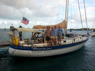
Mike, Nan, John and Brian aboard Whispering Jesse at Blue Water Marina
We packed in as much activity as possible during our short time on Bimini. The day after our arrival, we went on a snorkeling trip to the S.S. Sapona shipwreck, a ferro-cement cargo ship that sank in an upright position south of Bimini during a hurricane in 1926. The sea life that call the wreck their home were impressive, as was the wreck itself, especially the enormous propeller, still attached to the partially submerged, broken-off stern.

As we had done with the snorkeling trip, we coordinated a golf cart rental through the Bimini Big Game Club Resort and Marina, conveniently located just down the road from Blue Water Marina. There was a limit to how much we could see by foot and we wanted to explore farther to the north. Specifically, we wanted to see Resorts World Bimini, the resort and casino development near the north end of North Bimini. Nan and I used to pass their billboards in Miami and had wanted to take the inexpensive, high-speed cruise ship over for a quick weekend, but now we had arrived by other means. The enormous development was mostly deserted, except for small pockets of people at the pools and casino. We learned that the cruise ship was not currently running, which limited access to only those visitors willing to arrive by airplane. At the north end of the development, where their best beach is located, we expected to continue on a road around the northernmost point of the island to the pristine beaches on the east side of the island, but the way was blocked by new construction projects and employee housing--what a shame!

Approaching the S.S. Sapona shipwreck for a snorkeling adventure
There is a ferry that runs frequently between North and South Bimini, and we completed our tour of the islands one afternoon by taking it across to South Bimini. The ferry drops passengers off at a parking lot, where there is a shuttle bus that goes to the airport and the island's two resorts. We got off at Bimini Sands Resort & Marina to check on the accommodations. We found the marina to be hot, lacking in character, and full of biting sand gnats, so we retreated to the air-conditioned upstairs bar for ice-cold Kalik beers. Some sailors swear by the place, but we were happy we had chosen to stay at Blue Water Marina.

Our original plans called for us to leave Bimini early on Monday, April 18, but the southeast wind we bucked on the way over had shifted around to the north, against the current, creating large waves and making a return trip inadvisable until conditions changed. This was bad news for Mike, who needed to fly out of Miami on Tuesday. He set about coordinating a connecting flight from the Bimini airport and departed early that day, missing the possibility of some actual sailing on the return trip. Brian, Nan and I focused on the weather reports and kept our fingers crossed for a Thursday or Friday departure.


Friday, April 15, 2016

Arrival in Bimini

As we approached Bimini in the dark, Brian and I discussed what we knew about the entrance channel. Many sailors will not attempt it after dark for fear of running aground on the shifting shoals that would be clearly visible during daylight in the clear Bahamian waters. They would anchor off the beach on the southwest corner of North Bimini and wait for dawn. But we were tired and wanted the endless day to be over, motivating us to push on regardless. And besides, our chart plotter featured a dotted line through the channel that I was sure I could follow.

Darkness on the water is disorienting, especially on a moonless night. What at first we took to be blinking lights on the outermost channel markers turned out to be police boat lights. Welcome to the Bahamas! But they were not interested in us and slowly motored on. I quickly spotted the relatively dim channel marker lights blinking off to the east and made the turn. With Mike and Brian out on the bow, yelling and pointing directions, and Nan back with me in the cockpit, squinting at the boat's image on the chart plotter's dotted line and playing the steering like a video game, we made slow idle-speed progress, with only a few sandy bumps along the way.

It was almost 11:30 by this time and not much was happening ashore. We motored slowly past Browns Marina and then Sea Crest Marina, which I knew from Google Maps was right before Blue Water Marina, where we had reserved a slip, but there was no obvious sign and we were more than a hundred yards offshore. Brian and Mike flashed spotlights around and managed to get the attention of two people on the pier who yelled to confirm that we were at Blue Water, whereupon we promptly ran aground. With much forward-reverse and varying throttle, we managed to get the boat off the shoal in about ten minutes and headed toward Blue Water, coming in with the bow facing back the way we had come to avoid having to make another turn over the shoal when we departed. The two people on the pier turned out to be Cedric from Trillium Wind and the marina's night security guard, and they gave us a warm but incredulous welcome at our somewhat daring late-night arrival. Congratulatory drinks went down and sleep quickly followed.

Early the next morning, I checked in at the marina office to announce our arrival and then gathered up everyone's passports, along with the entry forms I had filled out from the official Bahamas website, and went off on foot to clear us in at Customs and Immigration, while everyone else waited at the boat as required. Customs in now at the Big Game Resort, not in the pink building down by the Government Dock, as reported on NoonSite.com. Check-in was relatively quick and easy, except that it cost $320. For that amount, we get to return to the Bahamas within 90 days free of charge. Not likely. Immigration was farther up the main road on the other side of the street. The official there asked me for our tourist visas, which I did not have. He showed me the form and said the marina office should have given them to us when we checked in. I hoofed it back to the marina office to request the forms I should have been given earlier, had everyone complete them, and then returned to Immigration. Stamp-stamp, rip-rip, and we were cleared in to the Bahamas. The first order of business back at the boat was to take down the "Q" quarantine flag and run up the Bahamas courtesy flag. Then it was off to breakfast at Capt. Bob's, followed by a leisurely walking tour of the area, which took less time than you would think. Bimini is a small place.

The "S" Curve

If you followed the Spots we sent out with our positions through the day as we sailed from Miami to Bimini, then you know that our course was not exactly a direct one. We needed to sail almost due east, but the northward Gulfstream current of 3-4 knots requires more of a southeast heading, which was exactly where the wind was coming from. We wanted to use the sails instead of the engine, so we pinched up as tightly as we could into the wind for a few hours, giving us a slightly north of east heading, and then added the engine for better "easting" when we saw how far north of Bimini we were drifting. As you can see in the image to the left from Brian's GPS (click it for a full-size view), we ended up about 18 miles north of Bimini and needed to motor south long past dark to reach our destination, finally arriving at 11:30 PM, 18 hours after our 5:30 AM departure.

Bimini is about 45 miles east of Miami, but our "S" curve route added up to about 80 miles, which explains why it took so much longer than the 10-12 hours most sailors expect. The lessons we learned are obvious ones: wait for wind out of the southwest quadrant, which was not possible due to crew members' schedules; and understand that the only way to flatten the "S" curve is to go much faster than the Gulfstream current, which we were not able to do either sailing into the wind or motoring at a careful 4-5 knots due to fan belt issues.

Thursday, April 14, 2016

Check-in/OK message from SPOT Whispering Jesse

Whispering Jesse
Latitude:25.72471
Longitude:-79.29758
GPS location Date/Time:04/14/2016 23:48:06 EDT

Message: This is the crew of Whispering Jesse checking in. All is well. Click the Google Maps link to see where we are:

http://maps.google.com/maps?f=q&hl=en&geocode=&q=25.72471,-79.29758&ll=25.72471,-79.29758&ie=UTF8&z=12&om=1

Check-in/OK message from SPOT Whispering Jesse

Whispering Jesse
Latitude: 25.98508
Longitude: -79.42352
GPS location Date/Time: 04/14/2016 18:01:18 EDT

Message: This is the crew of Whispering Jesse checking in. All is well. Click the Google Maps link to see where we are:

http://maps.google.com/maps?f=q&hl=en&geocode=&q=25.98508,-79.42352&ll=25.98508,-79.42352&ie=UTF8&z=12&om=1

Check-in/OK message from SPOT Whispering Jesse

Whispering Jesse
Latitude: 25.84279
Longitude: -79.81940
GPS location Date/Time: 04/14/2016 12:00:09 EDT

Message: This is the crew of Whispering Jesse checking in. All is well. Click the Google Maps link to see where we are:

http://maps.google.com/maps?f=q&hl=en&geocode=&q=25.84279,-79.81940&ll=25.84279,-79.81940&ie=UTF8&z=12&om=1

Check-in/OK message from SPOT Whispering Jesse

Whispering Jesse
Latitude: 25.66623
Longitude: -80.16031
GPS location Date/Time: 04/14/2016 06:26:40 EDT

Message: This is the crew of Whispering Jesse checking in. All is well. Click the Google Maps link to see where we are:

http://maps.google.com/maps?f=q&hl=en&geocode=&q=25.66623,-80.16031&ll=25.66623,-80.16031&ie=UTF8&z=12&om=1

Wednesday, April 13, 2016

Check-in/OK message from SPOT Whispering Jesse

Whispering Jesse
Latitude: 25.72593
Longitude: -80.23877
GPS location Date/Time: 04/13/2016 18:35:30 EDT

Message: This is the crew of Whispering Jesse checking in. All is well. Click the Google Maps link to see where we are:

http://maps.google.com/maps?f=q&hl=en&geocode=&q=25.72593,-80.23877&ll=25.72593,-80.23877&ie=UTF8&z=12&om=1

Sailing Trip to Bimini

Nan and I have been wanting to expand our sailing experiences beyond Biscayne Bay, and a Gulfstream crossing to Bimini seemed a logical choice. We enlisted our friend Mike Young from Colorado, who has been on every major Whispering Jesse voyage, and set a departure date for Thursday, April 14. As we prepared at the Coconut Grove Sailing Club over the last few days, Nan mentioned our plans to Brian McGrath, one of the first members we met when we joined over two years ago. He expressed an interest and soon we were a crew of four.

The weather should cooperate well for us, with predicted winds out of the southeast at 5-10 knots. This direction and speed combination should help to keep the wave heights at a tolerable level. We plan to leave at 5:00 AM and clear Cape Florida, at the south end of Key Biscayne, about an hour later. From there, it's into the Gulfstream's 3-4 knots of northbound current, where we're expecting a significant northward push. We're hoping to make it across in 10-12 hours. Wish us luck!